
| Memorials | : | 1 |
| Location | : | Nesbyen, Nes kommune, Norway |
| Phone | : | 32 06 85 10 |
| Website | : | www.neskirke.no |
| Coordinate | : | 60.5669920, 9.1034140 |
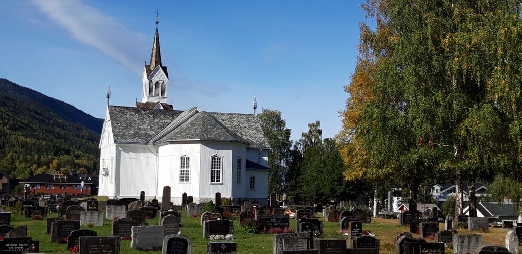
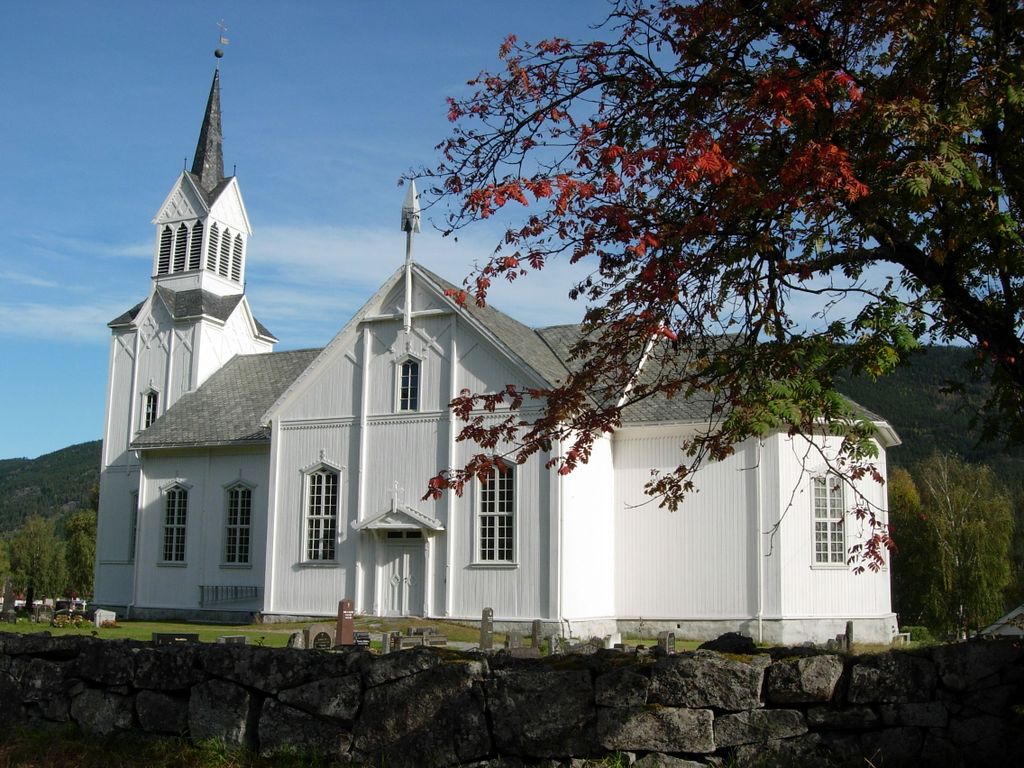
| Description | : | Nes kirke (church) is a cruciform church that opened in 1862 in Nesbyen municipality of Viken county, replacing the 13th century Nes Stave Church that stood approximately 500 meters further northwest and was demolished in 1864. Municipality: Nesbyen County: Viken Traditional District: Hallingdal aka Old Norse: Haddingjadalr (1443) (English: Halling Valley) Electoral District: Buskerud Region: Østlandet / Austlandet (Eastern Norway) Country: Norway |
frequently asked questions (FAQ):
-
Where is Nes kirke?
Nes kirke is located at Kirkevegen 1 Nesbyen, Nes kommune ,Buskerud fylke , 3540Norway.
-
Nes kirke cemetery's updated grave count on graveviews.com?
1 memorials
-
Where are the coordinates of the Nes kirke?
Latitude: 60.5669920
Longitude: 9.1034140
Nearby Cemetories:
1. Flaa Cemetery
Ler, Melhus kommune, Norway
Coordinate: 60.4284681, 9.4662050
2. Aal Cemetery
Al, Ål kommune, Norway
Coordinate: 60.6290400, 8.5567350
3. Hedalen Cemetery
Hedalen, Sør-Aurdal kommune, Norway
Coordinate: 60.6226500, 9.6905850
4. Leveld Church Cemetery
Al, Ål kommune, Norway
Coordinate: 60.6972348, 8.5010804
5. Uvdal Old Cemetery
Uvdal, Nore og Uvdal kommune, Norway
Coordinate: 60.2651450, 8.8348110
6. Bagn Cemetery
Bagn, Sør-Aurdal kommune, Norway
Coordinate: 60.8201360, 9.5629660
7. Eggedal Kirke
Eggedal, Sigdal kommune, Norway
Coordinate: 60.2463170, 9.3573130
8. Leirskogen Cemetery
Begndal, Sør-Aurdal kommune, Norway
Coordinate: 60.7977150, 9.6832080
9. Aurdal
Aurdal, Nord-Aurdal kommune, Norway
Coordinate: 60.9248040, 9.4132630
10. Hemsedal Church Cemetery
Hemsedal, Hemsedal kommune, Norway
Coordinate: 60.8618370, 8.5635500
11. Hovet Church and Cemetery
Hovet, Hol kommune, Norway
Coordinate: 60.6004500, 8.3001700
12. Hol Old Church & Cemetery
Hol, Hol kommune, Norway
Coordinate: 60.6150040, 8.3000550
13. Bruflat Cemetery
Bruflat, Etnedal kommune, Norway
Coordinate: 60.8884550, 9.6389820
14. Tingnes Kirke
Fagernes, Nord-Aurdal kommune, Norway
Coordinate: 60.9835994, 9.2585656
15. Ulnes Church Cemetery
Aurdal, Nord-Aurdal kommune, Norway
Coordinate: 60.9949520, 9.1140090
16. Viker Church Cemetery
Honefoss, Ringerike kommune, Norway
Coordinate: 60.4494390, 10.0396660
17. Øyjar Cemetery
Vestre Slidre kommune, Norway
Coordinate: 61.0435370, 9.0139510
18. Røn Cemetery
Vestre Slidre kommune, Norway
Coordinate: 61.0469680, 9.0497780
19. Nord Etnedal Kirke
Etnedal kommune, Norway
Coordinate: 61.0253740, 9.5010940
20. Rogne Cemetery
Rogne, Øystre Slidre kommune, Norway
Coordinate: 61.0874550, 9.1243580
21. Vestre Slidre Cemetery
Vestre Slidre kommune, Norway
Coordinate: 61.0902130, 8.9797490
22. Slidredomen Church and Cemetery
Slidre, Vestre Slidre kommune, Norway
Coordinate: 61.0902780, 8.9800000
23. Rollag kirke Cemetery
Rollag, Rollag kommune, Norway
Coordinate: 60.0210370, 9.2726230
24. Ostsinni Church Cemetery
Dokka, Nordre Land kommune, Norway
Coordinate: 60.8490580, 10.0783310