
| Memorials | : | 0 |
| Location | : | Crook County, USA |
| Coordinate | : | 43.9692001, -120.2846985 |
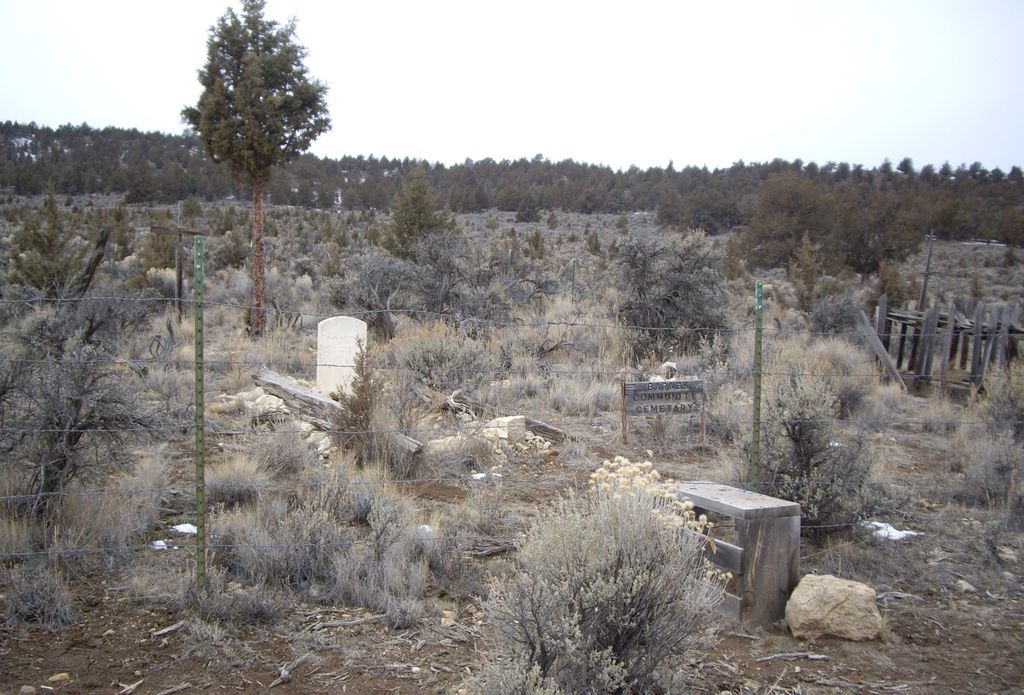
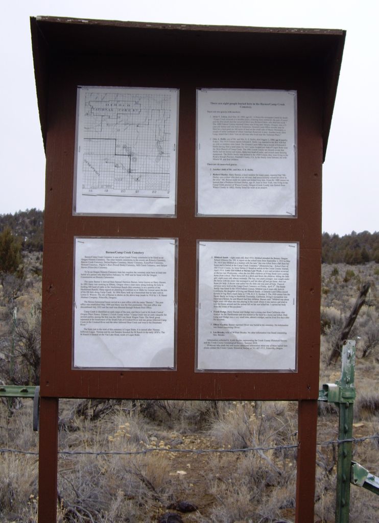
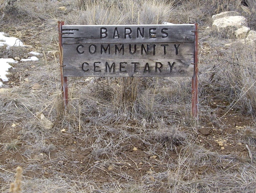
| Description | : | Barnes Camp Creek Cemetery is one of ten Crook County cemeteries to be listed as an Oregon Historic Cemetery. The other historic cemeteries in this county are: Roberts Cemetery, Beaver Creek Cemetery, Delore/Suplee Cemetery, Maury Cemetery, Knox/Post Cemetery, Howard Cemetery, Pilgrim's Rest (Powell Butte) Cemetery, Mill Creek Cemetery, and Juniper Haven (Prineville) Cemetery. To be an Oregon Historic Cemetery, state law requires the cemetery must have at least one burial of a person who died before February 14, 1909 and be listed with the Oregon Commission on Historic Cemeteries. The name Barnes is derived from Samuel Houston Barnes, better known as Harry... Read More |
frequently asked questions (FAQ):
-
Where is Barnes-Camp Creek Cemetery?
Barnes-Camp Creek Cemetery is located at Crook County ,Oregon ,USA.
-
Barnes-Camp Creek Cemetery cemetery's updated grave count on graveviews.com?
0 memorials
-
Where are the coordinates of the Barnes-Camp Creek Cemetery?
Latitude: 43.9692001
Longitude: -120.2846985


Nearby Cemetories:
1. Maury Cemetery
Paulina, Crook County, USA
Coordinate: 44.1099350, -120.1799580
2. Knox Cemetery
Crook County, USA
Coordinate: 44.1121000, -120.4808300
3. Alkali Butte Meek Gravesites
Post, Crook County, USA
Coordinate: 44.0559900, -120.6161400
4. Roberts Cemetery
Crook County, USA
Coordinate: 44.0755997, -120.6875000
5. Beaver Creek Cemetery
Paulina, Crook County, USA
Coordinate: 44.1847000, -119.8332977
6. Lowrey Family Burial Site
Crook County, USA
Coordinate: 44.3641600, -120.1516200
7. Howard Cemetery
Crook County, USA
Coordinate: 44.3736000, -120.4625015
8. Mill Creek Cemetery
Crook County, USA
Coordinate: 44.3208008, -120.6611023
9. Delore Cemetery
Suplee, Crook County, USA
Coordinate: 44.0726624, -119.6737289
10. Swick Cemetery
Izee, Grant County, USA
Coordinate: 44.0104060, -119.6450190
11. John Calbreath Gravesite
Paulina, Crook County, USA
Coordinate: 44.2064500, -119.7024300
12. Juniper Haven Cemetery
Prineville, Crook County, USA
Coordinate: 44.3153000, -120.8471985
13. Lost Immigrant Grave
Alfalfa, Deschutes County, USA
Coordinate: 44.0601578, -121.0321198
14. West Branch Cemetery
Wheeler County, USA
Coordinate: 44.5341988, -120.3080978
15. Pilgrims Rest Cemetery
Powell Butte, Crook County, USA
Coordinate: 44.2038400, -121.0271400
16. Camp Watson Cemetery
Mitchell, Wheeler County, USA
Coordinate: 44.4844437, -119.8994675
17. Silver Creek Cemetery
Riley, Harney County, USA
Coordinate: 43.6063004, -119.6266022
18. Mitchell Cemetery Upper
Mitchell, Wheeler County, USA
Coordinate: 44.5619850, -120.1425934
19. Caleb Cemetery
Mitchell, Wheeler County, USA
Coordinate: 44.5231018, -119.9383011
20. Lower Mitchell Cemetery
Mitchell, Wheeler County, USA
Coordinate: 44.5699387, -120.1636124
21. Mary Waterman Burial Site
Mitchell, Wheeler County, USA
Coordinate: 44.4727402, -119.8117371
22. Frederic Arnecke Burial Site
Wheeler County, USA
Coordinate: 44.4740700, -119.8121100
23. Spanish Gulch Cemetery
Wheeler County, USA
Coordinate: 44.4667015, -119.7722015
24. Izee Cemetery
Izee, Grant County, USA
Coordinate: 44.0694008, -119.3902969