| Memorials | : | 0 |
| Location | : | Mitchell, Wheeler County, USA |
| Coordinate | : | 44.4727402, -119.8117371 |
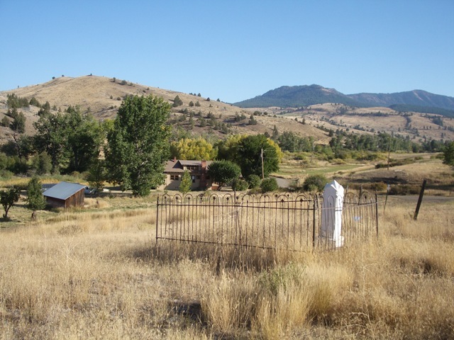
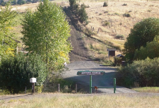
| Description | : | This is a single burial located at the site of the town of Antone, a place that used to be a town and that now is the location of the Antone Ranch. Take the Antone turnoff from Highway 26. Mary Waterman's monument is located on the left side of the road about 7.3 miles from the highway, right where there are several houses and then a bridge. The rest of the Antone pioneers are buried at Spanish Gulch Cemetery, 2.4 miles further along Antone Lane (turn left after the Antone bridge). |
frequently asked questions (FAQ):
-
Where is Mary Waterman Burial Site?
Mary Waterman Burial Site is located at Mitchell, Wheeler County ,Oregon ,USA.
-
Mary Waterman Burial Site cemetery's updated grave count on graveviews.com?
0 memorials
-
Where are the coordinates of the Mary Waterman Burial Site?
Latitude: 44.4727402
Longitude: -119.8117371
Nearby Cemetories:
1. Frederic Arnecke Burial Site
Wheeler County, USA
Coordinate: 44.4740700, -119.8121100
2. Spanish Gulch Cemetery
Wheeler County, USA
Coordinate: 44.4667015, -119.7722015
3. Camp Watson Cemetery
Mitchell, Wheeler County, USA
Coordinate: 44.4844437, -119.8994675
4. Caleb Cemetery
Mitchell, Wheeler County, USA
Coordinate: 44.5231018, -119.9383011
5. Foppiano Family Cemetery
Mitchell, Wheeler County, USA
Coordinate: 44.5954000, -119.9433000
6. Buckhorn Cemetery
Mitchell, Wheeler County, USA
Coordinate: 44.6240730, -119.7498810
7. Dayville Cemetery
Dayville, Grant County, USA
Coordinate: 44.4834222, -119.5748805
8. Mitchell Cemetery Upper
Mitchell, Wheeler County, USA
Coordinate: 44.5619850, -120.1425934
9. Toney Cemetery
Mitchell, Wheeler County, USA
Coordinate: 44.6394500, -120.0818000
10. Aldrich Gravesite
Grant County, USA
Coordinate: 44.4528008, -119.4499969
11. Lowrey Family Burial Site
Crook County, USA
Coordinate: 44.3641600, -120.1516200
12. Lower Mitchell Cemetery
Mitchell, Wheeler County, USA
Coordinate: 44.5699387, -120.1636124
13. John Calbreath Gravesite
Paulina, Crook County, USA
Coordinate: 44.2064500, -119.7024300
14. Richmond Cemetery
Richmond, Wheeler County, USA
Coordinate: 44.7311096, -119.9911118
15. Beaver Creek Cemetery
Paulina, Crook County, USA
Coordinate: 44.1847000, -119.8332977
16. Richmond Cemetery
Wheeler County, USA
Coordinate: 44.7296982, -120.0105972
17. Cummings Cemetery
Mount Vernon, Grant County, USA
Coordinate: 44.4398000, -119.3452000
18. Carroll Cemetery
Mitchell, Wheeler County, USA
Coordinate: 44.6580009, -120.2342987
19. West Branch Cemetery
Wheeler County, USA
Coordinate: 44.5341988, -120.3080978
20. Spray Cemetery
Spray, Wheeler County, USA
Coordinate: 44.8471985, -119.8110962
21. Twickenham Cemetery
Twickenham, Wheeler County, USA
Coordinate: 44.7675820, -120.1990560
22. Moon Creek Cemetery
Mount Vernon, Grant County, USA
Coordinate: 44.4291992, -119.2469025
23. Haystack Cemetery
Wheeler County, USA
Coordinate: 44.8800011, -119.7352982
24. Delore Cemetery
Suplee, Crook County, USA
Coordinate: 44.0726624, -119.6737289


