
| Memorials | : | 2 |
| Location | : | Peace Valley, Howell County, USA |
| Coordinate | : | 36.7874500, -91.7595020 |
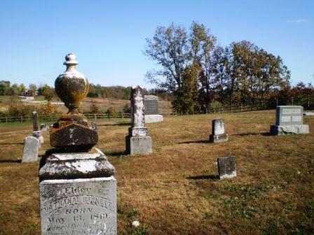
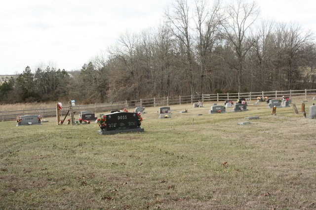
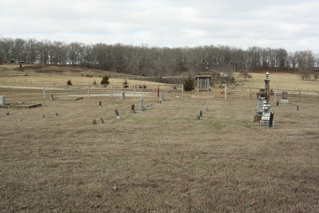
| Description | : | Take Hwy 160 east from West Plains, MO to Hwy 17, go north to Hwy EE, turn right. Cemetery is 1/4 mile on right. The cemetery is well cared for and still in use. The oldest marked grave dates back to 1867, there are numerous unmarked graves. |
frequently asked questions (FAQ):
-
Where is Barnett Cemetery?
Barnett Cemetery is located at Peace Valley, Howell County ,Missouri ,USA.
-
Barnett Cemetery cemetery's updated grave count on graveviews.com?
1 memorials
-
Where are the coordinates of the Barnett Cemetery?
Latitude: 36.7874500
Longitude: -91.7595020


Nearby Cemetories:
1. Barnett Cemetery
West Plains, Howell County, USA
Coordinate: 36.7871476, -91.7582962
2. Bennett Chapel Cemetery
Fanchon, Howell County, USA
Coordinate: 36.8025589, -91.7312546
3. New Hope Cemetery
Peace Valley, Howell County, USA
Coordinate: 36.8303337, -91.7540359
4. Pleasant View Cemetery
West Plains, Howell County, USA
Coordinate: 36.7900009, -91.8257980
5. Saint Joseph Cemetery
White Church, Howell County, USA
Coordinate: 36.8517100, -91.7876100
6. Elk Creek Cemetery
Cull, Howell County, USA
Coordinate: 36.7450600, -91.6929245
7. Dripping Springs Cemetery
West Plains, Howell County, USA
Coordinate: 36.8175583, -91.8487625
8. Howell Valley Cemetery
West Plains, Howell County, USA
Coordinate: 36.7144012, -91.7953033
9. Francis Cemetery
Cull, Howell County, USA
Coordinate: 36.7299995, -91.6789017
10. Oak Lawn Cemetery
West Plains, Howell County, USA
Coordinate: 36.7235985, -91.8419037
11. Galloway Cemetery
West Plains, Howell County, USA
Coordinate: 36.7529106, -91.8682175
12. Campbell Cemetery
West Plains, Howell County, USA
Coordinate: 36.7563600, -91.8721200
13. Antioch Cemetery
Pomona, Howell County, USA
Coordinate: 36.8725200, -91.8307400
14. Jim Willard Farm
Rover, Oregon County, USA
Coordinate: 36.7311100, -91.6496200
15. Chapin Cemetery
West Plains, Howell County, USA
Coordinate: 36.6781006, -91.7683029
16. Sadie Brown Cemetery
West Plains, Howell County, USA
Coordinate: 36.7967186, -91.8965530
17. County Farm Cemetery
Chapin, Howell County, USA
Coordinate: 36.6831017, -91.8097000
18. Howell County Rural Cemetery
Mountain View, Howell County, USA
Coordinate: 36.6831100, -91.8098600
19. Aikens Family Cemetery
Rover, Oregon County, USA
Coordinate: 36.7437200, -91.6285500
20. Mackey Cemetery
Pomona, Howell County, USA
Coordinate: 36.8659554, -91.8659134
21. Lone Pine Cemetery
West Plains, Howell County, USA
Coordinate: 36.7813988, -91.9057999
22. Parker Cemetery
Howell County, USA
Coordinate: 36.6730995, -91.8469009
23. Howell Memorial Park Cemetery
Pomona, Howell County, USA
Coordinate: 36.8460007, -91.9181976
24. Redburn Cemetery
Rover, Oregon County, USA
Coordinate: 36.7174988, -91.6066971