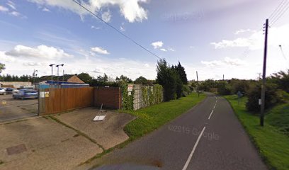
| Memorials | : | 0 |
| Location | : | Clophill, Central Bedfordshire Unitary Authority, England |
| Coordinate | : | 52.0339100, -0.3905900 |
| Description | : | Beadlow Priory (AKA Beaulieu Priory) was a monastic foundation established between 1140 and 1146 by Robert D'Albini for a community of Benedictine monks. Poverty made the community unsustainable and in 1428 the monks left the priory, which became absorbed into St Albans Abbey. In 1434 the ownership of the priory passed to the Crown, whilst the site was finally abandoned as a monastic settlement in 1435. The decay of the buildings ensued after this time, and by 1908 there existed no intact above-ground remains. From 1963 to 1965 archaeological excavations unearthed the foundations as well as artifacts dating to the 12th to 15th... Read More |
frequently asked questions (FAQ):
-
Where is Beadlow Priory?
Beadlow Priory is located at Clophill, Central Bedfordshire Unitary Authority ,Bedfordshire ,England.
-
Beadlow Priory cemetery's updated grave count on graveviews.com?
0 memorials
-
Where are the coordinates of the Beadlow Priory?
Latitude: 52.0339100
Longitude: -0.3905900
Nearby Cemetories:
1. Old St. Mary's Churchyard
Clophill, Central Bedfordshire Unitary Authority, England
Coordinate: 52.0373000, -0.4096000
2. St Mary the Virgin Churchyard
Clophill, Central Bedfordshire Unitary Authority, England
Coordinate: 52.0318880, -0.4126840
3. Chicksands Priory
Chicksands, Central Bedfordshire Unitary Authority, England
Coordinate: 52.0370000, -0.3600000
4. All Saints Churchyard
Campton, Central Bedfordshire Unitary Authority, England
Coordinate: 52.0295430, -0.3544430
5. St Giles Churchyard
Gravenhurst, Central Bedfordshire Unitary Authority, England
Coordinate: 52.0112000, -0.3797000
6. Campton and Shefford Cemetery
Campton, Central Bedfordshire Unitary Authority, England
Coordinate: 52.0351600, -0.3483720
7. St Marys Churchyard
Gravenhurst, Central Bedfordshire Unitary Authority, England
Coordinate: 52.0045690, -0.3821720
8. St Mary Churchyard
Haynes, Central Bedfordshire Unitary Authority, England
Coordinate: 52.0585390, -0.4245850
9. St James the Great Churchyard
Silsoe, Central Bedfordshire Unitary Authority, England
Coordinate: 52.0082000, -0.4246200
10. St Mary the Virgin Churchyard
Meppershall, Central Bedfordshire Unitary Authority, England
Coordinate: 52.0102000, -0.3483000
11. St. Mary the Virgin Churchyard
Maulden, Central Bedfordshire Unitary Authority, England
Coordinate: 52.0307500, -0.4588700
12. All Saints Churchyard
Shillington, Central Bedfordshire Unitary Authority, England
Coordinate: 51.9921700, -0.3648200
13. St John the Baptist Churchyard
Flitton, Central Bedfordshire Unitary Authority, England
Coordinate: 52.0110150, -0.4578050
14. All Saints Churchyard
Upper Stondon, Central Bedfordshire Unitary Authority, England
Coordinate: 52.0065450, -0.3258350
15. All Saints Churchyard
Southill, Central Bedfordshire Unitary Authority, England
Coordinate: 52.0666240, -0.3298690
16. St Margaret Churchyard
Higham Gobion, Central Bedfordshire Unitary Authority, England
Coordinate: 51.9825550, -0.3942590
17. Clifton Friends Burial Ground
Clifton, Central Bedfordshire Unitary Authority, England
Coordinate: 52.0378800, -0.3033100
18. Clifton Baptist Chapelyard
Clifton, Central Bedfordshire Unitary Authority, England
Coordinate: 52.0398940, -0.3025180
19. All Saints New Churchyard
Clifton, Central Bedfordshire Unitary Authority, England
Coordinate: 52.0403500, -0.3018700
20. All Saints Churchyard
Clifton, Central Bedfordshire Unitary Authority, England
Coordinate: 52.0393990, -0.3015550
21. St. James Churchyard
Pulloxhill, Central Bedfordshire Unitary Authority, England
Coordinate: 51.9924399, -0.4552110
22. Ampthill Cemetery
Ampthill, Central Bedfordshire Unitary Authority, England
Coordinate: 52.0341527, -0.4871042
23. St. Leonard's Churchyard
Old Warden, Central Bedfordshire Unitary Authority, England
Coordinate: 52.0855860, -0.3424550
24. All Saints Churchyard
Houghton Conquest, Central Bedfordshire Unitary Authority, England
Coordinate: 52.0614340, -0.4787670

