| Memorials | : | 2 |
| Location | : | Beeston, Broxtowe Borough, England |
| Coordinate | : | 52.9246600, -1.2122000 |
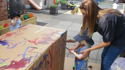
| Description | : | This particular Chapel was constructed about 1805. being occupied in 1806. The Baptist congregation used this chapel until 1890's when construction work was begun on a new "Union" Church. The new building was opened in 1899. From newspaper reports it seems that the land and buildings were renovated in Oct 1903. The whereabouts of any headstones is unknown. They may gave been reused as paving slabs or re-erected at a local cemetery. Currently the building houses a Children's Day and the grave yard is now a Car Park |
frequently asked questions (FAQ):
-
Where is Beeston Baptist Chapel?
Beeston Baptist Chapel is located at Nether Street, Nottingham, England Beeston, Broxtowe Borough ,Nottinghamshire , NG9 2ATEngland.
-
Beeston Baptist Chapel cemetery's updated grave count on graveviews.com?
2 memorials
-
Where are the coordinates of the Beeston Baptist Chapel?
Latitude: 52.9246600
Longitude: -1.2122000
Nearby Cemetories:
1. St. John the Baptist Churchyard
Beeston, Broxtowe Borough, England
Coordinate: 52.9255562, -1.2167680
2. Beeston Cemetery
Beeston, Broxtowe Borough, England
Coordinate: 52.9354540, -1.2275310
3. St Mary's Churchyard
Clifton, Nottingham Unitary Authority, England
Coordinate: 52.9083870, -1.1965435
4. Chilwell Cemetery
Nottingham, Nottingham Unitary Authority, England
Coordinate: 52.9164070, -1.2430800
5. St. Michael and All Angels Churchyard
Bramcote, Broxtowe Borough, England
Coordinate: 52.9352531, -1.2463690
6. St Mary's Church Attenborough
Beeston, Broxtowe Borough, England
Coordinate: 52.9039568, -1.2302235
7. Wollaton Cemetery
Wollaton, Nottingham Unitary Authority, England
Coordinate: 52.9503000, -1.2260800
8. St. Leonard's Churchyard
Wollaton, Nottingham Unitary Authority, England
Coordinate: 52.9529790, -1.2200830
9. Holy Trinity Churchyard
Lenton, Nottingham Unitary Authority, England
Coordinate: 52.9485630, -1.1753148
10. Wilford Village Cemetery
Wilford, Nottingham Unitary Authority, England
Coordinate: 52.9338540, -1.1591170
11. Bramcote Crematorium
Beeston, Broxtowe Borough, England
Coordinate: 52.9456300, -1.2555100
12. St. Wilfrid Churchyard
Wilford, Nottingham Unitary Authority, England
Coordinate: 52.9346290, -1.1587770
13. Stapleford Cemetery
Stapleford, Broxtowe Borough, England
Coordinate: 52.9299770, -1.2699190
14. St. Helen's Churchyard
Stapleford, Broxtowe Borough, England
Coordinate: 52.9316670, -1.2744440
15. St. Peter Churchyard Old Radford
Nottingham, Nottingham Unitary Authority, England
Coordinate: 52.9601830, -1.1789620
16. General Cemetery
Nottingham, Nottingham Unitary Authority, England
Coordinate: 52.9561430, -1.1615420
17. St. Laurence Churchyard
Long Eaton, Erewash Borough, England
Coordinate: 52.8985000, -1.2710000
18. Cathedral Church of St. Barnabas
Nottingham, Nottingham Unitary Authority, England
Coordinate: 52.9546750, -1.1570460
19. Southern Cemetery and Crematorium
West Bridgford, Rushcliffe Borough, England
Coordinate: 52.9113900, -1.1408500
20. St Nicholas Churchyard
Nottingham, Nottingham Unitary Authority, England
Coordinate: 52.9504780, -1.1509220
21. Nottingham General Cemetery
Nottingham, Nottingham Unitary Authority, England
Coordinate: 52.9575370, -1.1594236
22. Hardy Street Jewish Cemetery
Nottingham, Nottingham Unitary Authority, England
Coordinate: 52.9619500, -1.1665900
23. Jewish Cemetery
Nottingham, Nottingham Unitary Authority, England
Coordinate: 52.9123890, -1.1372670
24. St Peters Church Yard
Nottingham, Nottingham Unitary Authority, England
Coordinate: 52.9522800, -1.1486940

