
| Memorials | : | 0 |
| Location | : | Haskerdijken, Heerenveen Municipality, Netherlands |
| Coordinate | : | 53.0059505, 5.8665023 |
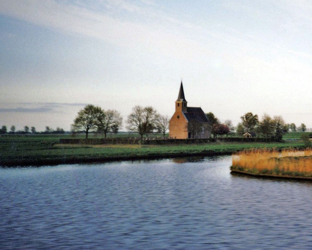
| Description | : | Kapelle van Haskerdijken, from 1818 was built on the site of a medieval monastery |
frequently asked questions (FAQ):
-
Where is Begraafplaats Kerkje De Kapelle Haskerdijken?
Begraafplaats Kerkje De Kapelle Haskerdijken is located at Kapellewei 6 Haskerdijken, Heerenveen Municipality ,Friesland , 8468 MKNetherlands.
-
Begraafplaats Kerkje De Kapelle Haskerdijken cemetery's updated grave count on graveviews.com?
0 memorials
-
Where are the coordinates of the Begraafplaats Kerkje De Kapelle Haskerdijken?
Latitude: 53.0059505
Longitude: 5.8665023
Nearby Cemetories:
1. Westermeer Begraafplaats
Joure, De Fryske Marren Municipality, Netherlands
Coordinate: 52.9634300, 5.8033480
2. Begraafplaats Binnenweg
Heerenveen, Heerenveen Municipality, Netherlands
Coordinate: 52.9505875, 5.9395154
3. Begraafplaats van
Rottum, De Fryske Marren Municipality, Netherlands
Coordinate: 52.9368667, 5.8917667
4. De Knijpe Kerkhof
De Knijpe, Heerenveen Municipality, Netherlands
Coordinate: 52.9678100, 5.9676500
5. Joodse Begraafplaats
Oranjewoud, Heerenveen Municipality, Netherlands
Coordinate: 52.9441810, 5.9499060
6. Begraafplaats Petruskerk
Zuidbroek, Menterwolde Municipality, Netherlands
Coordinate: 53.0000000, 6.0000000
7. Rooms-Katholiek Kerkhof Jirnsum
Jirnsum, Leeuwarden Municipality, Netherlands
Coordinate: 53.0815796, 5.7954741
8. Grouw Begraafplaats
Grou, Leeuwarden Municipality, Netherlands
Coordinate: 53.0943700, 5.8365700
9. Algemene Begraafplaats
Nij Beets, Opsterland Municipality, Netherlands
Coordinate: 53.0667908, 6.0042301
10. Gorredijk General Cemetery
Gorredijk, Opsterland Municipality, Netherlands
Coordinate: 52.9981400, 6.0583800
11. Oude Joodse Begraafplaats
Sneek, Sudwest Fryslan Municipality, Netherlands
Coordinate: 53.0362600, 5.6740600
12. Kortezwaag Cemetery
Kortezwaag, Opsterland Municipality, Netherlands
Coordinate: 52.9905200, 6.0647900
13. Joodse Begraafplaats
Gorredijk, Opsterland Municipality, Netherlands
Coordinate: 52.9824690, 6.0679550
14. Nieuwehorne Protestant Cemetery
Nieuwehorne, Heerenveen Municipality, Netherlands
Coordinate: 52.9511000, 6.0581900
15. Sint-MartinusKerk
Sudwest Fryslan Municipality, Netherlands
Coordinate: 53.0900008, 5.6961870
16. Wartena General Cemetery
Wartena, Leeuwarden Municipality, Netherlands
Coordinate: 53.1489700, 5.8919100
17. Kerkepad Begraafplaats
Wytgaard, Leeuwarden Municipality, Netherlands
Coordinate: 53.1418671, 5.7857350
18. Kerkhof Hervormde Kerk Wartena
Wartena, Leeuwarden Municipality, Netherlands
Coordinate: 53.1495985, 5.8972222
19. Wirdum Protestant Churchyard
Wirdum, Leeuwarden Municipality, Netherlands
Coordinate: 53.1497300, 5.8036500
20. Schillaard General Cemetery
Schillaard, Littenseradiel Municipality, Netherlands
Coordinate: 53.1237600, 5.7074600
21. Tirns Kerkhof
Tirns, Sudwest Fryslan Municipality, Netherlands
Coordinate: 53.0589810, 5.6260940
22. Oldetrijne Cemetery
Oldetrijne, Weststellingwerf Municipality, Netherlands
Coordinate: 52.8566500, 5.9318600
23. Wolvega General Cemetery
Wolvega, Weststellingwerf Municipality, Netherlands
Coordinate: 52.8715200, 6.0103480
24. Redbadtsjerke churchyard
Jorwerd, Littenseradiel Municipality, Netherlands
Coordinate: 53.1457503, 5.7113044