
| Memorials | : | 0 |
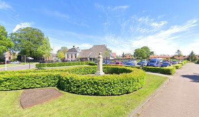
| Location | : | Grou, Leeuwarden Municipality, Netherlands |
| Coordinate | : | 53.0943700, 5.8365700 |
frequently asked questions (FAQ):
-
Where is Grouw Begraafplaats?
Grouw Begraafplaats is located at Grou, Leeuwarden Municipality ,Friesland ,Netherlands.
-
Grouw Begraafplaats cemetery's updated grave count on graveviews.com?
0 memorials
-
Where are the coordinates of the Grouw Begraafplaats?
Latitude: 53.0943700
Longitude: 5.8365700
Nearby Cemetories:
1. Rooms-Katholiek Kerkhof Jirnsum
Jirnsum, Leeuwarden Municipality, Netherlands
Coordinate: 53.0815796, 5.7954741
2. Kerkepad Begraafplaats
Wytgaard, Leeuwarden Municipality, Netherlands
Coordinate: 53.1418671, 5.7857350
3. Wirdum Protestant Churchyard
Wirdum, Leeuwarden Municipality, Netherlands
Coordinate: 53.1497300, 5.8036500
4. Wartena General Cemetery
Wartena, Leeuwarden Municipality, Netherlands
Coordinate: 53.1489700, 5.8919100
5. Kerkhof Hervormde Kerk Wartena
Wartena, Leeuwarden Municipality, Netherlands
Coordinate: 53.1495985, 5.8972222
6. Schillaard General Cemetery
Schillaard, Littenseradiel Municipality, Netherlands
Coordinate: 53.1237600, 5.7074600
7. Sint-MartinusKerk
Sudwest Fryslan Municipality, Netherlands
Coordinate: 53.0900008, 5.6961870
8. Agnestsjerke
Goutum, Leeuwarden Municipality, Netherlands
Coordinate: 53.1786867, 5.8068433
9. Mariatsjerke
Beers, Littenseradiel Municipality, Netherlands
Coordinate: 53.1558525, 5.7329919
10. Begraafplaats Kerkje De Kapelle Haskerdijken
Haskerdijken, Heerenveen Municipality, Netherlands
Coordinate: 53.0059505, 5.8665023
11. Redbadtsjerke churchyard
Jorwerd, Littenseradiel Municipality, Netherlands
Coordinate: 53.1457503, 5.7113044
12. Kerkhof Nederlands Hervormde Kerk
Suwâld, Tytsjerksteradiel Municipality, Netherlands
Coordinate: 53.1791922, 5.9273043
13. Algemene Begraafplaats
Nij Beets, Opsterland Municipality, Netherlands
Coordinate: 53.0667908, 6.0042301
14. Begraafplaats Petruskerk Garyp
Garijp, Tytsjerksteradiel Municipality, Netherlands
Coordinate: 53.1668001, 5.9658672
15. Kerkhof
Baard, Littenseradiel Municipality, Netherlands
Coordinate: 53.1423432, 5.6684373
16. Oude Joodse Begraafplaats
Sneek, Sudwest Fryslan Municipality, Netherlands
Coordinate: 53.0362600, 5.6740600
17. Joodse begraafplaats
Leeuwarden, Leeuwarden Municipality, Netherlands
Coordinate: 53.2089720, 5.7912400
18. Algemene Rooms-Katholieke Begraafplaats Vitushof
Leeuwarden, Leeuwarden Municipality, Netherlands
Coordinate: 53.2061700, 5.7694100
19. Begraafplaats Sint-Vituskerk
Tytsjerk, Tytsjerksteradiel Municipality, Netherlands
Coordinate: 53.2062242, 5.9142663
20. Leeuwarden Noorderbegraafplaats
Leeuwarden, Leeuwarden Municipality, Netherlands
Coordinate: 53.2135900, 5.7733900
21. Tirns Kerkhof
Tirns, Sudwest Fryslan Municipality, Netherlands
Coordinate: 53.0589810, 5.6260940
22. Lekkum Churchyard
Lekkum, Leeuwarden Municipality, Netherlands
Coordinate: 53.2263300, 5.8194900
23. Westermeer Begraafplaats
Joure, De Fryske Marren Municipality, Netherlands
Coordinate: 52.9634300, 5.8033480
24. Sint-Pontianustsjerke
Marsum, Menaldumadeel Municipality, Netherlands
Coordinate: 53.2108700, 5.7280502