
| Memorials | : | 0 |
| Location | : | Gorredijk, Opsterland Municipality, Netherlands |
| Coordinate | : | 52.9981400, 6.0583800 |
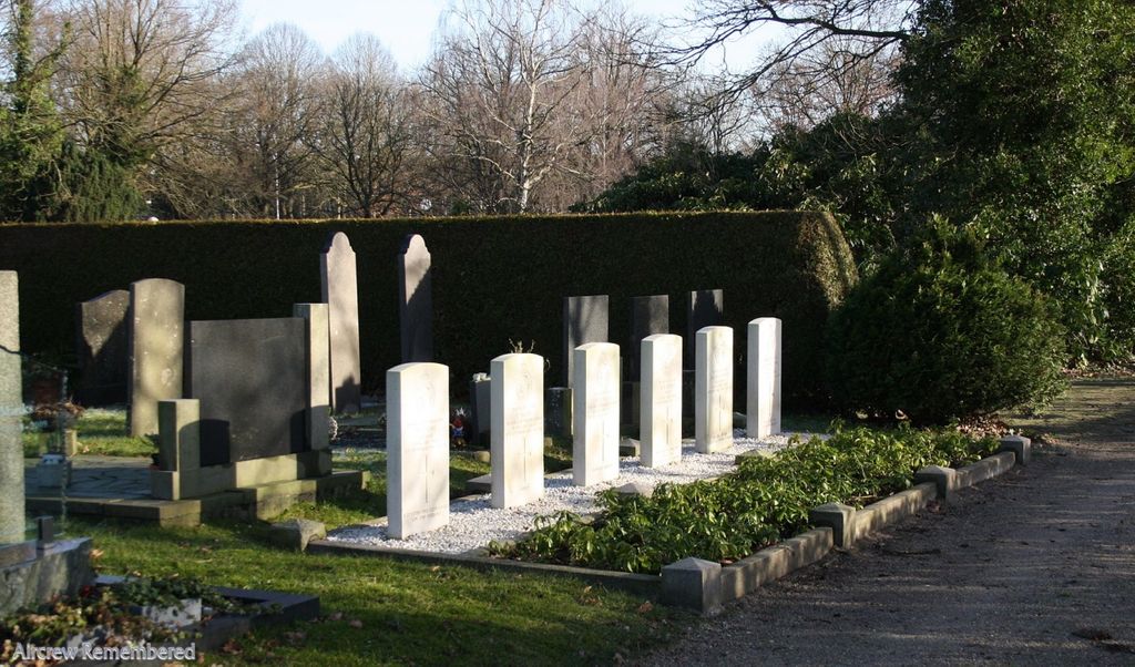
| Description | : | Opsterland is the administrative title of a commune, with headquarters in Beesterzwaag, which controls sixteen villages. Gorredijk is one of these, and lies 30 kilometres south-south-east of Leeuwarden. The cemetery is on the southern outskirts of the village, on the road to Heerenveen. |
frequently asked questions (FAQ):
-
Where is Gorredijk General Cemetery?
Gorredijk General Cemetery is located at Gorredijk, Opsterland Municipality ,Friesland ,Netherlands.
-
Gorredijk General Cemetery cemetery's updated grave count on graveviews.com?
0 memorials
-
Where are the coordinates of the Gorredijk General Cemetery?
Latitude: 52.9981400
Longitude: 6.0583800
Nearby Cemetories:
1. Kortezwaag Cemetery
Kortezwaag, Opsterland Municipality, Netherlands
Coordinate: 52.9905200, 6.0647900
2. Joodse Begraafplaats
Gorredijk, Opsterland Municipality, Netherlands
Coordinate: 52.9824690, 6.0679550
3. Begraafplaats Petruskerk
Zuidbroek, Menterwolde Municipality, Netherlands
Coordinate: 53.0000000, 6.0000000
4. Nieuwehorne Protestant Cemetery
Nieuwehorne, Heerenveen Municipality, Netherlands
Coordinate: 52.9511000, 6.0581900
5. De Knijpe Kerkhof
De Knijpe, Heerenveen Municipality, Netherlands
Coordinate: 52.9678100, 5.9676500
6. Algemene Begraafplaats
Nij Beets, Opsterland Municipality, Netherlands
Coordinate: 53.0667908, 6.0042301
7. Joodse Begraafplaats
Oranjewoud, Heerenveen Municipality, Netherlands
Coordinate: 52.9441810, 5.9499060
8. Begraafplaats Binnenweg
Heerenveen, Heerenveen Municipality, Netherlands
Coordinate: 52.9505875, 5.9395154
9. Begraafplaats Kerkje De Kapelle Haskerdijken
Haskerdijken, Heerenveen Municipality, Netherlands
Coordinate: 53.0059505, 5.8665023
10. Begraafplaats van
Rottum, De Fryske Marren Municipality, Netherlands
Coordinate: 52.9368667, 5.8917667
11. Wolvega General Cemetery
Wolvega, Weststellingwerf Municipality, Netherlands
Coordinate: 52.8715200, 6.0103480
12. Drachtstercompagnie Protestant Churchyard
Drachtstercompagnie, Smallingerland Municipality, Netherlands
Coordinate: 53.1353300, 6.1450000
13. Westermeer Begraafplaats
Joure, De Fryske Marren Municipality, Netherlands
Coordinate: 52.9634300, 5.8033480
14. Oldetrijne Cemetery
Oldetrijne, Weststellingwerf Municipality, Netherlands
Coordinate: 52.8566500, 5.9318600
15. Grouw Begraafplaats
Grou, Leeuwarden Municipality, Netherlands
Coordinate: 53.0943700, 5.8365700
16. De Wilp Cemetery
De Wilp, Marum Municipality, Netherlands
Coordinate: 53.1231200, 6.2500100
17. Willemsoord General Cemetery
Willemsoord, Steenwijkerland Municipality, Netherlands
Coordinate: 52.8266800, 6.0706300
18. Begraafplaats Petruskerk Garyp
Garijp, Tytsjerksteradiel Municipality, Netherlands
Coordinate: 53.1668001, 5.9658672
19. Rooms-Katholiek Kerkhof Jirnsum
Jirnsum, Leeuwarden Municipality, Netherlands
Coordinate: 53.0815796, 5.7954741
20. Kerkhof Hervormde Kerk Wartena
Wartena, Leeuwarden Municipality, Netherlands
Coordinate: 53.1495985, 5.8972222
21. Wartena General Cemetery
Wartena, Leeuwarden Municipality, Netherlands
Coordinate: 53.1489700, 5.8919100
22. Algemene Begraafplaats
Paasloo, Steenwijkerland Municipality, Netherlands
Coordinate: 52.8133500, 6.0135300
23. It Heechsân Cemetery
Eastermar, Tytsjerksteradiel Municipality, Netherlands
Coordinate: 53.1851321, 6.0703815
24. Marum Cemetery
Marum, Marum Municipality, Netherlands
Coordinate: 53.1461400, 6.2535900