
| Memorials | : | 0 |
| Location | : | Wirdum, Leeuwarden Municipality, Netherlands |
| Coordinate | : | 53.1497300, 5.8036500 |
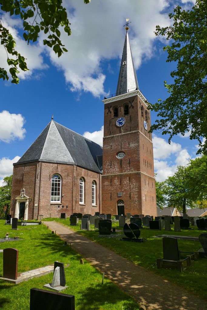
| Description | : | Wirdum, administered by Leeuwarden, is 8 kilometres south of that town, about 2 kilometres east of the main road to Meppel. The churchyard surrounds the church, in the centre of the village. |
frequently asked questions (FAQ):
-
Where is Wirdum Protestant Churchyard?
Wirdum Protestant Churchyard is located at Wirdum, Leeuwarden Municipality ,Friesland ,Netherlands.
-
Wirdum Protestant Churchyard cemetery's updated grave count on graveviews.com?
0 memorials
-
Where are the coordinates of the Wirdum Protestant Churchyard?
Latitude: 53.1497300
Longitude: 5.8036500
Nearby Cemetories:
1. Kerkepad Begraafplaats
Wytgaard, Leeuwarden Municipality, Netherlands
Coordinate: 53.1418671, 5.7857350
2. Agnestsjerke
Goutum, Leeuwarden Municipality, Netherlands
Coordinate: 53.1786867, 5.8068433
3. Mariatsjerke
Beers, Littenseradiel Municipality, Netherlands
Coordinate: 53.1558525, 5.7329919
4. Wartena General Cemetery
Wartena, Leeuwarden Municipality, Netherlands
Coordinate: 53.1489700, 5.8919100
5. Redbadtsjerke churchyard
Jorwerd, Littenseradiel Municipality, Netherlands
Coordinate: 53.1457503, 5.7113044
6. Kerkhof Hervormde Kerk Wartena
Wartena, Leeuwarden Municipality, Netherlands
Coordinate: 53.1495985, 5.8972222
7. Grouw Begraafplaats
Grou, Leeuwarden Municipality, Netherlands
Coordinate: 53.0943700, 5.8365700
8. Joodse begraafplaats
Leeuwarden, Leeuwarden Municipality, Netherlands
Coordinate: 53.2089720, 5.7912400
9. Algemene Rooms-Katholieke Begraafplaats Vitushof
Leeuwarden, Leeuwarden Municipality, Netherlands
Coordinate: 53.2061700, 5.7694100
10. Schillaard General Cemetery
Schillaard, Littenseradiel Municipality, Netherlands
Coordinate: 53.1237600, 5.7074600
11. Leeuwarden Noorderbegraafplaats
Leeuwarden, Leeuwarden Municipality, Netherlands
Coordinate: 53.2135900, 5.7733900
12. Rooms-Katholiek Kerkhof Jirnsum
Jirnsum, Leeuwarden Municipality, Netherlands
Coordinate: 53.0815796, 5.7954741
13. Sint-Pontianustsjerke
Marsum, Menaldumadeel Municipality, Netherlands
Coordinate: 53.2108700, 5.7280502
14. Lekkum Churchyard
Lekkum, Leeuwarden Municipality, Netherlands
Coordinate: 53.2263300, 5.8194900
15. Kerkhof Nederlands Hervormde Kerk
Suwâld, Tytsjerksteradiel Municipality, Netherlands
Coordinate: 53.1791922, 5.9273043
16. Kerkhof
Baard, Littenseradiel Municipality, Netherlands
Coordinate: 53.1423432, 5.6684373
17. Begraafplaats Sint-Vituskerk
Tytsjerk, Tytsjerksteradiel Municipality, Netherlands
Coordinate: 53.2062242, 5.9142663
18. Sint-MartinusKerk
Sudwest Fryslan Municipality, Netherlands
Coordinate: 53.0900008, 5.6961870
19. Kerkhof Cornjum
Cornjum, Leeuwarderadeel Municipality, Netherlands
Coordinate: 53.2431266, 5.7825235
20. Begraafplaats Petruskerk Garyp
Garijp, Tytsjerksteradiel Municipality, Netherlands
Coordinate: 53.1668001, 5.9658672
21. Rijperkerk Nederlands Hervormd Kerkhof
Rijperkerk, Tytsjerksteradiel Municipality, Netherlands
Coordinate: 53.2221200, 5.9183300
22. Giekerk Martinuskerk
Giekerk, Tytsjerksteradiel Municipality, Netherlands
Coordinate: 53.2411660, 5.8785276
23. Sint-Vituskerk
Wyns, Tytsjerksteradiel Municipality, Netherlands
Coordinate: 53.2516880, 5.8322860
24. Kerkhof Johanneskerk
Britsum, Leeuwarderadeel Municipality, Netherlands
Coordinate: 53.2542998, 5.7855996