
| Memorials | : | 0 |
| Location | : | Zeist, Zeist Municipality, Netherlands |
| Coordinate | : | 52.0898060, 5.2776180 |
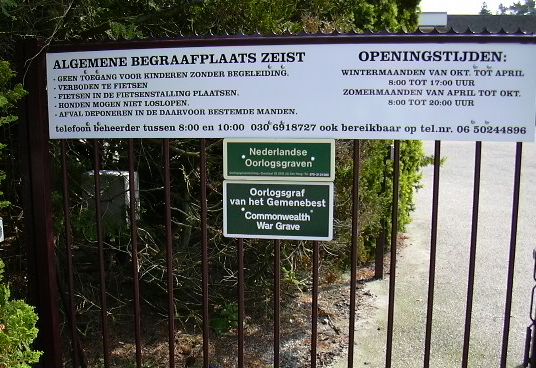
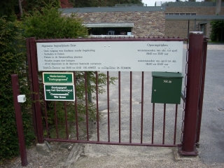
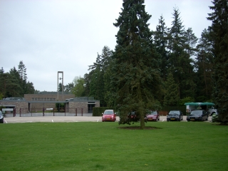
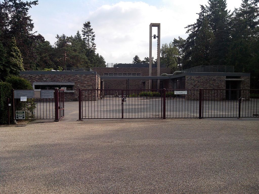
| Description | : | The name of the cemetery has changed in january 2020 to: Zeister Bosrust From 07-01-2020 there is a new name and address for the same cemetery that was previously called "nieuwe begraafplaats Zeist". The new name is Zeister Bosrust Cemetery. An electric crematorium has now also been built, which was put into use on April 20, 2020. |
frequently asked questions (FAQ):
-
Where is Begraafplaats Zeister Bosrust?
Begraafplaats Zeister Bosrust is located at Woudenbergseweg 46 Zeist, Zeist Municipality ,Utrecht , 3707 HXNetherlands.
-
Begraafplaats Zeister Bosrust cemetery's updated grave count on graveviews.com?
0 memorials
-
Where are the coordinates of the Begraafplaats Zeister Bosrust?
Latitude: 52.0898060
Longitude: 5.2776180
Nearby Cemetories:
1. Begraafplaats Soesterberg
Soest Municipality, Netherlands
Coordinate: 52.1091680, 5.2883344
2. Oude Algemene Begraafplaats
Zeist, Zeist Municipality, Netherlands
Coordinate: 52.0910100, 5.2400300
3. Nieuwe Begraafplaats
Driebergen-Rijsenburg, Utrechtse Heuvelrug Municipality, Netherlands
Coordinate: 52.0641100, 5.3100900
4. R.K. Begraafplaats Drieklinken
Driebergen-Rijsenburg, Utrechtse Heuvelrug Municipality, Netherlands
Coordinate: 52.0535356, 5.2747502
5. Doorn Nieuwe Algemene Begraafplaats
Doorn, Utrechtse Heuvelrug Municipality, Netherlands
Coordinate: 52.0484200, 5.3203200
6. Sint-Barbarakerk Begraafplaats
Bunnik, Bunnik Municipality, Netherlands
Coordinate: 52.0662689, 5.2050647
7. Oude Kerkhof Dorpskerk
De Bilt, De Bilt Municipality, Netherlands
Coordinate: 52.1044724, 5.1818385
8. Bilthoven Begraafplaats Brandenburg
Bilthoven, De Bilt Municipality, Netherlands
Coordinate: 52.1174800, 5.1856800
9. Oude Algemene Begraafplaats
Doorn, Utrechtse Heuvelrug Municipality, Netherlands
Coordinate: 52.0397100, 5.3459400
10. Katholieke Begraafplaats
Maarn, Utrechtse Heuvelrug Municipality, Netherlands
Coordinate: 52.0673700, 5.3790400
11. Amersfoort Concentration Camp
Leusden Municipality, Netherlands
Coordinate: 52.1322500, 5.3652800
12. Huis Doorn
Doorn, Utrechtse Heuvelrug Municipality, Netherlands
Coordinate: 52.0314140, 5.3386660
13. Bilthoven Den en Rust Cemetery
Bilthoven, De Bilt Municipality, Netherlands
Coordinate: 52.1407776, 5.2003312
14. Algemene Begraafplaats Oud Leusden
Oud-Leusden, Leusden Municipality, Netherlands
Coordinate: 52.1310600, 5.3721800
15. Rusthof Cemetery
Oud-Leusden, Leusden Municipality, Netherlands
Coordinate: 52.1288100, 5.3758500
16. Groenekan Nederlands Hevormde Begraafplaats
Groenekan, De Bilt Municipality, Netherlands
Coordinate: 52.1192100, 5.1654300
17. Woudenberg General Cemetery
Woudenberg, Woudenberg Municipality, Netherlands
Coordinate: 52.0823400, 5.4079800
18. Algemene Begraafplaats
Soest, Soest Municipality, Netherlands
Coordinate: 52.1712700, 5.3074300
19. Hervormde Begraafplaats Nederlangbroek
Langbroek, Wijk bij Duurstede Municipality, Netherlands
Coordinate: 52.0114502, 5.3274783
20. Joodse Begraafplaats Soesterweg
Amersfoort, Amersfoort Municipality, Netherlands
Coordinate: 52.1570050, 5.3699520
21. Amersfoort Soesterkwartier Cemetery
Amersfoort, Amersfoort Municipality, Netherlands
Coordinate: 52.1575100, 5.3689900
22. Amersfoort Roman Catholic Cemetery
Amersfoort, Amersfoort Municipality, Netherlands
Coordinate: 52.1509300, 5.3818700
23. Utrecht Kovelswade Algemene Begraafplaats
Utrecht, Utrecht Municipality, Netherlands
Coordinate: 52.0759735, 5.1351638
24. Utrecht Tolsteeg Cemetery
Utrecht, Utrecht Municipality, Netherlands
Coordinate: 52.0724100, 5.1318400