
| Memorials | : | 0 |
| Location | : | Langbroek, Wijk bij Duurstede Municipality, Netherlands |
| Phone | : | 0343 56 1433 |
| Website | : | hervormdlangbroek.nl/onze-gemeente/begraafplaats/ |
| Coordinate | : | 52.0114502, 5.3274783 |
frequently asked questions (FAQ):
-
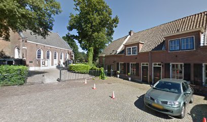
Where is Hervormde Begraafplaats Nederlangbroek?
Hervormde Begraafplaats Nederlangbroek is located at Brink 8 Langbroek, Wijk bij Duurstede Municipality ,Utrecht , 3947 NSNetherlands.
-
Hervormde Begraafplaats Nederlangbroek cemetery's updated grave count on graveviews.com?
0 memorials
-
Where are the coordinates of the Hervormde Begraafplaats Nederlangbroek?
Latitude: 52.0114502
Longitude: 5.3274783
Nearby Cemetories:
1. Huis Doorn
Doorn, Utrechtse Heuvelrug Municipality, Netherlands
Coordinate: 52.0314140, 5.3386660
2. Oude Algemene Begraafplaats
Doorn, Utrechtse Heuvelrug Municipality, Netherlands
Coordinate: 52.0397100, 5.3459400
3. Wijk-Bij-Duurstede General Cemetery
Wijk bij Duurstede, Wijk bij Duurstede Municipality, Netherlands
Coordinate: 51.9751800, 5.3388600
4. Joodse Begraafplaats Steenstraat
Wijk bij Duurstede Municipality, Netherlands
Coordinate: 51.9757500, 5.3432200
5. Doorn Nieuwe Algemene Begraafplaats
Doorn, Utrechtse Heuvelrug Municipality, Netherlands
Coordinate: 52.0484200, 5.3203200
6. Joodse Begraafplaats Heijmanspad
Wijk bij Duurstede Municipality, Netherlands
Coordinate: 51.9709900, 5.3428500
7. R.K. Begraafplaats Drieklinken
Driebergen-Rijsenburg, Utrechtse Heuvelrug Municipality, Netherlands
Coordinate: 52.0535356, 5.2747502
8. Nieuwe Begraafplaats
Driebergen-Rijsenburg, Utrechtse Heuvelrug Municipality, Netherlands
Coordinate: 52.0641100, 5.3100900
9. Nieuwe Begraafplaats
Leersum, Utrechtse Heuvelrug Municipality, Netherlands
Coordinate: 52.0163800, 5.4197400
10. Katholieke Begraafplaats
Maarn, Utrechtse Heuvelrug Municipality, Netherlands
Coordinate: 52.0673700, 5.3790400
11. Beusichem Algemene Begraafplaats
Beusichem, Buren Municipality, Netherlands
Coordinate: 51.9482800, 5.2960800
12. Joodse begraafplaats Culemborg
Culemborg Municipality, Netherlands
Coordinate: 51.9626100, 5.2322500
13. Culemborg General Cemetery
Culemborg, Culemborg Municipality, Netherlands
Coordinate: 51.9632800, 5.2311300
14. Maurik Roman Catholic Cemetery
Maurik, Buren Municipality, Netherlands
Coordinate: 51.9617100, 5.4302500
15. Begraafplaats Zeister Bosrust
Zeist, Zeist Municipality, Netherlands
Coordinate: 52.0898060, 5.2776180
16. Schalkwijk Protestant Churchyard
Schalkwijk, Houten Municipality, Netherlands
Coordinate: 51.9910100, 5.1933300
17. Amerongen Holleweg General Cemetery
Amerongen, Utrechtse Heuvelrug Municipality, Netherlands
Coordinate: 52.0030000, 5.4665700
18. Woudenberg General Cemetery
Woudenberg, Woudenberg Municipality, Netherlands
Coordinate: 52.0823400, 5.4079800
19. Oude Begraafplaats
Amerongen, Utrechtse Heuvelrug Municipality, Netherlands
Coordinate: 51.9989844, 5.4677837
20. Schalkwijk Roman Catholic Cemetery
Schalkwijk, Houten Municipality, Netherlands
Coordinate: 51.9949500, 5.1845200
21. Sint-Barbarakerk Begraafplaats
Bunnik, Bunnik Municipality, Netherlands
Coordinate: 52.0662689, 5.2050647
22. Oude Algemene Begraafplaats
Zeist, Zeist Municipality, Netherlands
Coordinate: 52.0910100, 5.2400300
23. Joodse begraafplaats
Buren Municipality, Netherlands
Coordinate: 51.9125800, 5.3296490
24. Buren Old General Cemetery
Buren, Buren Municipality, Netherlands
Coordinate: 51.9122100, 5.3298600