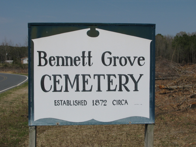
| Memorials | : | 2 |
| Location | : | Polkton, Anson County, USA |
| Coordinate | : | 34.9847908, -80.1757202 |
| Description | : | Coming from Polkton on highway 74 east. Turn right onto Prison Camp Road. Turn right onto Old Prison Camp Road. Cemetery will be on the left after you pass Lanesboro Correctional. In an old cemetery survey in 1939 this cemetery is know as Billingsley-Gaddy-Bennett Cemetery. I am sure this is the original name because there are graves here older than the organized date on the cemetery sign. This cemetery has also been known as Unity Chapel Presbyterian Church Cemetery. There was a church beside it at one time by that name but the cemetery is older than the church. It has... Read More |
frequently asked questions (FAQ):
-
Where is Bennett Grove Cemetery?
Bennett Grove Cemetery is located at Prison Camp Road Polkton, Anson County ,North Carolina , 28135USA.
-
Bennett Grove Cemetery cemetery's updated grave count on graveviews.com?
2 memorials
-
Where are the coordinates of the Bennett Grove Cemetery?
Latitude: 34.9847908
Longitude: -80.1757202
Nearby Cemetories:
1. Westview Memorial Park
Russellville, Anson County, USA
Coordinate: 34.9867440, -80.1476560
2. Richmond-Sturdivant Cemetery
Polkton, Anson County, USA
Coordinate: 35.0036011, -80.1592026
3. Branch-Old Polkton Cemetery
Polkton, Anson County, USA
Coordinate: 35.0052580, -80.1982100
4. Lawrence & Tabitha Moore Family Cemetery
Anson County, USA
Coordinate: 34.9531410, -80.1789090
5. W Edmund Horne Family Cemetery
Polkton, Anson County, USA
Coordinate: 34.9924040, -80.2159670
6. Williams Cemetery
Polkton, Anson County, USA
Coordinate: 35.0026910, -80.2119000
7. West Rocky Ford Missionary Baptist Church Cemetery
Wadesboro, Anson County, USA
Coordinate: 34.9518660, -80.1426080
8. May Cemetery
Polkton, Anson County, USA
Coordinate: 35.0236050, -80.1982000
9. Griffin and Old Davis Cemetery
Polkton, Anson County, USA
Coordinate: 35.0123010, -80.2169750
10. Brown Creek Baptist Church Cemetery
Wadesboro, Anson County, USA
Coordinate: 35.0240000, -80.1388000
11. Henry Cemetery
Polkton, Anson County, USA
Coordinate: 34.9338200, -80.1701710
12. Poplar Hill United Methodist Church Cemetery
Polkton, Anson County, USA
Coordinate: 34.9383230, -80.2031990
13. Preslars Cemetery
Polkton, Anson County, USA
Coordinate: 35.0266100, -80.2131720
14. Covington Cemetery
Peachland, Anson County, USA
Coordinate: 34.9942320, -80.2457020
15. John Horne Cemetery
White Store Township, Anson County, USA
Coordinate: 34.9261230, -80.1853470
16. Magnolia Summitt Cemetery
Wadesboro, Anson County, USA
Coordinate: 34.9786700, -80.1010600
17. Beeman Cemetery
Peachland, Anson County, USA
Coordinate: 34.9981610, -80.2533140
18. Mineral Springs Baptist Church Cemetery
Peachland, Anson County, USA
Coordinate: 34.9440660, -80.2407720
19. Peachland Cemetery
Peachland, Anson County, USA
Coordinate: 34.9854730, -80.2620790
20. Gordon Mountain Cemetery
Wadesboro Township, Anson County, USA
Coordinate: 34.9162604, -80.2001372
21. Gaddy's Wild Goose Refuge
Ansonville, Anson County, USA
Coordinate: 34.9766870, -80.0859920
22. Mount Vernon United Methodist Church Cemetery
Wadesboro, Anson County, USA
Coordinate: 35.0575600, -80.1569930
23. Old Westview Cemetery
Wadesboro, Anson County, USA
Coordinate: 34.9706210, -80.0852020
24. Gray Cemetery
Peachland, Anson County, USA
Coordinate: 34.9873410, -80.2685380

