
| Memorials | : | 0 |
| Location | : | Anson County, USA |
| Coordinate | : | 34.9531410, -80.1789090 |
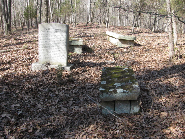
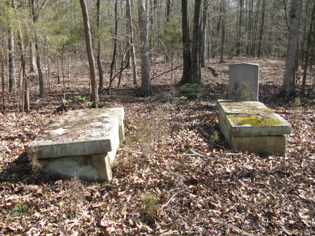
| Description | : | In Polkton,Anson Co NC going east on 74, turn right southeast on 1249 Prison Camp Road. Go one half mile turn right south on 1121 Camden Church Road. (Note: Camden Church Road is now Prison Camp Road). Go 2.8 miles. On the right, west, is a road into the woods. Three tenths of a mile is a pile of trash. Go right 200 feet in the woods to the cemetery near Little Brown Creek /You are now South west of Wadesboro,N. C. From Wadesboro you travel White Store Rd to it's intersection with RP State Rd 1121(Prison Camp Rd). A... Read More |
frequently asked questions (FAQ):
-
Where is Lawrence & Tabitha Moore Family Cemetery?
Lawrence & Tabitha Moore Family Cemetery is located at Old Camden Rd now Prison Camp RdArea SW of Wadesboro Anson County ,North Carolina ,USA.
-
Lawrence & Tabitha Moore Family Cemetery cemetery's updated grave count on graveviews.com?
0 memorials
-
Where are the coordinates of the Lawrence & Tabitha Moore Family Cemetery?
Latitude: 34.9531410
Longitude: -80.1789090


Nearby Cemetories:
1. Henry Cemetery
Polkton, Anson County, USA
Coordinate: 34.9338200, -80.1701710
2. Poplar Hill United Methodist Church Cemetery
Polkton, Anson County, USA
Coordinate: 34.9383230, -80.2031990
3. John Horne Cemetery
White Store Township, Anson County, USA
Coordinate: 34.9261230, -80.1853470
4. West Rocky Ford Missionary Baptist Church Cemetery
Wadesboro, Anson County, USA
Coordinate: 34.9518660, -80.1426080
5. Bennett Grove Cemetery
Polkton, Anson County, USA
Coordinate: 34.9847908, -80.1757202
6. Gordon Mountain Cemetery
Wadesboro Township, Anson County, USA
Coordinate: 34.9162604, -80.2001372
7. Westview Memorial Park
Russellville, Anson County, USA
Coordinate: 34.9867440, -80.1476560
8. W Edmund Horne Family Cemetery
Polkton, Anson County, USA
Coordinate: 34.9924040, -80.2159670
9. Poplar Hill Missionary Baptist Church Cemetery
Polkton, Anson County, USA
Coordinate: 34.9182590, -80.2223500
10. Mineral Springs Baptist Church Cemetery
Peachland, Anson County, USA
Coordinate: 34.9440660, -80.2407720
11. Tillman Cemetery
Travis, Anson County, USA
Coordinate: 34.9068350, -80.1492490
12. Richmond-Sturdivant Cemetery
Polkton, Anson County, USA
Coordinate: 35.0036011, -80.1592026
13. Camden Presbyterian Church Cemetery
Wadesboro, Anson County, USA
Coordinate: 34.9083061, -80.1437073
14. Branch-Old Polkton Cemetery
Polkton, Anson County, USA
Coordinate: 35.0052580, -80.1982100
15. Williams Cemetery
Polkton, Anson County, USA
Coordinate: 35.0026910, -80.2119000
16. Chewning Cemetery
Lowrys, Anson County, USA
Coordinate: 34.8983231, -80.1577988
17. McGregor Cemetery
White Store Township, Anson County, USA
Coordinate: 34.8868904, -80.1724396
18. Griffin and Old Davis Cemetery
Polkton, Anson County, USA
Coordinate: 35.0123010, -80.2169750
19. Gaddy Cemetery
Deep Creek, Anson County, USA
Coordinate: 34.8924332, -80.1427307
20. Covington Cemetery
Peachland, Anson County, USA
Coordinate: 34.9942320, -80.2457020
21. Magnolia Summitt Cemetery
Wadesboro, Anson County, USA
Coordinate: 34.9786700, -80.1010600
22. Hanna Chapel United Methodist Church Cemetery
Wadesboro, Anson County, USA
Coordinate: 34.9461680, -80.0919250
23. May Cemetery
Polkton, Anson County, USA
Coordinate: 35.0236050, -80.1982000
24. Sturdivant-Bennett-Dargan Cemetery
Peachland, Anson County, USA
Coordinate: 34.9506000, -80.2701150