
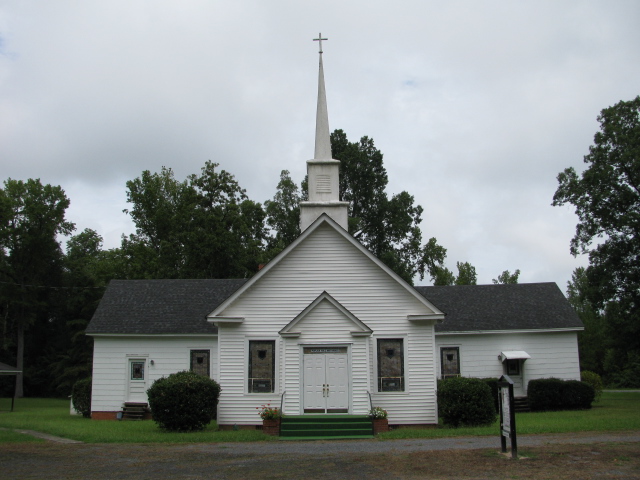
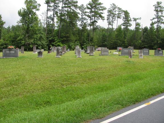
| Memorials | : | 3 |
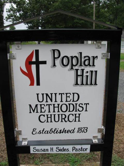
| Location | : | Polkton, Anson County, USA |
| Coordinate | : | 34.9383230, -80.2031990 |
| Description | : | Take highway 109 south from Wadesboro, N.C. Go about 7 miles and turn right on Camden Church Road. Turn the first left which is White Store Road. Then turn the first right which is Poplar Hill Church Road. Church will be on the left and cemetery on the right. |
frequently asked questions (FAQ):
-
Where is Poplar Hill United Methodist Church Cemetery?
Poplar Hill United Methodist Church Cemetery is located at Polkton, Anson County ,North Carolina ,USA.
-
Poplar Hill United Methodist Church Cemetery cemetery's updated grave count on graveviews.com?
3 memorials
-
Where are the coordinates of the Poplar Hill United Methodist Church Cemetery?
Latitude: 34.9383230
Longitude: -80.2031990
Nearby Cemetories:
1. John Horne Cemetery
White Store Township, Anson County, USA
Coordinate: 34.9261230, -80.1853470
2. Gordon Mountain Cemetery
Wadesboro Township, Anson County, USA
Coordinate: 34.9162604, -80.2001372
3. Lawrence & Tabitha Moore Family Cemetery
Anson County, USA
Coordinate: 34.9531410, -80.1789090
4. Poplar Hill Missionary Baptist Church Cemetery
Polkton, Anson County, USA
Coordinate: 34.9182590, -80.2223500
5. Henry Cemetery
Polkton, Anson County, USA
Coordinate: 34.9338200, -80.1701710
6. Mineral Springs Baptist Church Cemetery
Peachland, Anson County, USA
Coordinate: 34.9440660, -80.2407720
7. West Rocky Ford Missionary Baptist Church Cemetery
Wadesboro, Anson County, USA
Coordinate: 34.9518660, -80.1426080
8. Bennett Grove Cemetery
Polkton, Anson County, USA
Coordinate: 34.9847908, -80.1757202
9. Tillman Cemetery
Travis, Anson County, USA
Coordinate: 34.9068350, -80.1492490
10. Chewning Cemetery
Lowrys, Anson County, USA
Coordinate: 34.8983231, -80.1577988
11. W Edmund Horne Family Cemetery
Polkton, Anson County, USA
Coordinate: 34.9924040, -80.2159670
12. Col. Joseph White Cemetery
White Store Township, Anson County, USA
Coordinate: 34.9440760, -80.2709150
13. Sturdivant-Bennett-Dargan Cemetery
Peachland, Anson County, USA
Coordinate: 34.9506000, -80.2701150
14. Redfearn Cemetery
White Store Township, Anson County, USA
Coordinate: 34.8831670, -80.2186670
15. Camden Presbyterian Church Cemetery
Wadesboro, Anson County, USA
Coordinate: 34.9083061, -80.1437073
16. McGregor Cemetery
White Store Township, Anson County, USA
Coordinate: 34.8868904, -80.1724396
17. Union Methodist Church Cemetery
White Store Township, Anson County, USA
Coordinate: 34.8811188, -80.2098846
18. Gulledge Cemetery
White Store Township, Anson County, USA
Coordinate: 34.8821640, -80.2390366
19. Williams Cemetery
Polkton, Anson County, USA
Coordinate: 35.0026910, -80.2119000
20. Barrett Cemetery
White Store Township, Anson County, USA
Coordinate: 34.9109192, -80.2752991
21. Covington Cemetery
Peachland, Anson County, USA
Coordinate: 34.9942320, -80.2457020
22. Westview Memorial Park
Russellville, Anson County, USA
Coordinate: 34.9867440, -80.1476560
23. Gulledge Cemetery
White Store Township, Anson County, USA
Coordinate: 34.8834496, -80.2495880
24. Branch-Old Polkton Cemetery
Polkton, Anson County, USA
Coordinate: 35.0052580, -80.1982100