
| Memorials | : | 1 |
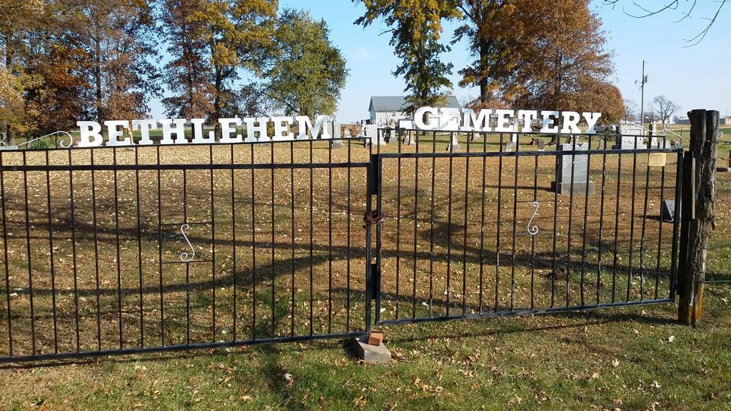
| Location | : | Audrain County, USA |
| Coordinate | : | 39.2680964, -92.0629515 |
| Description | : | Directions to Cemetery: State Highway 22 to State Road E, 5 miles North on State Highway E to State Road T, West about 3 miles to Cemetery, sits on North side of State Road T. This cemetery is located in Wilson Township; Audrain Co., Missouri (Sec 20; Township 52N; Range 10W) |
frequently asked questions (FAQ):
-
Where is Bethlehem Cemetery?
Bethlehem Cemetery is located at Audrain County ,Missouri ,USA.
-
Bethlehem Cemetery cemetery's updated grave count on graveviews.com?
1 memorials
-
Where are the coordinates of the Bethlehem Cemetery?
Latitude: 39.2680964
Longitude: -92.0629515
Nearby Cemetories:
1. Skull Lick Cemetery
Audrain County, USA
Coordinate: 39.2186012, -92.0524979
2. Pool Family Cemetery
Audrain County, USA
Coordinate: 39.2151900, -92.0544000
3. Maple Grove United Methodist Church Cemetery
Rowena, Audrain County, USA
Coordinate: 39.3252430, -92.0521150
4. Liberty Christian Church Cemetery
Skinner, Audrain County, USA
Coordinate: 39.2193400, -92.0098700
5. Glendale Memorial Gardens
Centralia, Boone County, USA
Coordinate: 39.2200012, -92.1342010
6. Antioch Christian Church Cemetery
Rowena, Audrain County, USA
Coordinate: 39.3401500, -92.0461700
7. Centralia Cemetery
Centralia, Boone County, USA
Coordinate: 39.2175400, -92.1340400
8. New Hope Cemetery
Mexico, Audrain County, USA
Coordinate: 39.1726420, -92.0498890
9. Applemans Chapel Cemetery
Saling, Audrain County, USA
Coordinate: 39.2646600, -92.1972400
10. Midway Christian Church Cemetery
Mexico, Audrain County, USA
Coordinate: 39.3244500, -91.9397200
11. Long Branch Cemetery
Monroe County, USA
Coordinate: 39.3418999, -91.9488983
12. Trinity Cemetery
Audrain County, USA
Coordinate: 39.2392006, -91.9141998
13. Mount Zion Cemetery
Paris, Monroe County, USA
Coordinate: 39.3882740, -92.0526410
14. Union Church Cemetery
Centralia, Boone County, USA
Coordinate: 39.1749992, -92.1635971
15. German Cemetery
Boone County, USA
Coordinate: 39.1418991, -92.1121979
16. Pleasant Grove Cemetery
Boone County, USA
Coordinate: 39.1514015, -92.1436005
17. Sunrise Christian Cemetery
Audrain County, USA
Coordinate: 39.2475320, -91.8926930
18. Mount Zion Cemetery
Audrain County, USA
Coordinate: 39.2933006, -91.8933029
19. Fountain Cemetery
Boone County, USA
Coordinate: 39.1963997, -92.2118988
20. Jesse Cemetery
Mexico, Audrain County, USA
Coordinate: 39.1683900, -91.9384800
21. Salt River Christian Church Cemetery
Mexico, Audrain County, USA
Coordinate: 39.1300200, -92.0340400
22. Berea Cemetery
Mexico, Audrain County, USA
Coordinate: 39.3352100, -91.8888900
23. Pleasant Grove Cemetery
Audrain County, USA
Coordinate: 39.3022900, -92.2536200
24. Mount Airy Cemetery
Holliday, Monroe County, USA
Coordinate: 39.4137830, -92.1168100