
| Memorials | : | 2 |
| Location | : | Saling, Audrain County, USA |
| Coordinate | : | 39.2646600, -92.1972400 |
| Description | : | Highway 22 to Centralia, MO (Boone County), turn north on 151, north on Audrain County Road 133...Cemetery is on the corner of Audrain County Road's 133 and 112. SW corner of the NW 1/4 of Sec. 30 T 52N R11W Saling Township |
frequently asked questions (FAQ):
-
Where is Applemans Chapel Cemetery?
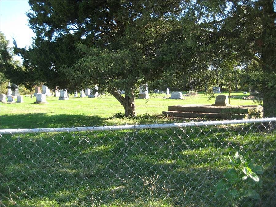
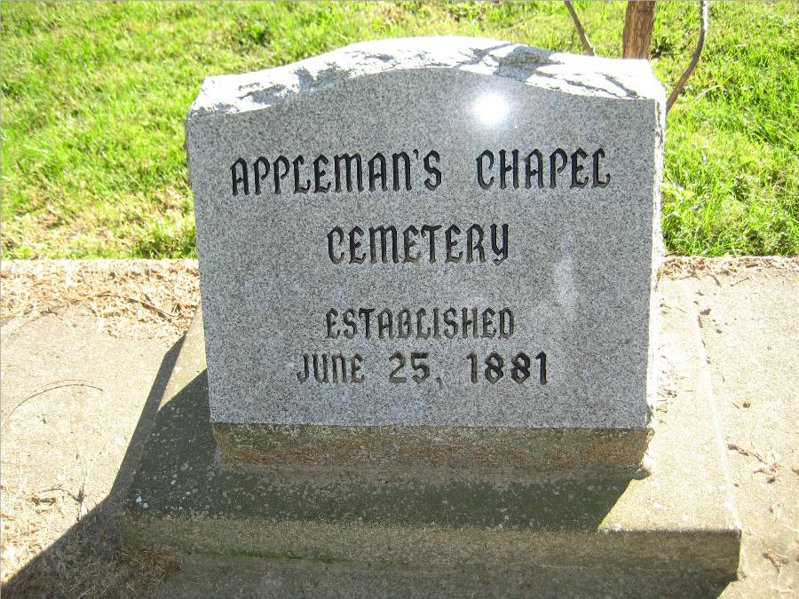
Applemans Chapel Cemetery is located at Saling, Audrain County ,Missouri ,USA.
-
Applemans Chapel Cemetery cemetery's updated grave count on graveviews.com?
2 memorials
-
Where are the coordinates of the Applemans Chapel Cemetery?
Latitude: 39.2646600
Longitude: -92.1972400
Nearby Cemetories:
1. Pleasant Grove Cemetery
Audrain County, USA
Coordinate: 39.3022900, -92.2536200
2. Glendale Memorial Gardens
Centralia, Boone County, USA
Coordinate: 39.2200012, -92.1342010
3. Centralia Cemetery
Centralia, Boone County, USA
Coordinate: 39.2175400, -92.1340400
4. Fountain Cemetery
Boone County, USA
Coordinate: 39.1963997, -92.2118988
5. Mount Pisgah Cemetery
Audrain County, USA
Coordinate: 39.2731500, -92.2908000
6. Far West Cemetery
Sturgeon, Boone County, USA
Coordinate: 39.1986008, -92.2388992
7. Sturgeon Cemetery
Sturgeon, Boone County, USA
Coordinate: 39.2331009, -92.2936020
8. Mount Horeb Cemetery
Sturgeon, Boone County, USA
Coordinate: 39.2158012, -92.2842026
9. Macedonia Cemetery
Audrain County, USA
Coordinate: 39.3177700, -92.2818780
10. Brink-Gibson Cemetery
Sturgeon, Boone County, USA
Coordinate: 39.2195540, -92.2956280
11. Union Church Cemetery
Centralia, Boone County, USA
Coordinate: 39.1749992, -92.1635971
12. Palmer Cemetery
Bourbon Township, Boone County, USA
Coordinate: 39.1880989, -92.2833023
13. Bethlehem Cemetery
Audrain County, USA
Coordinate: 39.2680964, -92.0629515
14. Crews-Adams Cemetery
Randolph County, USA
Coordinate: 39.2990210, -92.3256260
15. Chapel Grove Cemetery
Clark, Randolph County, USA
Coordinate: 39.2658005, -92.3424988
16. Palmer Family Cemetery
Sturgeon, Boone County, USA
Coordinate: 39.1666718, -92.2712555
17. Ruth Nowell Burial
Sturgeon, Boone County, USA
Coordinate: 39.1734026, -92.2921461
18. Pleasant Grove Cemetery
Boone County, USA
Coordinate: 39.1514015, -92.1436005
19. Birkhead Cemetery
Clark, Randolph County, USA
Coordinate: 39.3486230, -92.3101490
20. Pool Family Cemetery
Audrain County, USA
Coordinate: 39.2151900, -92.0544000
21. Skull Lick Cemetery
Audrain County, USA
Coordinate: 39.2186012, -92.0524979
22. Allen Cemetery
Middle Grove, Monroe County, USA
Coordinate: 39.3889000, -92.2036000
23. Settle Cemetery
Middle Grove, Monroe County, USA
Coordinate: 39.3723100, -92.2777000
24. Maple Grove United Methodist Church Cemetery
Rowena, Audrain County, USA
Coordinate: 39.3252430, -92.0521150