
| Memorials | : | 0 |
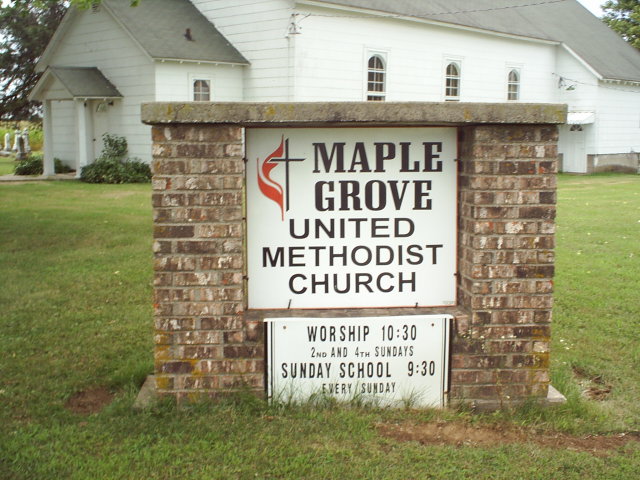
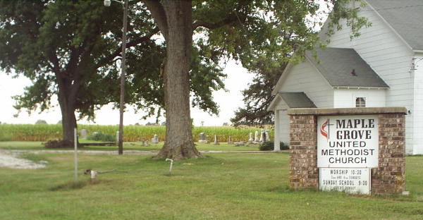
| Location | : | Rowena, Audrain County, USA |
| Coordinate | : | 39.3252430, -92.0521150 |
frequently asked questions (FAQ):
-
Where is Maple Grove United Methodist Church Cemetery?
Maple Grove United Methodist Church Cemetery is located at Rowena, Audrain County ,Missouri ,USA.
-
Maple Grove United Methodist Church Cemetery cemetery's updated grave count on graveviews.com?
0 memorials
-
Where are the coordinates of the Maple Grove United Methodist Church Cemetery?
Latitude: 39.3252430
Longitude: -92.0521150
Nearby Cemetories:
1. Antioch Christian Church Cemetery
Rowena, Audrain County, USA
Coordinate: 39.3401500, -92.0461700
2. Bethlehem Cemetery
Audrain County, USA
Coordinate: 39.2680964, -92.0629515
3. Mount Zion Cemetery
Paris, Monroe County, USA
Coordinate: 39.3882740, -92.0526410
4. Long Branch Cemetery
Monroe County, USA
Coordinate: 39.3418999, -91.9488983
5. Midway Christian Church Cemetery
Mexico, Audrain County, USA
Coordinate: 39.3244500, -91.9397200
6. Youngs Cemetery
Monroe County, USA
Coordinate: 39.4241982, -92.0306015
7. Deaver Cemetery
Monroe County, USA
Coordinate: 39.4258003, -92.0633011
8. Mount Airy Cemetery
Holliday, Monroe County, USA
Coordinate: 39.4137830, -92.1168100
9. Welch
Madison, Monroe County, USA
Coordinate: 39.4197510, -92.1152110
10. Skull Lick Cemetery
Audrain County, USA
Coordinate: 39.2186012, -92.0524979
11. Pool Family Cemetery
Audrain County, USA
Coordinate: 39.2151900, -92.0544000
12. Liberty Christian Church Cemetery
Skinner, Audrain County, USA
Coordinate: 39.2193400, -92.0098700
13. Union Cemetery
Paris, Monroe County, USA
Coordinate: 39.4310989, -92.1055984
14. Porter's Chapel Cemetery
Madison, Monroe County, USA
Coordinate: 39.4044647, -92.1602707
15. Bounds Cemetery
Monroe County, USA
Coordinate: 39.4412230, -92.0500870
16. McKinney Cemetery
Monroe County, USA
Coordinate: 39.4364014, -92.0975037
17. Curtright Cemetery
Monroe County, USA
Coordinate: 39.4463997, -92.0597000
18. Glendale Memorial Gardens
Centralia, Boone County, USA
Coordinate: 39.2200012, -92.1342010
19. Centralia Cemetery
Centralia, Boone County, USA
Coordinate: 39.2175400, -92.1340400
20. Cedar Grove Cemetery
Paris, Monroe County, USA
Coordinate: 39.4389600, -91.9843800
21. Berea Cemetery
Mexico, Audrain County, USA
Coordinate: 39.3352100, -91.8888900
22. Mount Zion Cemetery
Audrain County, USA
Coordinate: 39.2933006, -91.8933029
23. Applemans Chapel Cemetery
Saling, Audrain County, USA
Coordinate: 39.2646600, -92.1972400
24. Allen Cemetery
Middle Grove, Monroe County, USA
Coordinate: 39.3889000, -92.2036000