
| Memorials | : | 9 |
| Location | : | Boalsburg, Centre County, USA |
| Coordinate | : | 40.7787000, -77.7952000 |
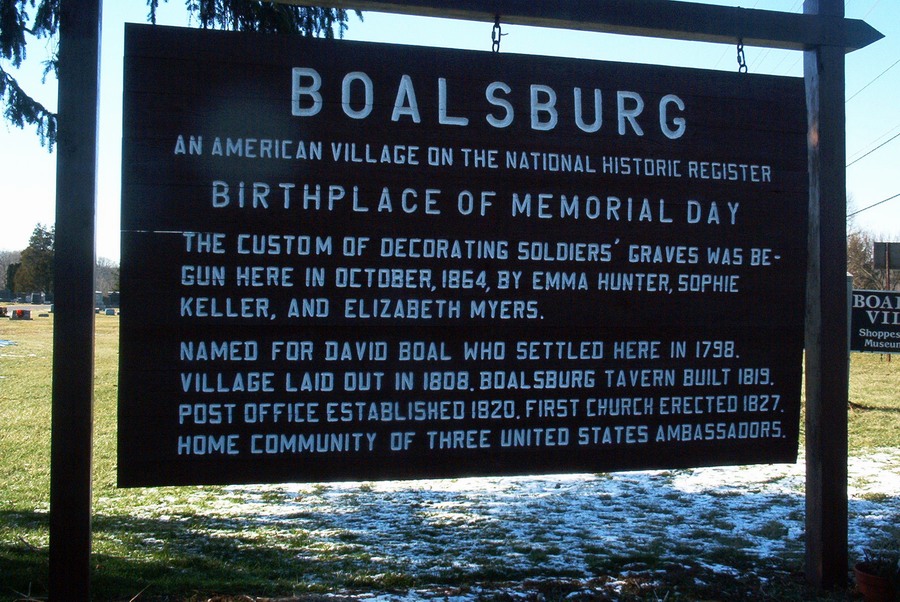
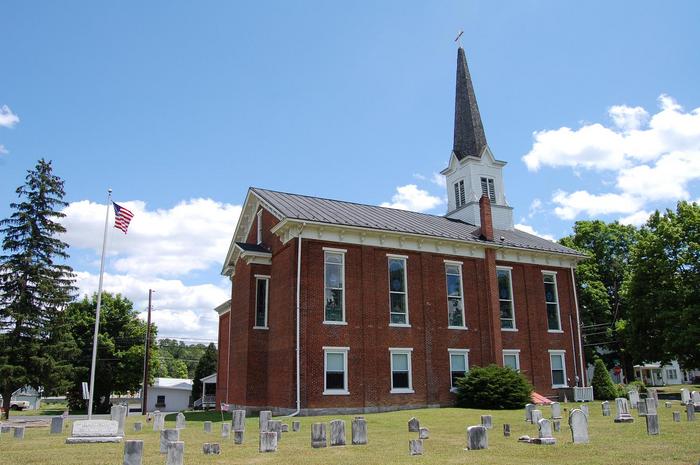
| Description | : | Rev. Henry Rossman's call from the German Reformed congregations of Loop, Boalsburg, and Penn's Creek was confirmed April 27, 1812. He had charge of all organized congregations in Centre County except Rebersburg and Aaronsburg. He was followed by Rev. B. S. Schenck in 1828 and Rev. P. S. Fisher in 1832. The Boalsburg church was organized in 1822 by Rev. Henry Rossman. The Lutheran congregation of Boalsburg was formed in 1825 when they united with the German Reformed congregation and built a stone church, the corner-stone was laid on June 6, 1825, and the dedication was on August... Read More |
frequently asked questions (FAQ):
-
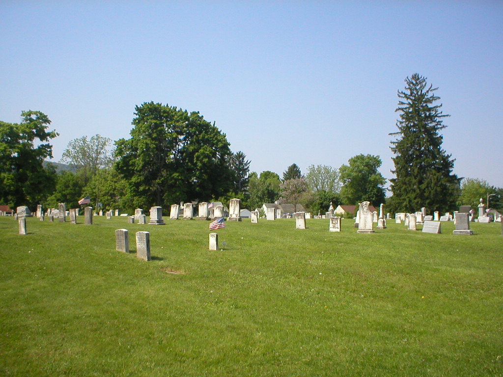
Where is Boalsburg Cemetery?
Boalsburg Cemetery is located at Old Boalsburg Rd Boalsburg, Centre County ,Pennsylvania , 16827USA.
-
Boalsburg Cemetery cemetery's updated grave count on graveviews.com?
9 memorials
-
Where are the coordinates of the Boalsburg Cemetery?
Latitude: 40.7787000
Longitude: -77.7952000

Nearby Cemetories:
1. Columbus Chapel - Boal Family Vault
Boalsburg, Centre County, USA
Coordinate: 40.7789900, -77.7993130
2. Dale Cemetery
Lemont, Centre County, USA
Coordinate: 40.8070000, -77.8100000
3. Rock Hill Cemetery
Linden Hall, Centre County, USA
Coordinate: 40.8001000, -77.7627000
4. Spring Creek Presbyterian Cemetery
State College, Centre County, USA
Coordinate: 40.7975006, -77.8349991
5. Cedar Creek Cemetery
Harris Township, Centre County, USA
Coordinate: 40.7900000, -77.7414110
6. Grace Lutheran Church Columbarium
State College, Centre County, USA
Coordinate: 40.7969950, -77.8547510
7. Saint Andrew's Episcopal Church Columbarium
State College, Centre County, USA
Coordinate: 40.7907300, -77.8598700
8. State College Presbyterian Church Columbarium
Centre County, USA
Coordinate: 40.7925140, -77.8610750
9. Houserville Cemetery
Houserville, Centre County, USA
Coordinate: 40.8264999, -77.8304977
10. Atherton Burial Site
State College, Centre County, USA
Coordinate: 40.7966780, -77.8638390
11. Shiloh Cemetery
Centre County, USA
Coordinate: 40.8365000, -77.8011000
12. Centre County Memorial Park
State College, Centre County, USA
Coordinate: 40.8377991, -77.7983017
13. Pine Hall Cemetery
State College, Centre County, USA
Coordinate: 40.7779000, -77.8841000
14. Old Pine Hall Cemetery
State College, Centre County, USA
Coordinate: 40.7743000, -77.8885000
15. Benner Cemetery
Centre County, USA
Coordinate: 40.8525009, -77.8182983
16. Pine Grove Mills Cemetery
Pine Grove Mills, Centre County, USA
Coordinate: 40.7355000, -77.8873000
17. Old Pine Grove Mills Cemetery
Pine Grove Mills, Centre County, USA
Coordinate: 40.7333000, -77.8878000
18. Zion Hill Cemetery
Centre County, USA
Coordinate: 40.7904000, -77.6793600
19. Emmanuel Union Cemetery
Tusseyville, Centre County, USA
Coordinate: 40.7987000, -77.6778000
20. Lutheran Church Cemetery
Pleasant Gap, Centre County, USA
Coordinate: 40.8680000, -77.7497000
21. Fruittown Cemetery
Centre Hall, Centre County, USA
Coordinate: 40.7764315, -77.6672651
22. Meyer Cemetery
Buffalo Run, Centre County, USA
Coordinate: 40.8736000, -77.8475037
23. Reformed and Lutheran Cemetery
Centre Hall, Centre County, USA
Coordinate: 40.8462410, -77.6895828
24. Kline Farm Cemetery
Fillmore, Centre County, USA
Coordinate: 40.8657062, -77.8880005