
| Memorials | : | 0 |
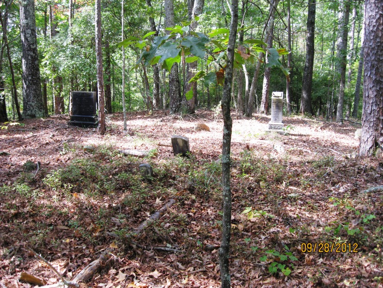
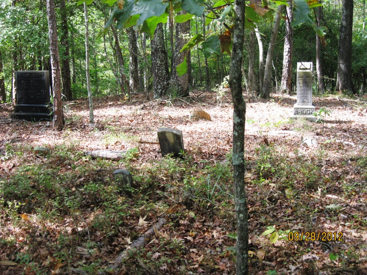
| Location | : | Muscadine, Cleburne County, USA |
| Description | : | Township 16 Range 10 Section 24. If planning to visit Brock Cemetery, go East from Heflin on US Highway 78 then take Alabama Cleburne County Road 46 at its bifurcation from US Highway 78 East. Continuing, travel beyond the summit of the first sighted elevation taking the paved road on the right, which would be the Evans Bridge Road. This road will eventually make a flyover thereby going over Interstate 20. From the I-20 site travel 1 mile, crossing over the Tallapoosa River. Go past the first building to the right and cease, in advance, before the road begins to... Read More |
frequently asked questions (FAQ):
-
Where is Brock Cemetery?
Brock Cemetery is located at Muscadine, Cleburne County, USA.
-
Brock Cemetery cemetery's updated grave count on graveviews.com?
0 memorials
Nearby Cemetories:
1. Antioch Cemetery
Abernathy, Cleburne County, USA
Coordinate: 33.7756004, -85.5642014
2. Crossroads Cemetery
Abernathy, Cleburne County, USA
3. Harmony Primitive Baptist Church Cemetery
Abernathy, Cleburne County, USA
Coordinate: 33.5564003, -85.4068985
4. Walker Cemetery
Abernathy, Cleburne County, USA
Coordinate: 33.6342010, -85.3835983
5. Chulafinnee Baptist Church Cemetery
Chulafinnee, Cleburne County, USA
Coordinate: 33.6021996, -85.4056015
6. Chulafinnee Methodist Church Cemetery
Chulafinnee, Cleburne County, USA
Coordinate: 33.5691986, -85.4403000
7. Haywood - Oswalt Family Cemetery
Chulafinnee, Cleburne County, USA
8. Liberty Hill Methodist Church Cemetery
Chulafinnee, Cleburne County, USA
Coordinate: 33.7991982, -85.3891983
9. Ligon Family Cemetery
Chulafinnee, Cleburne County, USA
10. Macedonia Baptist Church Cemetery
Macedonia, Cleburne County, USA
Coordinate: 33.9446983, -85.4302979
11. Pleasant Grove United Methodist Church Cemetery
Macedonia, Cleburne County, USA
Coordinate: 33.9455986, -85.4349976
12. Roe Cemetery
Cleburne County, USA
Coordinate: 33.9218740, -85.4745850
13. Shoal Creek Cemetery
Cleburne County, USA
Coordinate: 33.7756004, -85.5642014
14. Slate Hill Cemetery
Cleburne County, USA
15. Crumleys Chapel Cemetery
Trickem, Cleburne County, USA
Coordinate: 33.5564003, -85.4068985
16. New Hopewell Cemetery
Trickem, Cleburne County, USA
Coordinate: 33.6342010, -85.3835983
17. Old Hopewell Cemetery
Trickem, Cleburne County, USA
Coordinate: 33.6021996, -85.4056015
18. Wise Chapel Cemetery
Trickem, Cleburne County, USA
Coordinate: 33.5691986, -85.4403000
19. Bengal Cemetery
Cleburne County, USA
20. Bethel Cemetery
Cleburne County, USA
Coordinate: 33.7991982, -85.3891983
21. Borden Cemetery
Borden Springs, Cleburne County, USA
22. Cherry Grove Cemetery
Borden Springs, Cleburne County, USA
Coordinate: 33.9446983, -85.4302979
23. Cherry Grove Original Church Cemetery
Borden Springs, Cleburne County, USA
Coordinate: 33.9455986, -85.4349976
24. Church of Christ Cemetery
Borden Springs, Cleburne County, USA
Coordinate: 33.9218740, -85.4745850