
| Memorials | : | 2 |
| Location | : | Glen Sutton, Monteregie Region, Canada |
| Coordinate | : | 45.0466300, -72.5087100 |
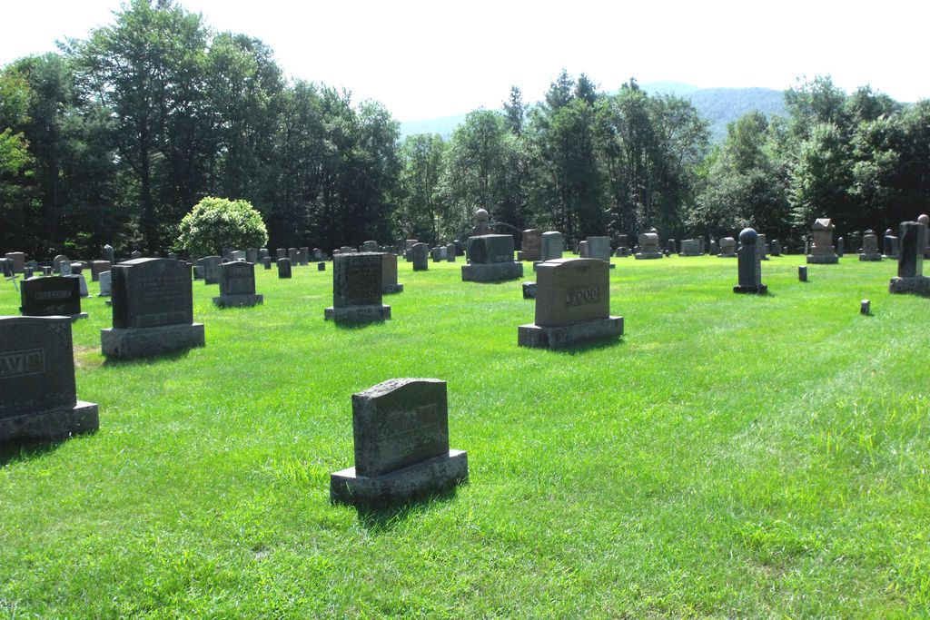
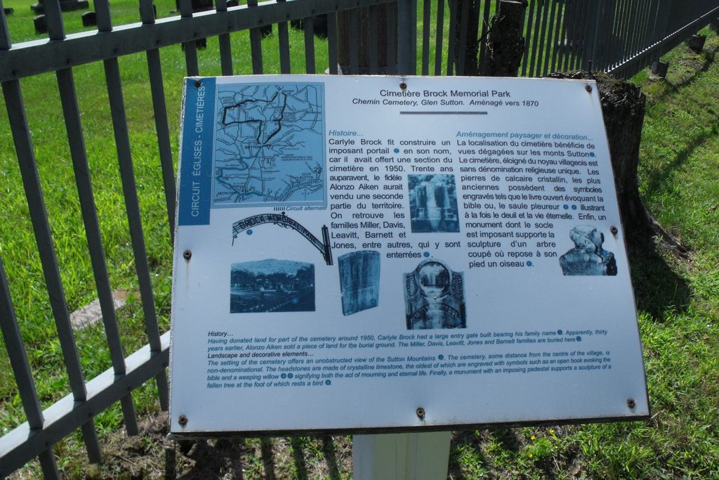
| Description | : | Brock memorial Cemetery is located between Dunkin and Glen Sutton Canada. It was established about 1870. Many of the stones are much older than 1870. Carlyle Brock had a large gate made in his name because he donated a parcel of land in 1950. Thirty years before this Alonzo Aiken had sold another portion of land to the Cemetery Association. |
frequently asked questions (FAQ):
-
Where is Brock Memorial Park?
Brock Memorial Park is located at Glen Sutton, Monteregie Region ,Quebec ,Canada.
-
Brock Memorial Park cemetery's updated grave count on graveviews.com?
2 memorials
-
Where are the coordinates of the Brock Memorial Park?
Latitude: 45.0466300
Longitude: -72.5087100


Nearby Cemetories:
1. Ruiter Settlement Cemetery
Dunkin, Estrie Region, Canada
Coordinate: 45.0523600, -72.4696000
2. Gilman-Sargent Campground Cemetery
Potton, Estrie Region, Canada
Coordinate: 45.0317500, -72.4374100
3. West Jay Cemetery
Jay, Orleans County, USA
Coordinate: 44.9968990, -72.5509210
4. East Richford Cemetery
East Richford, Franklin County, USA
Coordinate: 45.0111500, -72.5831400
5. Chapel Hill Cemetery
Mansonville, Estrie Region, Canada
Coordinate: 45.0493470, -72.4129620
6. Miltimore Cemetery
Mansonville, Estrie Region, Canada
Coordinate: 45.0396531, -72.4131703
7. Elkins Cemetery
Mansonville, Estrie Region, Canada
Coordinate: 45.0184720, -72.4083890
8. Mansonville Protestant Cemetery
Mansonville, Estrie Region, Canada
Coordinate: 45.0572500, -72.3923800
9. Cimetière Saint-Cajetan
Mansonville, Estrie Region, Canada
Coordinate: 45.0570400, -72.3920900
10. Barnett Monument Cemetery
Richford, Franklin County, USA
Coordinate: 45.0011562, -72.6134585
11. Cimetière de la Ste-Transfiguration
Mansonville, Estrie Region, Canada
Coordinate: 45.0106890, -72.3957750
12. Blanchard Family Cemetery
Potton, Estrie Region, Canada
Coordinate: 45.0968370, -72.3947780
13. Jay Center Cemetery
Jay, Orleans County, USA
Coordinate: 44.9632492, -72.4436951
14. Bennett Family Cemetery
Brome-Missisquoi, Monteregie Region, Canada
Coordinate: 45.1369450, -72.5622220
15. Province Hill Cemetery
Potton, Estrie Region, Canada
Coordinate: 45.0131860, -72.3725550
16. North Troy Cemetery
North Troy, Orleans County, USA
Coordinate: 44.9931300, -72.3857300
17. Notre Dame Cemetery
North Troy, Orleans County, USA
Coordinate: 44.9926700, -72.3835200
18. Pleasant Valley Cemetery
Abercorn, Monteregie Region, Canada
Coordinate: 45.0368097, -72.6551700
19. Old Abercorn Cemetery
Abercorn, Monteregie Region, Canada
Coordinate: 45.0348200, -72.6575500
20. Cimetière Saint-Simon
Abercorn, Monteregie Region, Canada
Coordinate: 45.0383690, -72.6627150
21. Hillside Cemetery
Richford, Franklin County, USA
Coordinate: 45.0017000, -72.6590100
22. Richford Center Cemetery
Richford, Franklin County, USA
Coordinate: 44.9737800, -72.6502900
23. Troy Street Cemetery
Richford, Franklin County, USA
Coordinate: 44.9913800, -72.6715400
24. Johnson Cemetery
Frelighsburg, Monteregie Region, Canada
Coordinate: 45.0561980, -72.6949290