| Memorials | : | 0 |
| Location | : | Potton, Estrie Region, Canada |
| Coordinate | : | 45.0317500, -72.4374100 |
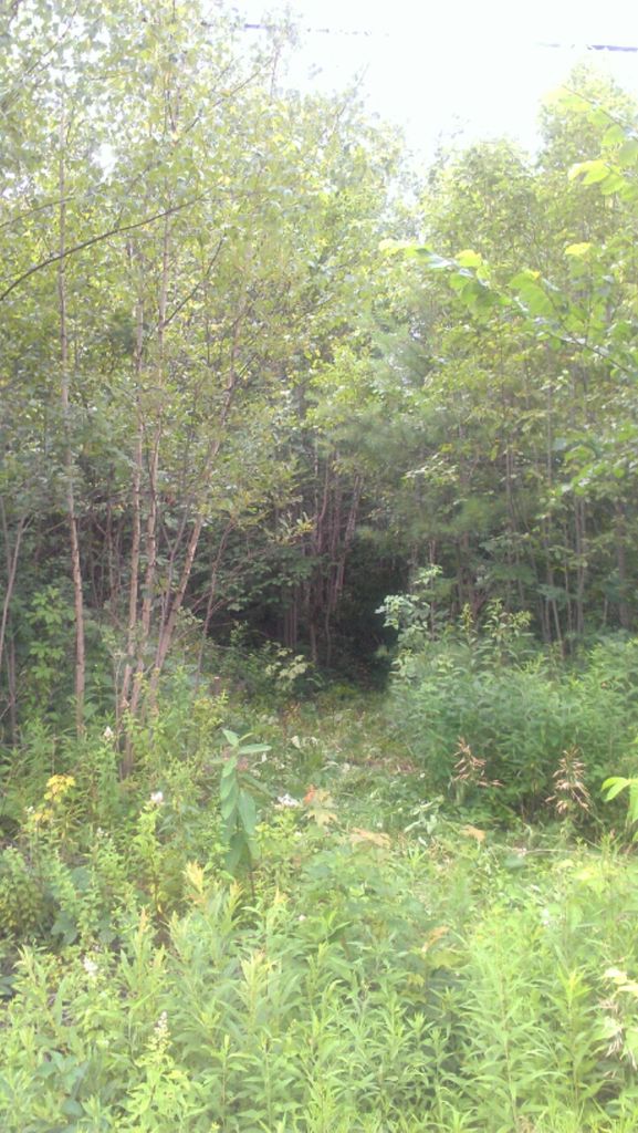
| Description | : | With the blessing of the local historical society--Potton Heritage Association/Association du patrimoine de Potton--the current Cemetery Caretaker is John Cogan of nearby Newport, Vermont. _______________________________________________________ This was an abandoned and overgrown cemetery on chemin de la Vallée Missisquoi next to the Carrefour des Campeurs Campground. Restoration of the cemetery began in July 2013. More details will be added. While recently working in the cemetery, local resident John Aiken stopped to look at progress. He stated that when he was a boy, the land that the cemetery sits on was part of "the Sargent farm," and that the cemetery was not... Read More |
frequently asked questions (FAQ):
-
Where is Gilman-Sargent Campground Cemetery?
Gilman-Sargent Campground Cemetery is located at Across from 2748 Chemin de la Vallée Missisquoi (Judd Residence) Potton, Estrie Region ,Quebec , J0E 1X0Canada.
-
Gilman-Sargent Campground Cemetery cemetery's updated grave count on graveviews.com?
0 memorials
-
Where are the coordinates of the Gilman-Sargent Campground Cemetery?
Latitude: 45.0317500
Longitude: -72.4374100
Nearby Cemetories:
1. Miltimore Cemetery
Mansonville, Estrie Region, Canada
Coordinate: 45.0396531, -72.4131703
2. Elkins Cemetery
Mansonville, Estrie Region, Canada
Coordinate: 45.0184720, -72.4083890
3. Chapel Hill Cemetery
Mansonville, Estrie Region, Canada
Coordinate: 45.0493470, -72.4129620
4. Ruiter Settlement Cemetery
Dunkin, Estrie Region, Canada
Coordinate: 45.0523600, -72.4696000
5. Cimetière de la Ste-Transfiguration
Mansonville, Estrie Region, Canada
Coordinate: 45.0106890, -72.3957750
6. Mansonville Protestant Cemetery
Mansonville, Estrie Region, Canada
Coordinate: 45.0572500, -72.3923800
7. Cimetière Saint-Cajetan
Mansonville, Estrie Region, Canada
Coordinate: 45.0570400, -72.3920900
8. Province Hill Cemetery
Potton, Estrie Region, Canada
Coordinate: 45.0131860, -72.3725550
9. Brock Memorial Park
Glen Sutton, Monteregie Region, Canada
Coordinate: 45.0466300, -72.5087100
10. North Troy Cemetery
North Troy, Orleans County, USA
Coordinate: 44.9931300, -72.3857300
11. Notre Dame Cemetery
North Troy, Orleans County, USA
Coordinate: 44.9926700, -72.3835200
12. Jay Center Cemetery
Jay, Orleans County, USA
Coordinate: 44.9632492, -72.4436951
13. Blanchard Family Cemetery
Potton, Estrie Region, Canada
Coordinate: 45.0968370, -72.3947780
14. West Jay Cemetery
Jay, Orleans County, USA
Coordinate: 44.9968990, -72.5509210
15. Cimetière Owl's Head
Potton, Estrie Region, Canada
Coordinate: 45.0510620, -72.3073590
16. East Richford Cemetery
East Richford, Franklin County, USA
Coordinate: 45.0111500, -72.5831400
17. Leadville Cemetery
Leadville, Estrie Region, Canada
Coordinate: 45.0134290, -72.2733450
18. West Road Cemetery
Troy, Orleans County, USA
Coordinate: 44.9113700, -72.4053300
19. North Hill Cemetery
Westfield, Orleans County, USA
Coordinate: 44.9056800, -72.4309800
20. Barnett Monument Cemetery
Richford, Franklin County, USA
Coordinate: 45.0011562, -72.6134585
21. Troy Cemetery
Troy, Orleans County, USA
Coordinate: 44.9045100, -72.4030500
22. Bennett Family Cemetery
Brome-Missisquoi, Monteregie Region, Canada
Coordinate: 45.1369450, -72.5622220
23. Lake Road Cemetery
Newport, Orleans County, USA
Coordinate: 44.9703800, -72.2469900
24. Newport Center Cemetery
Newport Center, Orleans County, USA
Coordinate: 44.9225006, -72.2913971

