
| Memorials | : | 0 |
| Location | : | Purdy, McNairy County, USA |
| Coordinate | : | 35.2082660, -88.5330580 |
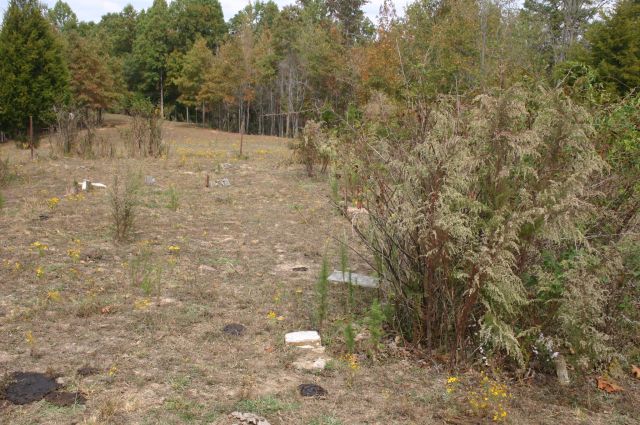
| Description | : | From the intersection of Airport Rd. & Gann Rd., south of Purdy, travel southeast on Airport Rd. for 0.3 mi.; turning south (right) onto Purdy Rd., going 0.7 mi. to a open pasture on the west (right) side of the road. The cemetery is about 200 yards across this field in a sparse cluster of trees. |
frequently asked questions (FAQ):
-
Where is Brooks Cemetery?
Brooks Cemetery is located at Purdy Road Purdy, McNairy County ,Tennessee ,USA.
-
Brooks Cemetery cemetery's updated grave count on graveviews.com?
0 memorials
-
Where are the coordinates of the Brooks Cemetery?
Latitude: 35.2082660
Longitude: -88.5330580
Nearby Cemetories:
1. Purdy Wright Cemetery
Purdy, McNairy County, USA
Coordinate: 35.2306570, -88.5403730
2. Purdy Wisdom Cemetery
Purdy, McNairy County, USA
Coordinate: 35.2343230, -88.5341050
3. Bethesda Memorial Gardens
Selmer, McNairy County, USA
Coordinate: 35.1988880, -88.5709240
4. Poor Farm Cemetery
McNairy County, USA
Coordinate: 35.1802990, -88.5564760
5. Warren Cemetery
Selmer, McNairy County, USA
Coordinate: 35.1775480, -88.5603820
6. Chapel Hill Cemetery
Bethel Springs, McNairy County, USA
Coordinate: 35.2373190, -88.5663610
7. Mount Zion MB Church Cemetery
Selmer, McNairy County, USA
Coordinate: 35.1730920, -88.5710370
8. Fink Cemetery
Purdy, McNairy County, USA
Coordinate: 35.1898540, -88.4780670
9. Clear Creek Church Cemetery
New Lawton, McNairy County, USA
Coordinate: 35.2059380, -88.4723690
10. Sanders Cemetery #2
Old Lawton, McNairy County, USA
Coordinate: 35.2137200, -88.4724260
11. Pounds Cemetery
Stantonville, McNairy County, USA
Coordinate: 35.1889630, -88.4763830
12. Brackin Cemetery
Old Lawton, McNairy County, USA
Coordinate: 35.2299480, -88.4748610
13. Sanders Cemetery #4
Stantonville, McNairy County, USA
Coordinate: 35.1793350, -88.4793370
14. McCullar Family Cemetery
Selmer, McNairy County, USA
Coordinate: 35.1642580, -88.5716610
15. Beauty Hill Church Cemetery
Purdy, McNairy County, USA
Coordinate: 35.2621840, -88.5426830
16. Fellowship Baptist Church Cemetery
Selmer, McNairy County, USA
Coordinate: 35.1519470, -88.5456420
17. Dunn Cemetery
Bethel Springs, McNairy County, USA
Coordinate: 35.2666290, -88.5355270
18. Good Hope Cemetery
Adamsville, McNairy County, USA
Coordinate: 35.2552986, -88.4888992
19. Lake Hill Memory Gardens
Bethel Springs, McNairy County, USA
Coordinate: 35.2169810, -88.6048380
20. Oak Hill Cemetery
Selmer, McNairy County, USA
Coordinate: 35.1785650, -88.6008290
21. Union Grove East Cemetery
Adamsville, McNairy County, USA
Coordinate: 35.2491989, -88.4719009
22. Bethel Springs Cemetery
Bethel Springs, McNairy County, USA
Coordinate: 35.2332380, -88.6066780
23. Union Grove Church Cemetery
Selmer, McNairy County, USA
Coordinate: 35.1463330, -88.5071040
24. Prospect Church Cemetery
Selmer, McNairy County, USA
Coordinate: 35.1453460, -88.5053200