
| Memorials | : | 11 |
| Location | : | Chobham, Surrey Heath Borough, England |
| Coordinate | : | 51.3647100, -0.6317100 |
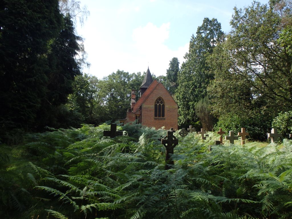
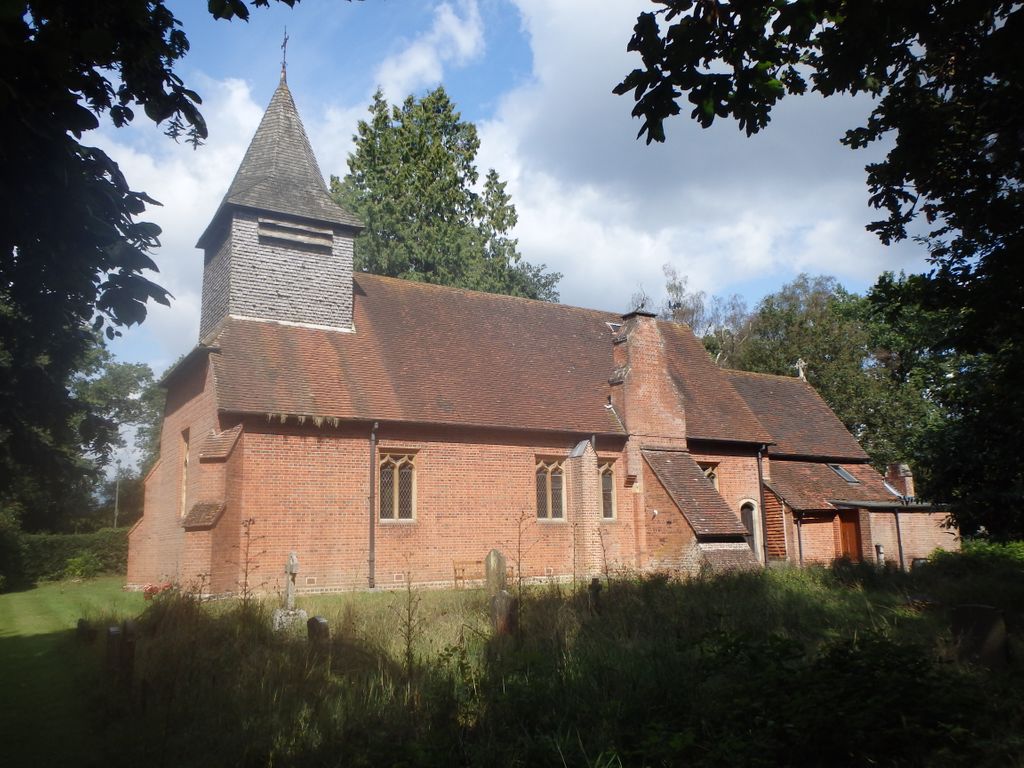
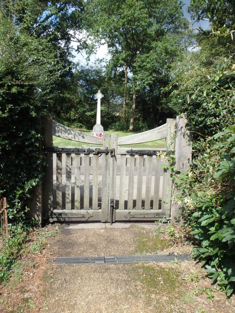
| Description | : | The church is next to Valley End School and just round the corner from the Valley End Institute. |
frequently asked questions (FAQ):
-
Where is Valley End St Saviour Churchyard?
Valley End St Saviour Churchyard is located at Valley End Road Chobham, Surrey Heath Borough ,Surrey , GU24 8TDEngland.
-
Valley End St Saviour Churchyard cemetery's updated grave count on graveviews.com?
11 memorials
-
Where are the coordinates of the Valley End St Saviour Churchyard?
Latitude: 51.3647100
Longitude: -0.6317100

Nearby Cemetories:
1. Windlesham Cemetery
Windlesham, Surrey Heath Borough, England
Coordinate: 51.3654000, -0.6654900
2. Holy Trinity Churchyard
West End, Surrey Heath Borough, England
Coordinate: 51.3434880, -0.6420670
3. Christ Church
Chertsey, Runnymede Borough, England
Coordinate: 51.3781700, -0.5831300
4. Holy Trinity Churchyard
Sunningdale, Windsor and Maidenhead Royal Borough, England
Coordinate: 51.3989170, -0.6304810
5. Sunningdale Cemetery
Sunningdale, Windsor and Maidenhead Royal Borough, England
Coordinate: 51.4021820, -0.6322850
6. St. John the Baptist Churchyard
Bisley, Surrey Heath Borough, England
Coordinate: 51.3273600, -0.6266370
7. St Michael and All Angels Churchyard
Sunninghill, Windsor and Maidenhead Royal Borough, England
Coordinate: 51.4000090, -0.6570340
8. All Souls Churchyard
South Ascot, Windsor and Maidenhead Royal Borough, England
Coordinate: 51.4035450, -0.6745890
9. Christ Church Churchyard
Virginia Water, Runnymede Borough, England
Coordinate: 51.4073160, -0.5796440
10. Woking Crematorium
Woking, Woking Borough, England
Coordinate: 51.3122590, -0.6022630
11. St Mary the Virgin Churchyard
Horsell, Woking Borough, England
Coordinate: 51.3227460, -0.5703770
12. St John the Baptist Churchyard
St Johns, Woking Borough, England
Coordinate: 51.3104700, -0.5929170
13. All Saints Churchyard
Ascot, Windsor and Maidenhead Royal Borough, England
Coordinate: 51.4114680, -0.6905550
14. Christ Church Cemetery
Ottershaw, Runnymede Borough, England
Coordinate: 51.3610140, -0.5353310
15. Brookwood Cemetery
Brookwood, Woking Borough, England
Coordinate: 51.3013535, -0.6297340
16. Brookwood American Military Cemetery
Brookwood, Woking Borough, England
Coordinate: 51.3014080, -0.6397010
17. Brookwood French Military Cemetery
Brookwood, Woking Borough, England
Coordinate: 51.3011700, -0.6384920
18. Brookwood Military Cemetery
Brookwood, Woking Borough, England
Coordinate: 51.3012619, -0.6419710
19. Brookwood 1914-1918 Memorial
Brookwood, Woking Borough, England
Coordinate: 51.3007800, -0.6403300
20. Brookwood 1939-1945 Memorial
Brookwood, Woking Borough, England
Coordinate: 51.3002815, -0.6409460
21. Ascot Priory Cemetery
Ascot, Windsor and Maidenhead Royal Borough, England
Coordinate: 51.4135440, -0.7075955
22. St Michael and All Angels Churchyard
Pirbright, Guildford Borough, England
Coordinate: 51.2945800, -0.6500000
23. Englefield Green Cemetery
Englefield Green, Runnymede Borough, England
Coordinate: 51.4273640, -0.5730490
24. Church of Saint Francis of Assisi
Camberley, Surrey Heath Borough, England
Coordinate: 51.3311000, -0.7350400