
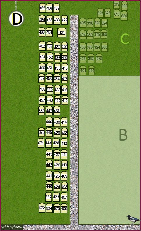
| Memorials | : | 0 |
| Location | : | Bisley, Surrey Heath Borough, England |
| Coordinate | : | 51.3273600, -0.6266370 |
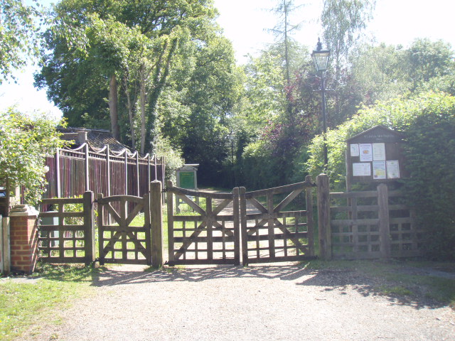
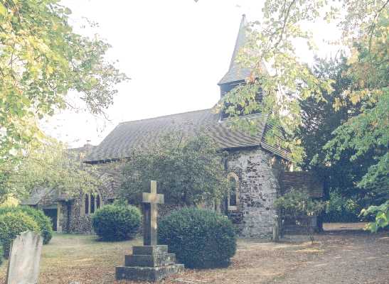
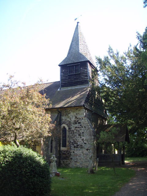
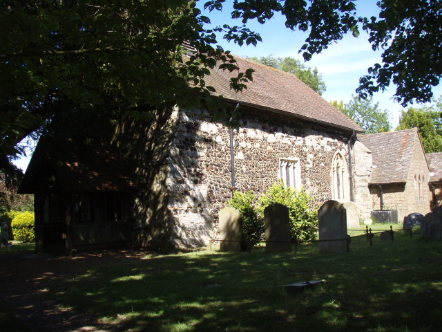
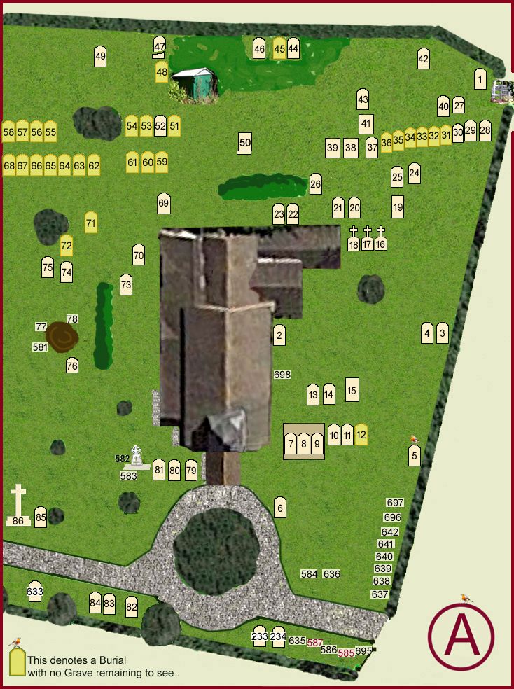
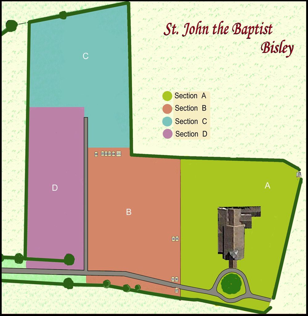
| Description | : | The location of Bisley Church is interesting since it is in a lonely spot out of the village. So maybe the location was sacred. The old walls of the church are certainly very interesting. They include blue sandstone (which is not local), thin tile and iron-slag which may indicate nearby iron working As for the spring near the church, we know that the Celts venerated springs and these sites were adopted by the Romans - as excavations have shown at Bath. However, like the temples, they tended to be dedicated to pagan deities. The... Read More |
frequently asked questions (FAQ):
-
Where is St. John the Baptist Churchyard?
St. John the Baptist Churchyard is located at Church Land Bisley, Surrey Heath Borough ,Surrey , GU24 9DXEngland.
-
St. John the Baptist Churchyard cemetery's updated grave count on graveviews.com?
0 memorials
-
Where are the coordinates of the St. John the Baptist Churchyard?
Latitude: 51.3273600
Longitude: -0.6266370
Nearby Cemetories:
1. Holy Trinity Churchyard
West End, Surrey Heath Borough, England
Coordinate: 51.3434880, -0.6420670
2. Woking Crematorium
Woking, Woking Borough, England
Coordinate: 51.3122590, -0.6022630
3. Brookwood Cemetery
Brookwood, Woking Borough, England
Coordinate: 51.3013535, -0.6297340
4. St John the Baptist Churchyard
St Johns, Woking Borough, England
Coordinate: 51.3104700, -0.5929170
5. Brookwood American Military Cemetery
Brookwood, Woking Borough, England
Coordinate: 51.3014080, -0.6397010
6. Brookwood French Military Cemetery
Brookwood, Woking Borough, England
Coordinate: 51.3011700, -0.6384920
7. Brookwood Military Cemetery
Brookwood, Woking Borough, England
Coordinate: 51.3012619, -0.6419710
8. Brookwood 1914-1918 Memorial
Brookwood, Woking Borough, England
Coordinate: 51.3007800, -0.6403300
9. Brookwood 1939-1945 Memorial
Brookwood, Woking Borough, England
Coordinate: 51.3002815, -0.6409460
10. St Mary the Virgin Churchyard
Horsell, Woking Borough, England
Coordinate: 51.3227460, -0.5703770
11. St Michael and All Angels Churchyard
Pirbright, Guildford Borough, England
Coordinate: 51.2945800, -0.6500000
12. Valley End St Saviour Churchyard
Chobham, Surrey Heath Borough, England
Coordinate: 51.3647100, -0.6317100
13. Windlesham Cemetery
Windlesham, Surrey Heath Borough, England
Coordinate: 51.3654000, -0.6654900
14. Deepcut Military Cemetery
Deepcut, Surrey Heath Borough, England
Coordinate: 51.3062170, -0.7049060
15. St Mary the Virgin Churchyard
Worplesdon, Guildford Borough, England
Coordinate: 51.2730100, -0.6067360
16. Christ Church
Chertsey, Runnymede Borough, England
Coordinate: 51.3781700, -0.5831300
17. St Peter's Church
Old Woking, Woking Borough, England
Coordinate: 51.3017410, -0.5372560
18. Old Woking Burial Ground
Old Woking, Woking Borough, England
Coordinate: 51.3026230, -0.5351320
19. Christ Church Cemetery
Ottershaw, Runnymede Borough, England
Coordinate: 51.3610140, -0.5353310
20. St Edward the Confessor Churchyard
Sutton Green, Woking Borough, England
Coordinate: 51.2741930, -0.5608230
21. Church of Saint Francis of Assisi
Camberley, Surrey Heath Borough, England
Coordinate: 51.3311000, -0.7350400
22. St Peter's Churchyard
Frimley, Surrey Heath Borough, England
Coordinate: 51.3149770, -0.7393330
23. Holy Trinity Churchyard
Sunningdale, Windsor and Maidenhead Royal Borough, England
Coordinate: 51.3989170, -0.6304810
24. St Mary the Virgin Churchyard
Send, Guildford Borough, England
Coordinate: 51.2791230, -0.5408600