
| Memorials | : | 1 |
| Location | : | Glenville, Daviess County, USA |
| Coordinate | : | 37.6045640, -87.1835790 |
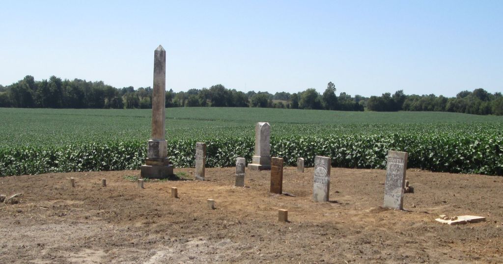
| Description | : | Located south of Owensboro on Hwy 81 turn East (left) one house past the Glenville Baptist Church. Turn right at intersection go about 100 yards, cemetery is on the right. Only two stones were located in 1974. |
frequently asked questions (FAQ):
-
Where is Baird Family Cemetery?
Baird Family Cemetery is located at L B Cravens Road Glenville, Daviess County ,Kentucky , 42376USA.
-
Baird Family Cemetery cemetery's updated grave count on graveviews.com?
1 memorials
-
Where are the coordinates of the Baird Family Cemetery?
Latitude: 37.6045640
Longitude: -87.1835790
Nearby Cemetories:
1. Glenville Christian Church Cemetery
Glenville, Daviess County, USA
Coordinate: 37.6054040, -87.1909100
2. Glenville Baptist Church Cemetery
Glenville, Daviess County, USA
Coordinate: 37.6085815, -87.1892014
3. Glenville Methodist Church Cemetery
Glenville, Daviess County, USA
Coordinate: 37.6083300, -87.1905000
4. Mount Pleasant Cumberland Presbyterian Cemetery
Glenville, Daviess County, USA
Coordinate: 37.6211070, -87.1914960
5. Brushy Fork Cemetery
Guffie, McLean County, USA
Coordinate: 37.6120370, -87.2289600
6. Leet-Wilhite Family Cemetery
Guffie, McLean County, USA
Coordinate: 37.6052100, -87.2320000
7. Smith-Ratliff Cemetery
McLean County, USA
Coordinate: 37.5645200, -87.1594300
8. Short Family Cemetery
Panther, Daviess County, USA
Coordinate: 37.6387040, -87.2234630
9. Nickel Ridge Cemetery
Panther, Daviess County, USA
Coordinate: 37.6505400, -87.2037100
10. Oak Grove Cemetery
McLean County, USA
Coordinate: 37.5590591, -87.2065964
11. Utica Baptist Church Cemetery
Utica, Daviess County, USA
Coordinate: 37.6021300, -87.1182400
12. Johnson Family Graveyard
Calhoun, McLean County, USA
Coordinate: 37.5578295, -87.2134155
13. Dabney C Robertson Family Graveyard
Daviess County, USA
Coordinate: 37.6256720, -87.2453760
14. Murphy Grave
Panther, Daviess County, USA
Coordinate: 37.6469530, -87.2270990
15. Pleasant Hope General Baptist Church Cemetery
Livermore, McLean County, USA
Coordinate: 37.5502205, -87.1675034
16. Mount Vernon Baptist Church Cemetery
Calhoun, McLean County, USA
Coordinate: 37.5772400, -87.2452011
17. Trunnell Family Cemetery
Browns Valley, Daviess County, USA
Coordinate: 37.6320700, -87.1150200
18. Nalley-Taylor Family Cemetery
Buel, McLean County, USA
Coordinate: 37.5433000, -87.1711000
19. Brushy Fork Cemetery
Panther, Daviess County, USA
Coordinate: 37.6375999, -87.2545013
20. Saint Anthony Church Cemetery
Browns Valley, Daviess County, USA
Coordinate: 37.6431300, -87.1157100
21. Bethlehem Baptist Cemetery
Utica, Daviess County, USA
Coordinate: 37.6066000, -87.0986200
22. Mount Zion Methodist Episcopal Church Cemetery
Panther, Daviess County, USA
Coordinate: 37.6638700, -87.2325500
23. Underwood Family Cemetery
McLean County, USA
Coordinate: 37.5542412, -87.1169968
24. Robert C. Moseley Family Cemetery
Cleopatra, McLean County, USA
Coordinate: 37.6136000, -87.2814400