
| Memorials | : | 5 |
| Location | : | Washington County, USA |
| Coordinate | : | 35.9514250, -94.2011060 |
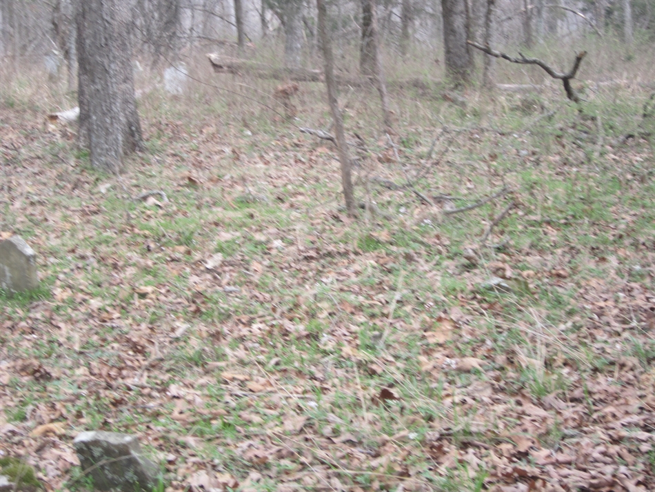
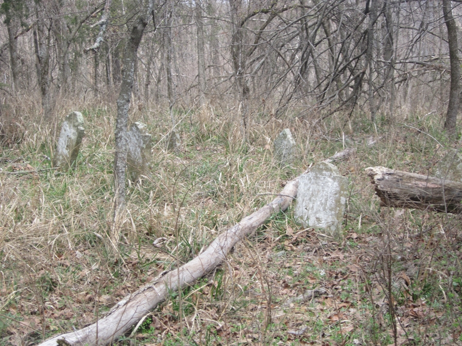
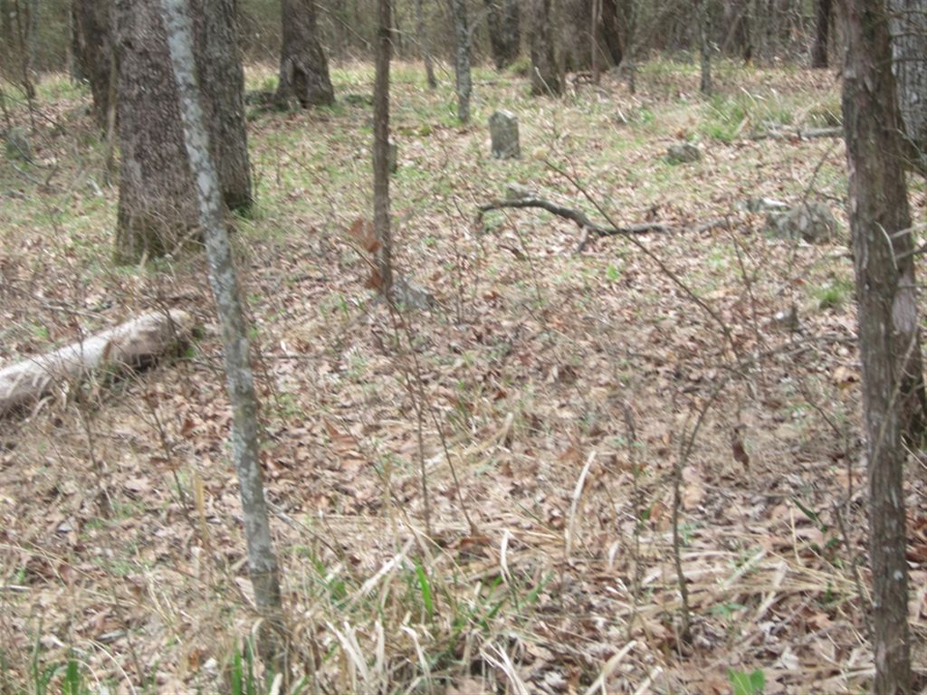
| Description | : | In Section 30-15-30 on the old Archibald Henry Bryant Farm.There are about thirty to forty graves in this family cemetery, It appears that Archibald Henry and Winnie "House" may be buried here also. They do not show up in the 1860 census. About one hundred feet south of this cemetery lies another cemetery,Rutherford/Martin's are buried in this cemetery. Rutherford was a neighbor of Archibald H Bryant. |
frequently asked questions (FAQ):
-
Where is Bryant Cemetery?
Bryant Cemetery is located at Washington County ,Arkansas ,USA.
-
Bryant Cemetery cemetery's updated grave count on graveviews.com?
0 memorials
-
Where are the coordinates of the Bryant Cemetery?
Latitude: 35.9514250
Longitude: -94.2011060

Nearby Cemetories:
1. John A Rutherford - Martin Cemetery
Washington County, USA
Coordinate: 35.9513950, -94.2011490
2. Campbell Church Cemetery
West Fork, Washington County, USA
Coordinate: 35.9583015, -94.1903000
3. Reed Cemetery
West Fork, Washington County, USA
Coordinate: 35.9630800, -94.2051510
4. West Fork Cemetery
West Fork, Washington County, USA
Coordinate: 35.9324989, -94.1932983
5. John Westley Rutherford Cemetery
Washington County, USA
Coordinate: 35.9486760, -94.1669400
6. Greenland Cemetery
Greenland, Washington County, USA
Coordinate: 35.9643900, -94.1696800
7. Dale Family Cemetery
Hogeye, Washington County, USA
Coordinate: 35.9651640, -94.2322680
8. Barron Cemetery
Greenland, Washington County, USA
Coordinate: 35.9599440, -94.2355570
9. Union Cemetery
Greenland, Washington County, USA
Coordinate: 35.9805984, -94.1735992
10. Baptist Ford Cemetery
Greenland, Washington County, USA
Coordinate: 35.9803160, -94.1724660
11. Boone Pioneer Cemetery
Greenland, Washington County, USA
Coordinate: 35.9880050, -94.1916090
12. Black Oak Cemetery
Greenland, Washington County, USA
Coordinate: 35.9815480, -94.2291780
13. Stevenson Leach Cemetery
Prairie Grove, Washington County, USA
Coordinate: 35.9586000, -94.2524000
14. Karnes Cemetery
West Fork, Washington County, USA
Coordinate: 35.9084930, -94.1865082
15. Carney Cemetery
Washington County, USA
Coordinate: 35.9242710, -94.2484530
16. Friendship Cemetery
West Fork, Washington County, USA
Coordinate: 35.9043740, -94.2217230
17. Illinois Chapel Cemetery
Prairie Grove, Washington County, USA
Coordinate: 35.9736350, -94.2643590
18. Mineral Springs Cemetery
West Fork, Washington County, USA
Coordinate: 35.9264980, -94.1349980
19. Phillips Cemetery
Hogeye, Washington County, USA
Coordinate: 35.9119760, -94.2556360
20. Union Star Cemetery
West Fork, Washington County, USA
Coordinate: 35.8922005, -94.2031021
21. Rieff Chapel Cemetery
Washington County, USA
Coordinate: 36.0158005, -94.2082977
22. Sharp Cemetery
Prairie Grove, Washington County, USA
Coordinate: 35.9393997, -94.2827988
23. Joseph Samuel Wilson Farm Cemetery
Washington County, USA
Coordinate: 35.9975470, -94.1403760
24. Billingsley Cemetery
West Fork, Washington County, USA
Coordinate: 35.9132996, -94.2716980