
| Memorials | : | 0 |
| Location | : | Hogeye, Washington County, USA |
| Coordinate | : | 35.9119760, -94.2556360 |
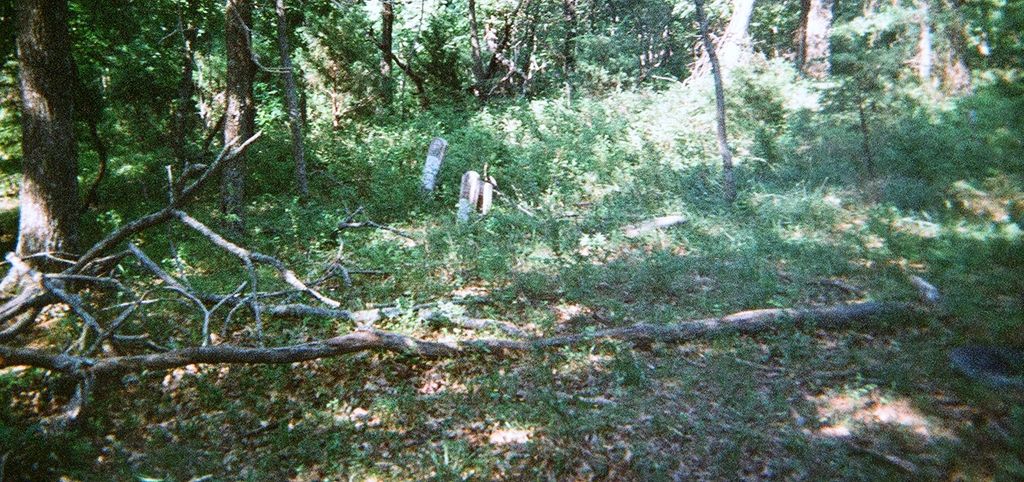
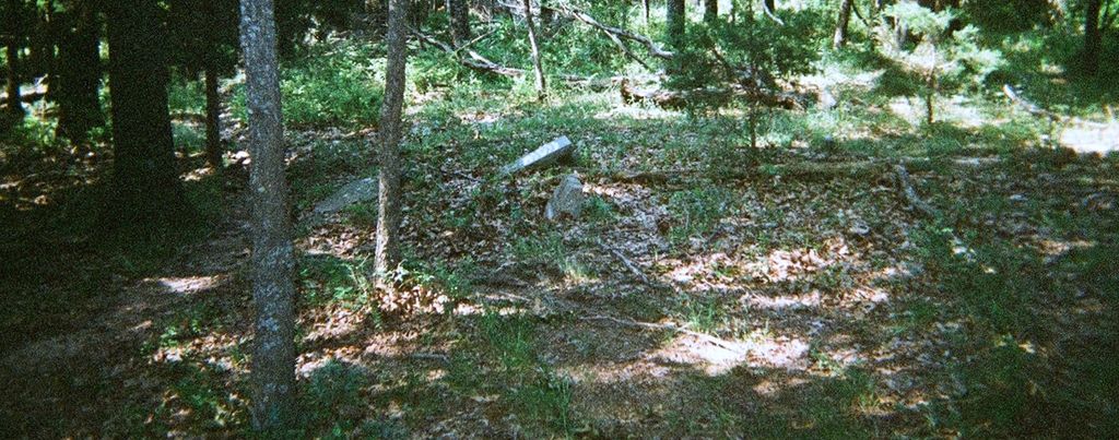
| Description | : | This cemetery sits on a farm outside Hogeye Ar. If you take Co Rd 156 east out of Hogeye,go .98 miles,you will see a narrow dirt road on right,across from old chicken house.This road goes to the Mark Findahl farm, You will have to call ahead ,to see if anyone is home,it is 3/4 mile to the farm,but a gate is across the road as you approach the farm. When you get past the gate,you will see a red barn on the right. Just before the barn there is a road that cuts up across fields to a smal... Read More |
frequently asked questions (FAQ):
-
Where is Phillips Cemetery?
Phillips Cemetery is located at Hogeye, Washington County ,Arkansas ,USA.
-
Phillips Cemetery cemetery's updated grave count on graveviews.com?
0 memorials
-
Where are the coordinates of the Phillips Cemetery?
Latitude: 35.9119760
Longitude: -94.2556360
Nearby Cemetories:
1. Billingsley Cemetery
West Fork, Washington County, USA
Coordinate: 35.9132996, -94.2716980
2. Carney Cemetery
Washington County, USA
Coordinate: 35.9242710, -94.2484530
3. Holcomb Cemetery
West Fork, Washington County, USA
Coordinate: 35.8954065, -94.2519087
4. Burris Cemetery
Washington County, USA
Coordinate: 35.8935000, -94.2482650
5. Choate Cemetery
Onda, Washington County, USA
Coordinate: 35.8938200, -94.2732500
6. Howell Cemetery
Prairie Grove, Washington County, USA
Coordinate: 35.9056015, -94.2835999
7. Friendship Cemetery
West Fork, Washington County, USA
Coordinate: 35.9043740, -94.2217230
8. Rutherford Cemetery
Prairie Grove, Washington County, USA
Coordinate: 35.9305992, -94.2825012
9. Parks Cemetery
Hogeye, Washington County, USA
Coordinate: 35.8988991, -94.2906036
10. Sharp Cemetery
Prairie Grove, Washington County, USA
Coordinate: 35.9393997, -94.2827988
11. McDonald Cemetery
Onda, Washington County, USA
Coordinate: 35.8806000, -94.2799988
12. Stevenson Leach Cemetery
Prairie Grove, Washington County, USA
Coordinate: 35.9586000, -94.2524000
13. Union Star Cemetery
West Fork, Washington County, USA
Coordinate: 35.8922005, -94.2031021
14. McClelland Cemetery
Washington County, USA
Coordinate: 35.8635950, -94.2410980
15. Barron Cemetery
Greenland, Washington County, USA
Coordinate: 35.9599440, -94.2355570
16. Baker Cemetery
Onda, Washington County, USA
Coordinate: 35.8680992, -94.2910995
17. West Fork Cemetery
West Fork, Washington County, USA
Coordinate: 35.9324989, -94.1932983
18. Karnes Cemetery
West Fork, Washington County, USA
Coordinate: 35.9084930, -94.1865082
19. Dale Family Cemetery
Hogeye, Washington County, USA
Coordinate: 35.9651640, -94.2322680
20. John A Rutherford - Martin Cemetery
Washington County, USA
Coordinate: 35.9513950, -94.2011490
21. Bryant Cemetery
Washington County, USA
Coordinate: 35.9514250, -94.2011060
22. Pleasant Home Cemetery
Prairie Grove, Washington County, USA
Coordinate: 35.9276500, -94.3283600
23. Low Gap Cemetery
West Fork, Washington County, USA
Coordinate: 35.8658218, -94.2063904
24. Dripping Springs Cemetery
Onda, Washington County, USA
Coordinate: 35.8584310, -94.2932080