
| Memorials | : | 0 |
| Location | : | Washington County, USA |
| Coordinate | : | 35.9242710, -94.2484530 |
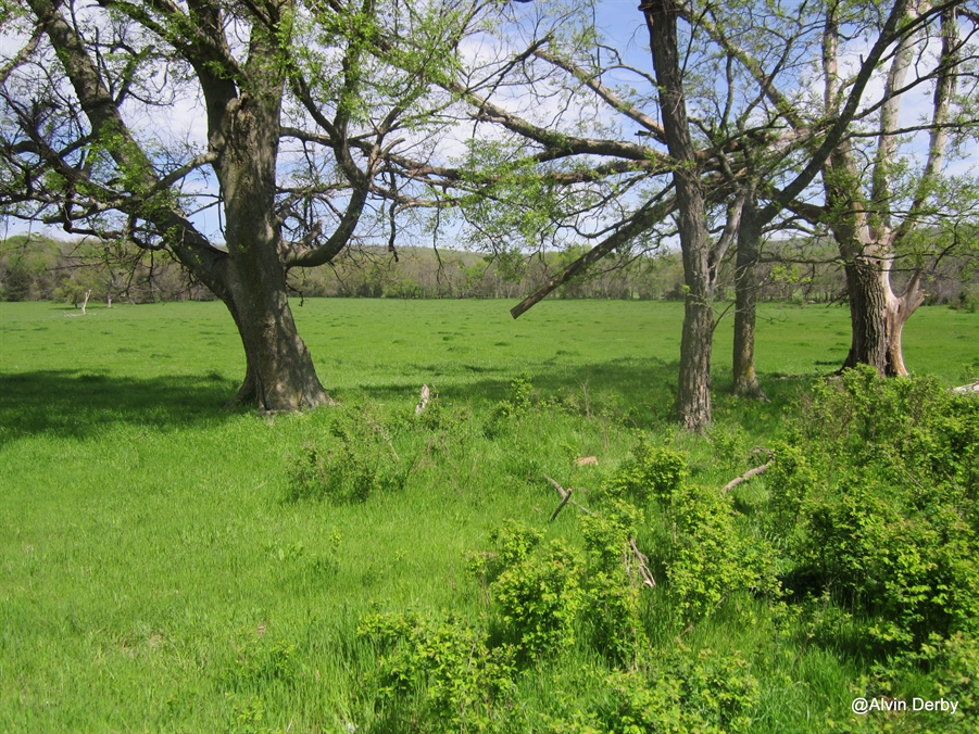
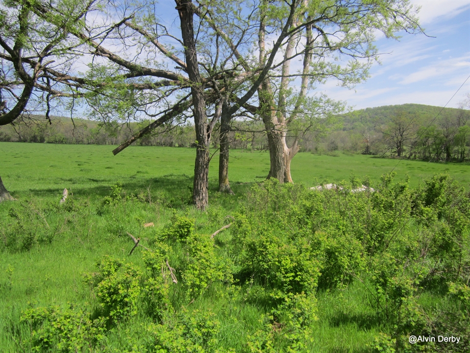
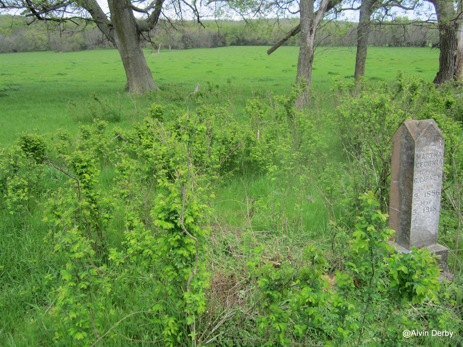
| Description | : | Located on the old George Carney Farm,now owned by James Carter. It has about six marked greves and about four unmarked graves. Take Hwy 265 North out of Hogeye. Go about a mile,cross a bridge and take road right, S.Billingsley Road. Follow this dirt road for about a mile and take first road right onto the Carney Farm . Go past barn on left and follow old road about half mile. You will see another barn on left and the old foundation to the house. Beyond about 250 feet,on left, is the cemetery. |
frequently asked questions (FAQ):
-
Where is Carney Cemetery?
Carney Cemetery is located at Washington County ,Arkansas ,USA.
-
Carney Cemetery cemetery's updated grave count on graveviews.com?
0 memorials
-
Where are the coordinates of the Carney Cemetery?
Latitude: 35.9242710
Longitude: -94.2484530


Nearby Cemetories:
1. Phillips Cemetery
Hogeye, Washington County, USA
Coordinate: 35.9119760, -94.2556360
2. Billingsley Cemetery
West Fork, Washington County, USA
Coordinate: 35.9132996, -94.2716980
3. Rutherford Cemetery
Prairie Grove, Washington County, USA
Coordinate: 35.9305992, -94.2825012
4. Holcomb Cemetery
West Fork, Washington County, USA
Coordinate: 35.8954065, -94.2519087
5. Friendship Cemetery
West Fork, Washington County, USA
Coordinate: 35.9043740, -94.2217230
6. Burris Cemetery
Washington County, USA
Coordinate: 35.8935000, -94.2482650
7. Sharp Cemetery
Prairie Grove, Washington County, USA
Coordinate: 35.9393997, -94.2827988
8. Howell Cemetery
Prairie Grove, Washington County, USA
Coordinate: 35.9056015, -94.2835999
9. Stevenson Leach Cemetery
Prairie Grove, Washington County, USA
Coordinate: 35.9586000, -94.2524000
10. Choate Cemetery
Onda, Washington County, USA
Coordinate: 35.8938200, -94.2732500
11. Barron Cemetery
Greenland, Washington County, USA
Coordinate: 35.9599440, -94.2355570
12. Parks Cemetery
Hogeye, Washington County, USA
Coordinate: 35.8988991, -94.2906036
13. Dale Family Cemetery
Hogeye, Washington County, USA
Coordinate: 35.9651640, -94.2322680
14. West Fork Cemetery
West Fork, Washington County, USA
Coordinate: 35.9324989, -94.1932983
15. John A Rutherford - Martin Cemetery
Washington County, USA
Coordinate: 35.9513950, -94.2011490
16. Bryant Cemetery
Washington County, USA
Coordinate: 35.9514250, -94.2011060
17. Union Star Cemetery
West Fork, Washington County, USA
Coordinate: 35.8922005, -94.2031021
18. McDonald Cemetery
Onda, Washington County, USA
Coordinate: 35.8806000, -94.2799988
19. Illinois Chapel Cemetery
Prairie Grove, Washington County, USA
Coordinate: 35.9736350, -94.2643590
20. Reed Cemetery
West Fork, Washington County, USA
Coordinate: 35.9630800, -94.2051510
21. Karnes Cemetery
West Fork, Washington County, USA
Coordinate: 35.9084930, -94.1865082
22. Campbell Church Cemetery
West Fork, Washington County, USA
Coordinate: 35.9583015, -94.1903000
23. Black Oak Cemetery
Greenland, Washington County, USA
Coordinate: 35.9815480, -94.2291780
24. McClelland Cemetery
Washington County, USA
Coordinate: 35.8635950, -94.2410980