
| Memorials | : | 0 |
| Location | : | Camp Springs, Caswell County, USA |
| Coordinate | : | 36.2748030, -79.5112650 |
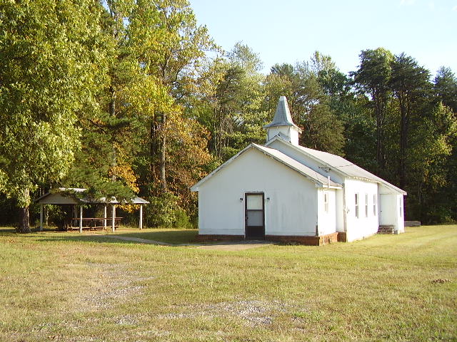
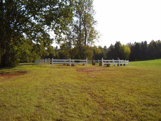
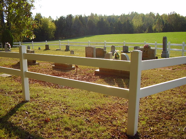
| Description | : | Historically significant African-American Primitive Baptist Church and Cemetery. This church cemetery established by African-American members of the community does not have a survey of record. |
frequently asked questions (FAQ):
-
Where is Brown Arbor Baptist Church Cemetery?
Brown Arbor Baptist Church Cemetery is located at 570 Underwood Road Camp Springs, Caswell County ,North Carolina ,USA.
-
Brown Arbor Baptist Church Cemetery cemetery's updated grave count on graveviews.com?
0 memorials
-
Where are the coordinates of the Brown Arbor Baptist Church Cemetery?
Latitude: 36.2748030
Longitude: -79.5112650
Nearby Cemetories:
1. Brown's Chapel Baptist Church Cemetery
Matkins, Caswell County, USA
Coordinate: 36.2736270, -79.5196330
2. Cherry Grove Baptist Church Cemetery
Cherry Grove, Caswell County, USA
Coordinate: 36.2736270, -79.5205660
3. Bouldin Family Cemetery
Camp Springs, Caswell County, USA
Coordinate: 36.2827340, -79.5144080
4. Pleasant View Assembly of God Church Cemetery
Camp Springs, Caswell County, USA
Coordinate: 36.2828550, -79.5180770
5. Boswell-Lambeth-Williams-Saunders Family Cemetery
Camp Springs, Caswell County, USA
Coordinate: 36.2849870, -79.5195260
6. Simpson Family Cemetery
Camp Springs, Caswell County, USA
Coordinate: 36.2867690, -79.4928750
7. Camp Springs UMC Cemetery
Camp Springs, Caswell County, USA
Coordinate: 36.2930250, -79.5012760
8. Harris-Swift Cemetery
Stony Creek, Caswell County, USA
Coordinate: 36.2687480, -79.4844800
9. Camp Springs United Methodist Church Cemetery
Camp Springs, Caswell County, USA
Coordinate: 36.2952766, -79.4972229
10. Family Cemetery on Apple Road
Camp Springs, Caswell County, USA
Coordinate: 36.2989100, -79.5002500
11. Lambeth Family Cemetery
Camp Springs, Caswell County, USA
Coordinate: 36.3077030, -79.5116780
12. Norman Family Cemetery
Camp Springs, Caswell County, USA
Coordinate: 36.3129850, -79.5007770
13. Family Cemetery on Pagetown Road
Stony Creek, Caswell County, USA
Coordinate: 36.2670100, -79.4629700
14. Shiloh United Methodist Church Cemetery
Alamance County, USA
Coordinate: 36.2309680, -79.5191400
15. Brown Family Cemetery
Camp Springs, Caswell County, USA
Coordinate: 36.3175200, -79.4922640
16. Simpson Cemetery
Stony Creek, Caswell County, USA
Coordinate: 36.2496460, -79.4592300
17. Underwood-Boswell Family Cemetery
Altamahaw, Alamance County, USA
Coordinate: 36.2433820, -79.4599650
18. Fieldstone Drive Family Cemetery
Ashland, Caswell County, USA
Coordinate: 36.3261700, -79.4995400
19. Rice Cemetery
Ashland, Caswell County, USA
Coordinate: 36.3270020, -79.5245150
20. Ware Family Cemetery
Ashland, Caswell County, USA
Coordinate: 36.3323080, -79.5118200
21. Williamson Cemetery
Cherry Grove, Caswell County, USA
Coordinate: 36.2979370, -79.4437910
22. Leath-Kernodle-Hornbuckle Family Cemetery
Stony Creek, Caswell County, USA
Coordinate: 36.2565420, -79.4391190
23. Scott Family Cemetery
Stony Creek, Caswell County, USA
Coordinate: 36.2562560, -79.4391610
24. Gilliam's Primitive Baptist Church Cemetery
Elon College, Alamance County, USA
Coordinate: 36.2132150, -79.5121690