
| Memorials | : | 0 |
| Location | : | Camp Springs, Caswell County, USA |
| Coordinate | : | 36.2989100, -79.5002500 |
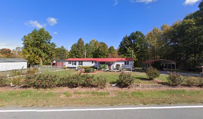
| Description | : | Family Cemetery on Camp Springs Road Family Cemetery on Private Property No Recorded Right of Public Access Property Owner's Permission Required This family cemetery does not have a survey of record. At least sixteen graves were evident in 1973. In the vicinity of 2497 Camp Springs Road. Carolina Caswell identified this cemetery by Deed Book 171 page 253. This cemetery does not have a survey of record in the J. Burch Blaylock Collection. |
frequently asked questions (FAQ):
-
Where is Family Cemetery on Apple Road?
Family Cemetery on Apple Road is located at Apple Road Camp Springs, Caswell County ,North Carolina ,USA.
-
Family Cemetery on Apple Road cemetery's updated grave count on graveviews.com?
0 memorials
-
Where are the coordinates of the Family Cemetery on Apple Road?
Latitude: 36.2989100
Longitude: -79.5002500
Nearby Cemetories:
1. Camp Springs United Methodist Church Cemetery
Camp Springs, Caswell County, USA
Coordinate: 36.2952766, -79.4972229
2. Camp Springs UMC Cemetery
Camp Springs, Caswell County, USA
Coordinate: 36.2930250, -79.5012760
3. Lambeth Family Cemetery
Camp Springs, Caswell County, USA
Coordinate: 36.3077030, -79.5116780
4. Simpson Family Cemetery
Camp Springs, Caswell County, USA
Coordinate: 36.2867690, -79.4928750
5. Norman Family Cemetery
Camp Springs, Caswell County, USA
Coordinate: 36.3129850, -79.5007770
6. Brown Family Cemetery
Camp Springs, Caswell County, USA
Coordinate: 36.3175200, -79.4922640
7. Bouldin Family Cemetery
Camp Springs, Caswell County, USA
Coordinate: 36.2827340, -79.5144080
8. Boswell-Lambeth-Williams-Saunders Family Cemetery
Camp Springs, Caswell County, USA
Coordinate: 36.2849870, -79.5195260
9. Pleasant View Assembly of God Church Cemetery
Camp Springs, Caswell County, USA
Coordinate: 36.2828550, -79.5180770
10. Brown Arbor Baptist Church Cemetery
Camp Springs, Caswell County, USA
Coordinate: 36.2748030, -79.5112650
11. Fieldstone Drive Family Cemetery
Ashland, Caswell County, USA
Coordinate: 36.3261700, -79.4995400
12. Brown's Chapel Baptist Church Cemetery
Matkins, Caswell County, USA
Coordinate: 36.2736270, -79.5196330
13. Cherry Grove Baptist Church Cemetery
Cherry Grove, Caswell County, USA
Coordinate: 36.2736270, -79.5205660
14. Harris-Swift Cemetery
Stony Creek, Caswell County, USA
Coordinate: 36.2687480, -79.4844800
15. Rice Cemetery
Ashland, Caswell County, USA
Coordinate: 36.3270020, -79.5245150
16. Ware Family Cemetery
Ashland, Caswell County, USA
Coordinate: 36.3323080, -79.5118200
17. Trinity Baptist Church Cemetery
Locust Hill, Caswell County, USA
Coordinate: 36.3418720, -79.4982020
18. Paschal Family Cemetery
Ashland, Caswell County, USA
Coordinate: 36.3387660, -79.5214030
19. Trinity Old Baptist Church Cemetery
Locust Hill, Caswell County, USA
Coordinate: 36.3422660, -79.4955680
20. Family Cemetery on Pagetown Road
Stony Creek, Caswell County, USA
Coordinate: 36.2670100, -79.4629700
21. Paschal-Butler Family Cemetery
Locust Hill, Caswell County, USA
Coordinate: 36.3403470, -79.4815830
22. Heydon Family Cemetery
Cherry Grove, Caswell County, USA
Coordinate: 36.3055890, -79.4444190
23. Williamson Cemetery
Cherry Grove, Caswell County, USA
Coordinate: 36.2979370, -79.4437910
24. Apple Cemetery
Ashland, Caswell County, USA
Coordinate: 36.3442001, -79.5147018