
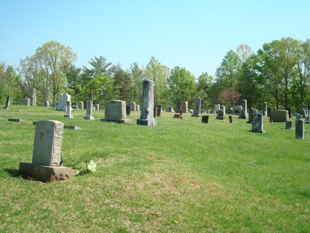
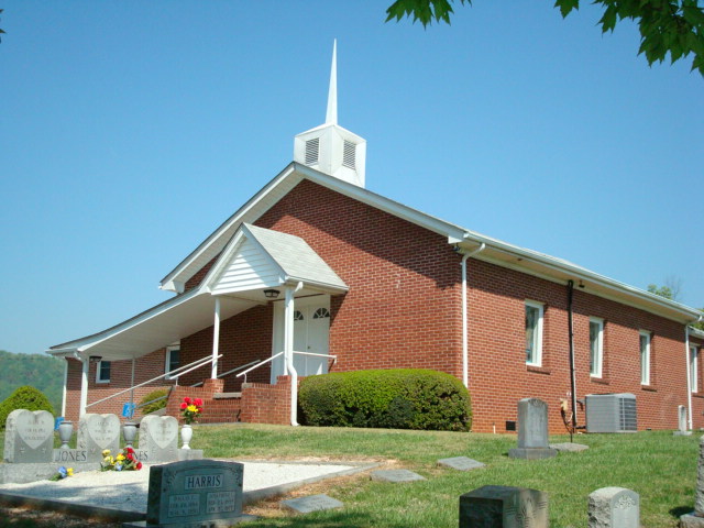
| Memorials | : | 55 |
| Location | : | Lake Lure, Rutherford County, USA |
| Coordinate | : | 35.4090340, -82.1950920 |
| Description | : | This cemetery is in the Lake Lure area in the western part of Rutherford County, NC. To get to it out of Rutherfordton, North Carolina, take highway US64-74A for about fifteen miles or until you come to the intersection where NC9 turns off to the south, the lake will be visible on your right. The church and cemetery is less than a half mile out NC9 on the left. |
frequently asked questions (FAQ):
-
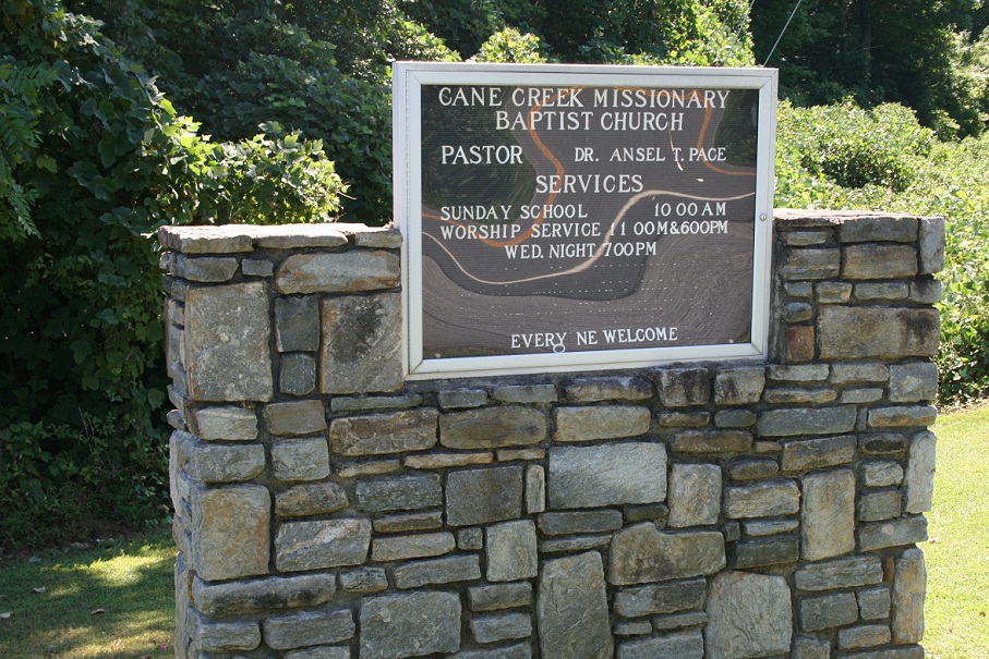
Where is Cane Creek Missionary Baptist Church Cemetery?
Cane Creek Missionary Baptist Church Cemetery is located at Lake Lure, Rutherford County ,North Carolina ,USA.
-
Cane Creek Missionary Baptist Church Cemetery cemetery's updated grave count on graveviews.com?
55 memorials
-
Where are the coordinates of the Cane Creek Missionary Baptist Church Cemetery?
Latitude: 35.4090340
Longitude: -82.1950920
Nearby Cemetories:
1. Laughter Family Cemetery
Mill Spring, Polk County, USA
Coordinate: 35.3992130, -82.1977540
2. McGuinn Burying Ground
Mill Spring, Polk County, USA
Coordinate: 35.3941157, -82.1944560
3. Grassy Knob Church Cemetery
Lake Lure, Rutherford County, USA
Coordinate: 35.4087500, -82.1723090
4. Son RIse Old TIme Gospel Church Cemetery
Mill Spring, Polk County, USA
Coordinate: 35.4040300, -82.1723580
5. Weaver Cemetery
Lake Lure, Rutherford County, USA
Coordinate: 35.4294587, -82.2047271
6. Temple of Jesus Cemetery
Lake Lure, Rutherford County, USA
Coordinate: 35.4255508, -82.1639378
7. Coopers Gap Baptist Church Cemetery
Mill Spring, Polk County, USA
Coordinate: 35.3786030, -82.1986630
8. Chimney Rock Baptist Church Cemetery
Lake Lure, Rutherford County, USA
Coordinate: 35.4382380, -82.2301020
9. Flynn Cemetery
Bills Creek, Rutherford County, USA
Coordinate: 35.4530640, -82.1729440
10. Whiteside Family Cemetery
Uree, Rutherford County, USA
Coordinate: 35.4234390, -82.1384470
11. Bagwell Cemetery
Lake Lure, Rutherford County, USA
Coordinate: 35.4542730, -82.1719410
12. Buffalo Cemetery
Lake Lure, Rutherford County, USA
Coordinate: 35.4611250, -82.1910620
13. Fairfield Mountains Chapel Columbarium
Lake Lure, Rutherford County, USA
Coordinate: 35.4612430, -82.1878700
14. Victory in Jesus Baptist Church Cemetery
Mill Spring, Polk County, USA
Coordinate: 35.3573120, -82.1833700
15. Mount Nebo Baptist Cemetery
Lake Lure, Rutherford County, USA
Coordinate: 35.4502700, -82.1500200
16. Rock Springs Baptist Church Cemetery
Rutherfordton, Rutherford County, USA
Coordinate: 35.3970520, -82.1287280
17. Big Level Baptist Church Cemetery
Mill Spring, Polk County, USA
Coordinate: 35.3632060, -82.1509230
18. Bills Creek Baptist Church Cemetery
Bills Creek, Rutherford County, USA
Coordinate: 35.4514980, -82.1411210
19. Mountain View Baptist Church Cemetery
Mill Spring, Polk County, USA
Coordinate: 35.3533530, -82.2353240
20. Saint Johns Missionary Baptist Cemetery
Lake Lure, Rutherford County, USA
Coordinate: 35.4523926, -82.1266098
21. Collins Cemetery
Edneyville, Henderson County, USA
Coordinate: 35.4082280, -82.2849970
22. Mountain Home Baptist Church Cemetery
Edneyville, Henderson County, USA
Coordinate: 35.3950745, -82.2884417
23. Episcopal Church of the Transfiguration Cemetery
Bat Cave, Henderson County, USA
Coordinate: 35.4501200, -82.2800600
24. Bald Mountain Baptist Church Cemetery
Buncombe County, USA
Coordinate: 35.4703690, -82.2637050