
| Memorials | : | 61 |
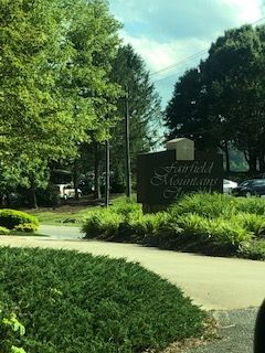
| Location | : | Lake Lure, Rutherford County, USA |
| Coordinate | : | 35.4612430, -82.1878700 |
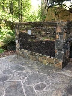
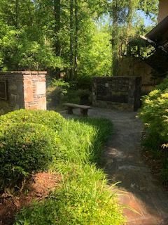
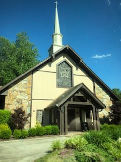
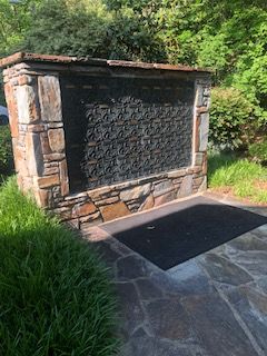
| Description | : | Fairfield Mountains Chapel is an interdenominational, ecumenical Christian church, located at 1384 Buffalo Creek Road, Lake Lure, adjacent to the security gate at Rumbling Bald Resort and Spa. |
frequently asked questions (FAQ):
-
Where is Fairfield Mountains Chapel Columbarium?
Fairfield Mountains Chapel Columbarium is located at Lake Lure, Rutherford County ,North Carolina ,USA.
-
Fairfield Mountains Chapel Columbarium cemetery's updated grave count on graveviews.com?
61 memorials
-
Where are the coordinates of the Fairfield Mountains Chapel Columbarium?
Latitude: 35.4612430
Longitude: -82.1878700
Nearby Cemetories:
1. Buffalo Cemetery
Lake Lure, Rutherford County, USA
Coordinate: 35.4611250, -82.1910620
2. Flynn Cemetery
Bills Creek, Rutherford County, USA
Coordinate: 35.4530640, -82.1729440
3. Bagwell Cemetery
Lake Lure, Rutherford County, USA
Coordinate: 35.4542730, -82.1719410
4. Mount Nebo Baptist Cemetery
Lake Lure, Rutherford County, USA
Coordinate: 35.4502700, -82.1500200
5. Weaver Cemetery
Lake Lure, Rutherford County, USA
Coordinate: 35.4294587, -82.2047271
6. Bills Creek Baptist Church Cemetery
Bills Creek, Rutherford County, USA
Coordinate: 35.4514980, -82.1411210
7. Temple of Jesus Cemetery
Lake Lure, Rutherford County, USA
Coordinate: 35.4255508, -82.1639378
8. Chimney Rock Baptist Church Cemetery
Lake Lure, Rutherford County, USA
Coordinate: 35.4382380, -82.2301020
9. Dalton Family Cemetery
Bills Creek, Rutherford County, USA
Coordinate: 35.4826320, -82.1391050
10. Saint Johns Missionary Baptist Cemetery
Lake Lure, Rutherford County, USA
Coordinate: 35.4523926, -82.1266098
11. Cane Creek Missionary Baptist Church Cemetery
Lake Lure, Rutherford County, USA
Coordinate: 35.4090340, -82.1950920
12. Red Top Cemetery
Buncombe County, USA
Coordinate: 35.5043000, -82.2269000
13. Grassy Knob Church Cemetery
Lake Lure, Rutherford County, USA
Coordinate: 35.4087500, -82.1723090
14. Whiteside Family Cemetery
Uree, Rutherford County, USA
Coordinate: 35.4234390, -82.1384470
15. Son RIse Old TIme Gospel Church Cemetery
Mill Spring, Polk County, USA
Coordinate: 35.4040300, -82.1723580
16. Antioch Church Cemetery
Bills Creek, Rutherford County, USA
Coordinate: 35.4826780, -82.1201230
17. Bald Mountain Baptist Church Cemetery
Buncombe County, USA
Coordinate: 35.4703690, -82.2637050
18. Laughter Family Cemetery
Mill Spring, Polk County, USA
Coordinate: 35.3992130, -82.1977540
19. McGuinn Burying Ground
Mill Spring, Polk County, USA
Coordinate: 35.3941157, -82.1944560
20. Cedar Creek Holiness Church Cemetery
Bills Creek, Rutherford County, USA
Coordinate: 35.4855560, -82.1106620
21. Old Broad River Cemetery
Black Mountain, Buncombe County, USA
Coordinate: 35.4894400, -82.2733280
22. Ledbetter-Gilliam Family Cemetery
Buncombe County, USA
Coordinate: 35.5107630, -82.2584800
23. Episcopal Church of the Transfiguration Cemetery
Bat Cave, Henderson County, USA
Coordinate: 35.4501200, -82.2800600
24. Broad River Baptist Church Cemetery
Black Mountain, Buncombe County, USA
Coordinate: 35.5008300, -82.2689800