
| Memorials | : | 350 |
| Location | : | Oakland, Alameda County, USA |
| Phone | : | (510) 271-1928 |
| Website | : | catholiccemeteries.culturezoo.com/ |
| Coordinate | : | 37.8105316, -122.2633896 |
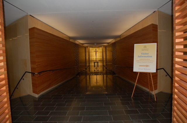
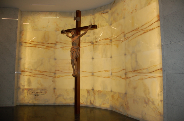
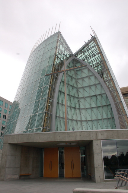
| Description | : | On November 2, 2008, the Cathedral of Christ the Light Mausoleum was officially dedicated and opened. That same day, the first bishop of the Diocese of Oakland, Bishop Floyd Begin, was entombed there after having been moved from his original burial site at Holy Sepulchre Cemetery in Hayward. He now rests in a section reserved for bishops of the Diocese of Oakland. The marble-fronted crypts of that section are backlit so that they glow from within. The mausoleum has a capacity of 882 single and double crypts and 1,850 single and double cremation niches. There are both... Read More |
frequently asked questions (FAQ):
-
Where is Cathedral of Christ the Light Mausoleum?
Cathedral of Christ the Light Mausoleum is located at 180 Grand Avenue Oakland, Alameda County ,California , 94612USA.
-
Cathedral of Christ the Light Mausoleum cemetery's updated grave count on graveviews.com?
350 memorials
-
Where are the coordinates of the Cathedral of Christ the Light Mausoleum?
Latitude: 37.8105316
Longitude: -122.2633896
Nearby Cemetories:
1. Chapel of Memories Columbarium
Oakland, Alameda County, USA
Coordinate: 37.8310471, -122.2480927
2. Chapel of the Chimes Columbarium and Mausoleum
Oakland, Alameda County, USA
Coordinate: 37.8318863, -122.2456894
3. Home of Eternity Cemetery
Oakland, Alameda County, USA
Coordinate: 37.8322970, -122.2448270
4. Mountain View Cemetery
Oakland, Alameda County, USA
Coordinate: 37.8327600, -122.2395200
5. Saint Mary's Cemetery
Oakland, Alameda County, USA
Coordinate: 37.8349991, -122.2418976
6. Saint Paul Lutheran Church
Oakland, Alameda County, USA
Coordinate: 37.8020820, -122.2222780
7. Home of Peace Cemetery
Oakland, Alameda County, USA
Coordinate: 37.7790604, -122.2036285
8. Sunnyside Cemetery
Oakland, Alameda County, USA
Coordinate: 37.7806260, -122.1822410
9. Evergreen Cemetery
Oakland, Alameda County, USA
Coordinate: 37.7719002, -122.1782990
10. Northbrae Community Church Columbarium
Berkeley, Alameda County, USA
Coordinate: 37.8905500, -122.2763200
11. Golden Gate Fields
Albany, Alameda County, USA
Coordinate: 37.8854000, -122.3117000
12. Yerba Buena Island Cemetery (Defunct)
San Francisco, San Francisco County, USA
Coordinate: 37.8127420, -122.3707880
13. Golden Gate Mausoleum and Columbaria
El Cerrito, Contra Costa County, USA
Coordinate: 37.9073150, -122.2857220
14. Sunset View Cemetery
El Cerrito, Contra Costa County, USA
Coordinate: 37.9077721, -122.2871017
15. First Street Cemetery (Defunct)
San Francisco, San Francisco County, USA
Coordinate: 37.7906170, -122.3991770
16. Bush Street Cemetery (Defunct)
San Francisco, San Francisco County, USA
Coordinate: 37.7907950, -122.4011960
17. Lafayette-Orinda Presbyterian Church Garden
Contra Costa County, USA
Coordinate: 37.8866040, -122.1606950
18. Saint Stephens Episcopal Church Memorial Garden
Orinda, Contra Costa County, USA
Coordinate: 37.8982650, -122.1729170
19. Old Saint Marys Cathedral Crypt
San Francisco, San Francisco County, USA
Coordinate: 37.7929010, -122.4058220
20. Grace Cathedral Columbarium
San Francisco, San Francisco County, USA
Coordinate: 37.7921110, -122.4133220
21. Yerba Buena Cemetery (Defunct)
San Francisco, San Francisco County, USA
Coordinate: 37.7792015, -122.4124985
22. First Unitarian Universalist Church Grounds
San Francisco, San Francisco County, USA
Coordinate: 37.7852859, -122.4231339
23. Hebrew Cemetery (Defunct)
San Francisco, San Francisco County, USA
Coordinate: 37.7959320, -122.4261060
24. Episcopal Church of Saint John the Evangelist Garden
San Francisco, San Francisco County, USA
Coordinate: 37.7662880, -122.4212860