
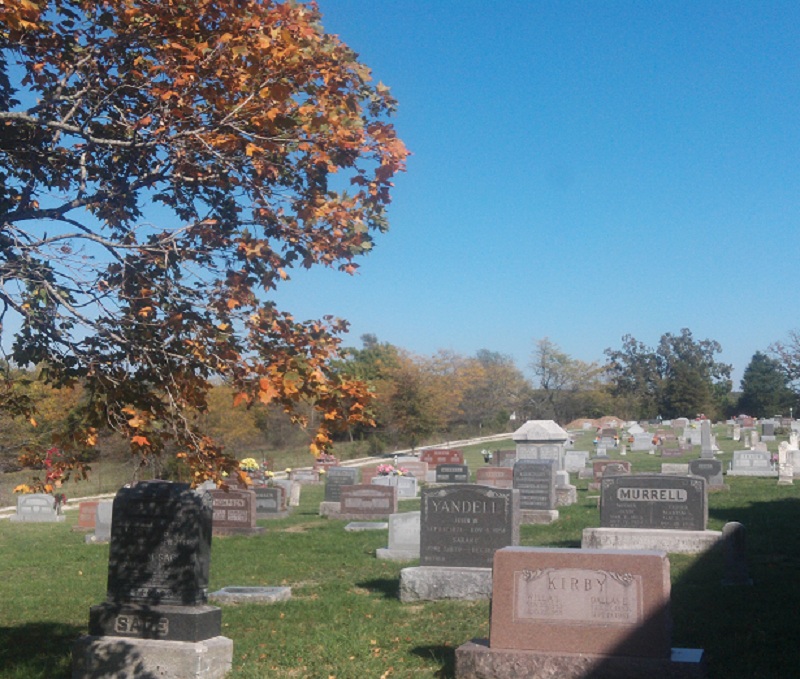
| Memorials | : | 10 |
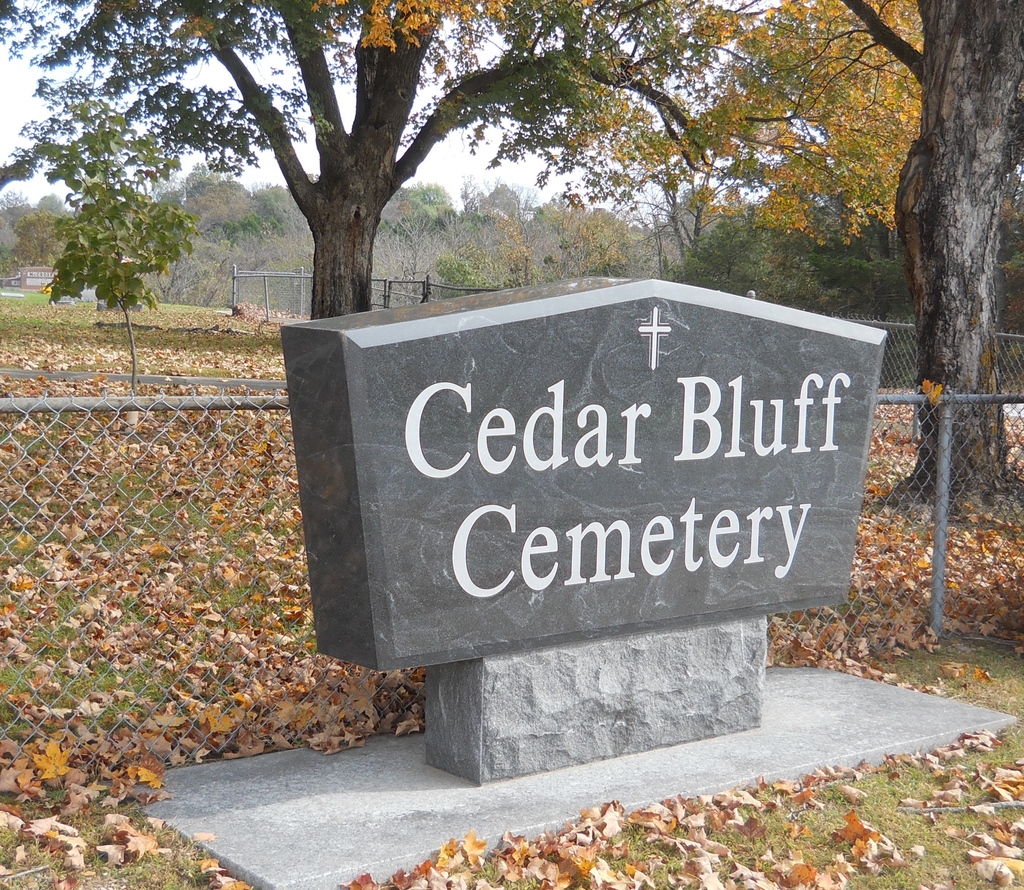
| Location | : | Fair Grove, Greene County, USA |
| Coordinate | : | 37.3771706, -93.1040878 |
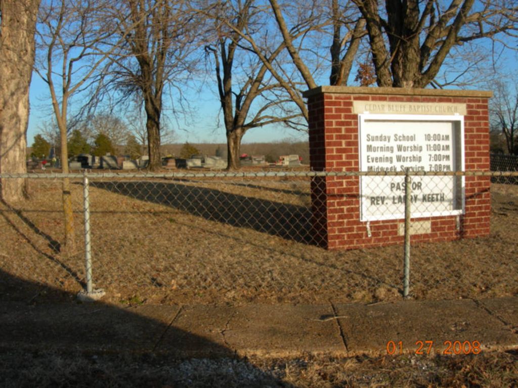
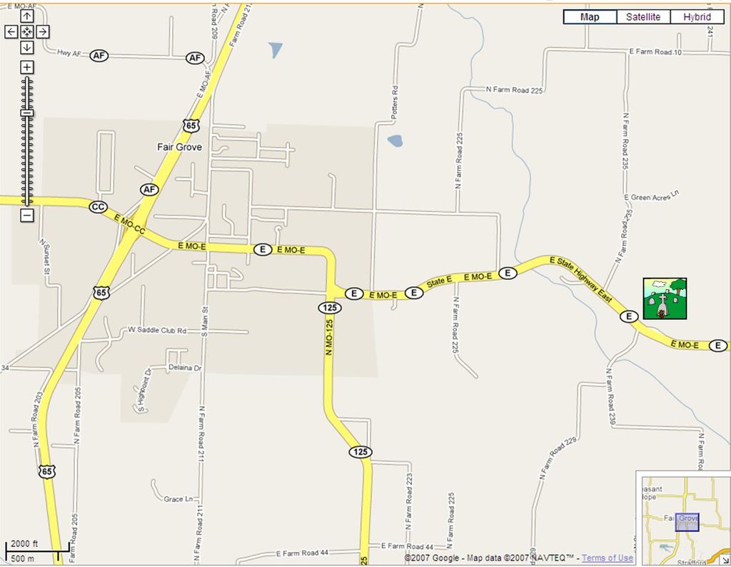
| Description | : | Hwy 65 to E at Fair Grove. Take E through Fair Grove. Cemetery is behind Cedar Bluff Church near the N Farm Road 239 intersection |
frequently asked questions (FAQ):
-
Where is Cedar Bluff Cemetery?
Cedar Bluff Cemetery is located at Fair Grove, Greene County ,Missouri ,USA.
-
Cedar Bluff Cemetery cemetery's updated grave count on graveviews.com?
8 memorials
-
Where are the coordinates of the Cedar Bluff Cemetery?
Latitude: 37.3771706
Longitude: -93.1040878
Nearby Cemetories:
1. Fair Grove First Baptist Church
Fair Grove, Greene County, USA
Coordinate: 37.3798500, -93.1507800
2. Bass Chapel Cemetery
Strafford, Greene County, USA
Coordinate: 37.3458980, -93.1323790
3. Old Fair Grove Cemetery
Fair Grove, Greene County, USA
Coordinate: 37.3820648, -93.1525116
4. Pleasant Ridge Cemetery
Fair Grove, Greene County, USA
Coordinate: 37.4144300, -93.1230800
5. Elm Spring Cemetery
Greene County, USA
Coordinate: 37.3427600, -93.1849600
6. Elm Springs Cemetery
Greene County, USA
Coordinate: 37.3426674, -93.1851045
7. Olive Free Will Chapel Cemetery
Olive, Dallas County, USA
Coordinate: 37.4556600, -93.1174000
8. Dishman Cemetery
Strafford, Greene County, USA
Coordinate: 37.2997017, -93.1258011
9. Mallard Cemetery
March, Dallas County, USA
Coordinate: 37.4538994, -93.1430969
10. Union Grove Cemetery #2
Goodnight, Polk County, USA
Coordinate: 37.4240260, -93.1914420
11. Mount Olive Cemetery
Olive, Dallas County, USA
Coordinate: 37.4663315, -93.1046677
12. Liberty Cemetery
Springfield, Greene County, USA
Coordinate: 37.3192000, -93.1993900
13. Willis Cemetery
Greene County, USA
Coordinate: 37.2757988, -93.0785980
14. Glover Cemetery
Tin Town, Polk County, USA
Coordinate: 37.4585200, -93.1899200
15. Old Salem Cemetery
Springfield, Greene County, USA
Coordinate: 37.3558006, -93.2380981
16. Bumgarner-Keiser Cemetery
Strafford, Greene County, USA
Coordinate: 37.2670580, -93.1217560
17. Mullinax Cemetery
Strafford, Greene County, USA
Coordinate: 37.2647018, -93.1031036
18. Potter Family Cemetery
Strafford, Greene County, USA
Coordinate: 37.2656517, -93.1362610
19. Union Mound Cemetery
March, Dallas County, USA
Coordinate: 37.4914093, -93.0956802
20. High Prairie Cemetery
Redtop, Dallas County, USA
Coordinate: 37.4891900, -93.1442000
21. Mayfield Cemetery
Tin Town, Polk County, USA
Coordinate: 37.4601800, -93.2076400
22. Caldwell Cemetery
Strafford, Greene County, USA
Coordinate: 37.2619019, -93.0717010
23. New Hope Cemetery
Fruitland, Greene County, USA
Coordinate: 37.4006004, -93.2589035
24. Mount Comfort Cemetery
Springfield, Greene County, USA
Coordinate: 37.3250010, -93.2475450