
| Memorials | : | 4 |
| Location | : | Springfield, Greene County, USA |
| Coordinate | : | 37.3192000, -93.1993900 |
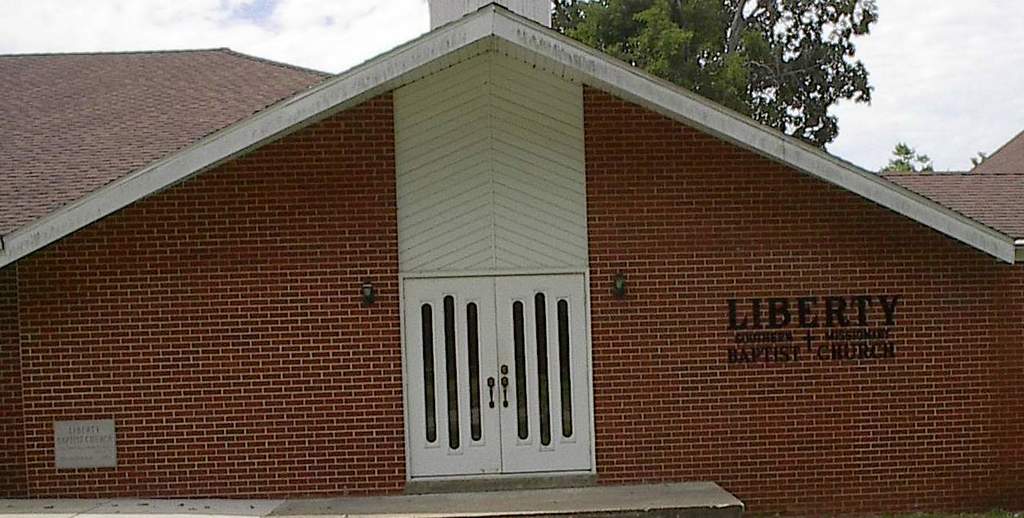
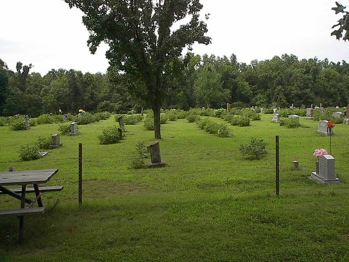
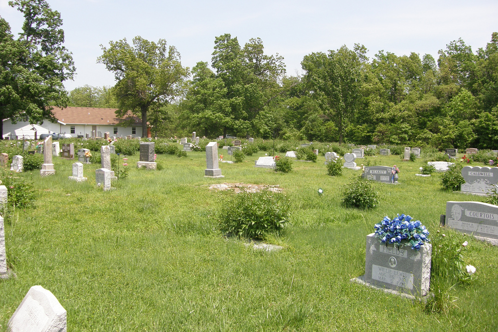
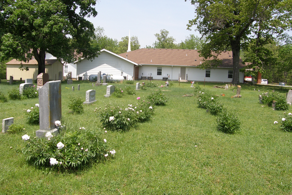
| Description | : | Take Glenstone St. north after you stop at the stop sign at AA and FR80 go north to KK Hwy past Crystal Cave and turn right. Go about 2.5 miles to FR189 and turn right on FR189 and go to the stop sign by Fellows Lake which is FR66. Turn left on FR66 and the cemetery is 1/4 mile on the right behind Liberty Baptist Church. |
frequently asked questions (FAQ):
-
Where is Liberty Cemetery?
Liberty Cemetery is located at 4360 E. FR66 Springfield, Greene County ,Missouri , 65803USA.
-
Liberty Cemetery cemetery's updated grave count on graveviews.com?
4 memorials
-
Where are the coordinates of the Liberty Cemetery?
Latitude: 37.3192000
Longitude: -93.1993900
Nearby Cemetories:
1. Elm Springs Cemetery
Greene County, USA
Coordinate: 37.3426674, -93.1851045
2. Elm Spring Cemetery
Greene County, USA
Coordinate: 37.3427600, -93.1849600
3. Mount Comfort Cemetery
Springfield, Greene County, USA
Coordinate: 37.3250010, -93.2475450
4. Old Salem Cemetery
Springfield, Greene County, USA
Coordinate: 37.3558006, -93.2380981
5. Bellview Cemetery
Springfield, Greene County, USA
Coordinate: 37.2880287, -93.2539215
6. Bass Chapel Cemetery
Strafford, Greene County, USA
Coordinate: 37.3458980, -93.1323790
7. Union Campground Cemetery
Springfield, Greene County, USA
Coordinate: 37.2609400, -93.2234000
8. Dishman Cemetery
Strafford, Greene County, USA
Coordinate: 37.2997017, -93.1258011
9. Hancock-Morton-Westmoreland Cemetery
Greene County, USA
Coordinate: 37.2489014, -93.2133026
10. Fair Grove First Baptist Church
Fair Grove, Greene County, USA
Coordinate: 37.3798500, -93.1507800
11. Old Fair Grove Cemetery
Fair Grove, Greene County, USA
Coordinate: 37.3820648, -93.1525116
12. Potter Family Cemetery
Strafford, Greene County, USA
Coordinate: 37.2656517, -93.1362610
13. Bumgarner-Keiser Cemetery
Strafford, Greene County, USA
Coordinate: 37.2670580, -93.1217560
14. Greenlawn Memorial Gardens
Springfield, Greene County, USA
Coordinate: 37.2611008, -93.2750015
15. Danforth Family Cemetery
Strafford, Greene County, USA
Coordinate: 37.2403000, -93.1480000
16. Danforth Cemetery
Strafford, Greene County, USA
Coordinate: 37.2368850, -93.1554670
17. Mullinax Cemetery
Strafford, Greene County, USA
Coordinate: 37.2647018, -93.1031036
18. New Hope Cemetery
Fruitland, Greene County, USA
Coordinate: 37.4006004, -93.2589035
19. Banfield Cemetery
Greene County, USA
Coordinate: 37.2779400, -93.3071900
20. Cedar Bluff Cemetery
Fair Grove, Greene County, USA
Coordinate: 37.3771706, -93.1040878
21. Mullings Family Cemetery
Greene County, USA
Coordinate: 37.3111110, -93.3197520
22. Dysart Cemetery
Springfield, Greene County, USA
Coordinate: 37.2516020, -93.2913170
23. Doling Park
Springfield, Greene County, USA
Coordinate: 37.2461815, -93.2902374
24. Bodenhamer Cemetery
Greene County, USA
Coordinate: 37.2153015, -93.1841965