
| Memorials | : | 0 |
| Location | : | Randolph County, USA |
| Coordinate | : | 39.4494090, -92.5041380 |
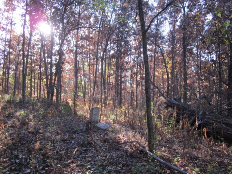
| Description | : | Located in T54 R14 S29 on the west side of CR 1245 about 1/2 mile south of former Mount Hope Cumberland Presbyterian Church. This grave was marked in 1931 by the DAR. Reportedly, his wife and a daughter are also buried here, but no other engraved stones were found. There does appear to be three graves, all of which look to have been completely covered with rocks at one time. |
frequently asked questions (FAQ):
-
Where is Chapman Cemetery?
Chapman Cemetery is located at Randolph County ,Missouri ,USA.
-
Chapman Cemetery cemetery's updated grave count on graveviews.com?
0 memorials
-
Where are the coordinates of the Chapman Cemetery?
Latitude: 39.4494090
Longitude: -92.5041380
Nearby Cemetories:
1. Mount Olivette Cemetery
Randolph County, USA
Coordinate: 39.4690780, -92.5131110
2. Klink-Lay Cemetery
Randolph County, USA
Coordinate: 39.4474120, -92.5345440
3. Devore Family Cemetery
Randolph County, USA
Coordinate: 39.4269540, -92.5165500
4. Hardister Cemetery
Randolph County, USA
Coordinate: 39.4799210, -92.5116790
5. Huntsville City Cemetery
Huntsville, Randolph County, USA
Coordinate: 39.4440500, -92.5460000
6. Henry Austin Cemetery
Huntsville, Randolph County, USA
Coordinate: 39.4365180, -92.5434960
7. Little Union Primitive Baptist Church Cemetery
Randolph County, USA
Coordinate: 39.4528000, -92.5510280
8. Holbrook Family Cemetery
Moberly, Randolph County, USA
Coordinate: 39.4152880, -92.4861960
9. Boulware-Morehead Cemetery
Randolph County, USA
Coordinate: 39.4398600, -92.5504750
10. Sugar Creek Cemetery
Moberly, Randolph County, USA
Coordinate: 39.4468994, -92.4550018
11. Phipps-Goodding Cemetery
Randolph County, USA
Coordinate: 39.4897420, -92.5200980
12. Hagar Cemetery
Huntsville, Randolph County, USA
Coordinate: 39.4049988, -92.5130997
13. Pleasant Hill Cemetery
Cairo, Randolph County, USA
Coordinate: 39.4976600, -92.4969900
14. David Austin Cemetery
Huntsville, Randolph County, USA
Coordinate: 39.4737420, -92.5649930
15. Memorial Park Cemetery
Moberly, Randolph County, USA
Coordinate: 39.4508018, -92.4332962
16. Polson-Pipes Cemetery
Randolph County, USA
Coordinate: 39.5044590, -92.4919350
17. Mason-Payton Cemetery
Randolph County, USA
Coordinate: 39.5067770, -92.5215990
18. Dameron Family Cemetery
Cairo, Randolph County, USA
Coordinate: 39.5074898, -92.4732701
19. Terry Cemetery
Huntsville, Randolph County, USA
Coordinate: 39.4985470, -92.5585630
20. McKinsey Cemetery
Moberly, Randolph County, USA
Coordinate: 39.3953700, -92.4576900
21. McKinsey-Deskin Cemetery
Moberly, Randolph County, USA
Coordinate: 39.4027470, -92.4422910
22. Sweet Springs Baptist Church Cemetery
Huntsville, Randolph County, USA
Coordinate: 39.3816500, -92.5259500
23. Oakland Cemetery
Moberly, Randolph County, USA
Coordinate: 39.4178009, -92.4203033
24. Saint Marys Cemetery
Moberly, Randolph County, USA
Coordinate: 39.4227982, -92.4169006