
| Memorials | : | 0 |
| Location | : | Randolph County, USA |
| Coordinate | : | 39.4474120, -92.5345440 |
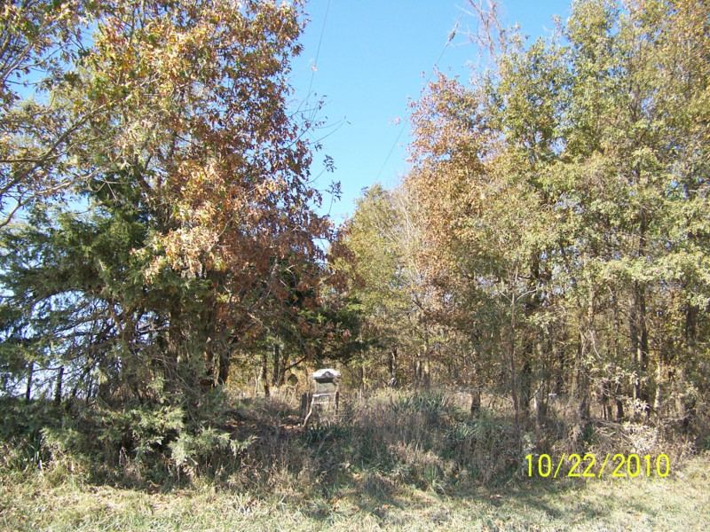
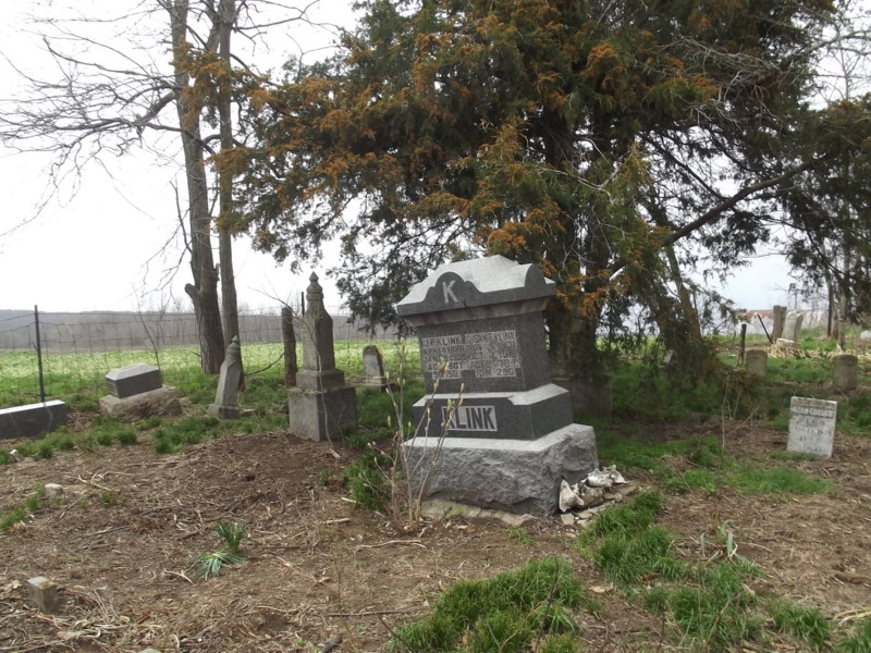
| Description | : | Located in T54 R15 S24 on the west side of CR 1225 north of Huntsville. This cemetery is right next to the road, up an embankment. It has been overgrown for years, but has been somewhat cleaned up fairly recently. Most stones found are in fairly good condition. According to some obituaries and death certificates there are several burials here for which no stones or markers of any kind were found. UPDATE April 2013: This cemetery was cleared again during the winter of 2012-13 and currently looks great |
frequently asked questions (FAQ):
-
Where is Klink-Lay Cemetery?
Klink-Lay Cemetery is located at Randolph County ,Missouri ,USA.
-
Klink-Lay Cemetery cemetery's updated grave count on graveviews.com?
0 memorials
-
Where are the coordinates of the Klink-Lay Cemetery?
Latitude: 39.4474120
Longitude: -92.5345440


Nearby Cemetories:
1. Huntsville City Cemetery
Huntsville, Randolph County, USA
Coordinate: 39.4440500, -92.5460000
2. Henry Austin Cemetery
Huntsville, Randolph County, USA
Coordinate: 39.4365180, -92.5434960
3. Little Union Primitive Baptist Church Cemetery
Randolph County, USA
Coordinate: 39.4528000, -92.5510280
4. Boulware-Morehead Cemetery
Randolph County, USA
Coordinate: 39.4398600, -92.5504750
5. Chapman Cemetery
Randolph County, USA
Coordinate: 39.4494090, -92.5041380
6. Devore Family Cemetery
Randolph County, USA
Coordinate: 39.4269540, -92.5165500
7. Mount Olivette Cemetery
Randolph County, USA
Coordinate: 39.4690780, -92.5131110
8. David Austin Cemetery
Huntsville, Randolph County, USA
Coordinate: 39.4737420, -92.5649930
9. Hardister Cemetery
Randolph County, USA
Coordinate: 39.4799210, -92.5116790
10. Phipps-Goodding Cemetery
Randolph County, USA
Coordinate: 39.4897420, -92.5200980
11. Hagar Cemetery
Huntsville, Randolph County, USA
Coordinate: 39.4049988, -92.5130997
12. Holbrook Family Cemetery
Moberly, Randolph County, USA
Coordinate: 39.4152880, -92.4861960
13. Terry Cemetery
Huntsville, Randolph County, USA
Coordinate: 39.4985470, -92.5585630
14. Burton-Burk Cemetery
Clifton Hill, Randolph County, USA
Coordinate: 39.4152590, -92.5930630
15. Pleasant Hill Cemetery
Cairo, Randolph County, USA
Coordinate: 39.4976600, -92.4969900
16. Mason-Payton Cemetery
Randolph County, USA
Coordinate: 39.5067770, -92.5215990
17. Sugar Creek Cemetery
Moberly, Randolph County, USA
Coordinate: 39.4468994, -92.4550018
18. Old Fort Henry Cemetery
Clifton Hill, Randolph County, USA
Coordinate: 39.4636990, -92.6114830
19. Mount Salem Cemetery
Huntsville, Randolph County, USA
Coordinate: 39.3890200, -92.5688200
20. New Fort Henry Cemetery
Fort Henry, Randolph County, USA
Coordinate: 39.4616500, -92.6164990
21. Polson-Pipes Cemetery
Randolph County, USA
Coordinate: 39.5044590, -92.4919350
22. Sweet Springs Baptist Church Cemetery
Huntsville, Randolph County, USA
Coordinate: 39.3816500, -92.5259500
23. Fullington Cemetery
Randolph County, USA
Coordinate: 39.3919730, -92.5837650
24. Charles Barron Cemetery
Randolph County, USA
Coordinate: 39.3805710, -92.5589660