
| Memorials | : | 0 |
| Location | : | Huntsville, Randolph County, USA |
| Coordinate | : | 39.4737420, -92.5649930 |
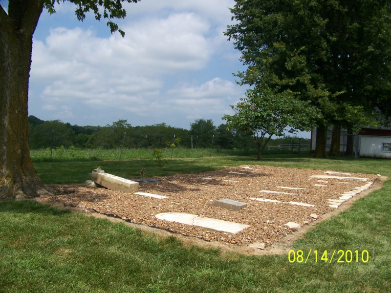
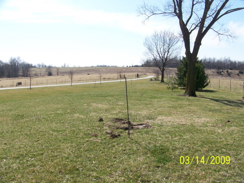
| Description | : | Located north of Huntsville on the east side of Rt C about 1 1/2 miles north of Rt O on private property. This cemetery was "rediscovered" in March 2009 and restored by the landowner. Only patches of a few stones were showing through the grass, and were found to be stacked three and four deep. Many of the Austins buried here died from a cholera epidemic which spread through this area in the late 1840's A dedication was held in August 2010 for the stone and SAR marker of Revolutionary War veteran Randolph White |
frequently asked questions (FAQ):
-
Where is David Austin Cemetery?
David Austin Cemetery is located at Huntsville, Randolph County ,Missouri ,USA.
-
David Austin Cemetery cemetery's updated grave count on graveviews.com?
0 memorials
-
Where are the coordinates of the David Austin Cemetery?
Latitude: 39.4737420
Longitude: -92.5649930
Nearby Cemetories:
1. Little Union Primitive Baptist Church Cemetery
Randolph County, USA
Coordinate: 39.4528000, -92.5510280
2. Terry Cemetery
Huntsville, Randolph County, USA
Coordinate: 39.4985470, -92.5585630
3. Huntsville City Cemetery
Huntsville, Randolph County, USA
Coordinate: 39.4440500, -92.5460000
4. Klink-Lay Cemetery
Randolph County, USA
Coordinate: 39.4474120, -92.5345440
5. Boulware-Morehead Cemetery
Randolph County, USA
Coordinate: 39.4398600, -92.5504750
6. Old Fort Henry Cemetery
Clifton Hill, Randolph County, USA
Coordinate: 39.4636990, -92.6114830
7. Phipps-Goodding Cemetery
Randolph County, USA
Coordinate: 39.4897420, -92.5200980
8. Cleveland Cemetery
Darksville, Randolph County, USA
Coordinate: 39.5018380, -92.6006240
9. Mount Olivette Cemetery
Randolph County, USA
Coordinate: 39.4690780, -92.5131110
10. Henry Austin Cemetery
Huntsville, Randolph County, USA
Coordinate: 39.4365180, -92.5434960
11. New Fort Henry Cemetery
Fort Henry, Randolph County, USA
Coordinate: 39.4616500, -92.6164990
12. Hardister Cemetery
Randolph County, USA
Coordinate: 39.4799210, -92.5116790
13. Mason-Payton Cemetery
Randolph County, USA
Coordinate: 39.5067770, -92.5215990
14. Chapman Cemetery
Randolph County, USA
Coordinate: 39.4494090, -92.5041380
15. Pleasant Hill Cemetery
Cairo, Randolph County, USA
Coordinate: 39.4976600, -92.4969900
16. Devore Family Cemetery
Randolph County, USA
Coordinate: 39.4269540, -92.5165500
17. Martin Green Cemetery
Randolph County, USA
Coordinate: 39.4972340, -92.6369320
18. Burton-Burk Cemetery
Clifton Hill, Randolph County, USA
Coordinate: 39.4152590, -92.5930630
19. Polson-Pipes Cemetery
Randolph County, USA
Coordinate: 39.5044590, -92.4919350
20. McCully-Haines Cemetery
Randolph County, USA
Coordinate: 39.5080870, -92.6410220
21. Hickory Grove Cemetery
Randolph County, USA
Coordinate: 39.5402985, -92.5852966
22. Summers Family Cemetery
Huntsville, Randolph County, USA
Coordinate: 39.5439036, -92.5413740
23. Ancell Cemetery
Cairo, Randolph County, USA
Coordinate: 39.5324600, -92.5044200
24. Eldad Cumberland Presbyterian Cemetery
Randolph County, USA
Coordinate: 39.5380800, -92.6190800