
| Memorials | : | 0 |
| Location | : | Mount Sterling, Montgomery County, USA |
| Coordinate | : | 38.0357450, -83.9220540 |
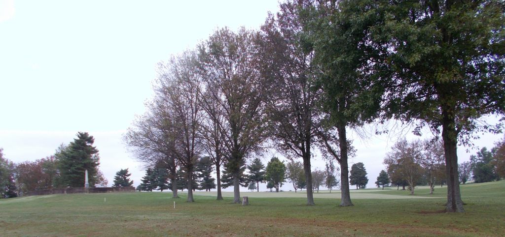
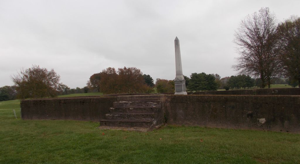
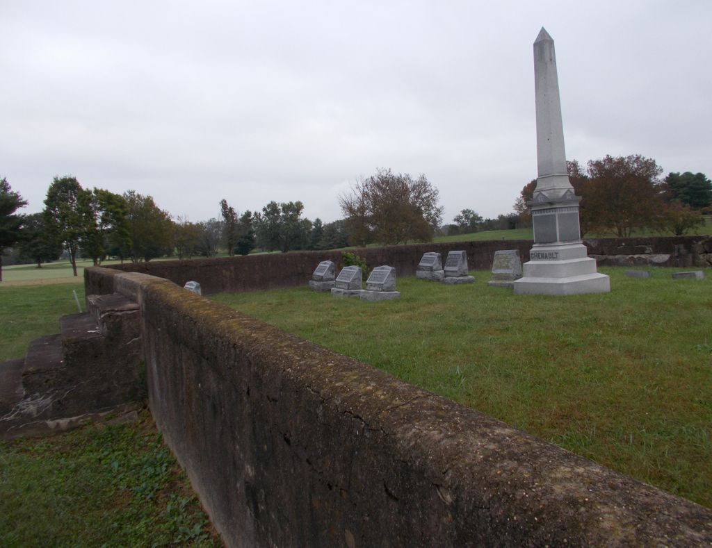
| Description | : | Directions: From KY 686, Mt. Sterling, take US 460 east 0.6 mile. Turn left into the Golf Course drive and follow this 0.5 mile to the Club House. The cemetery is in the field next to parking area. |
frequently asked questions (FAQ):
-
Where is Chenault Cemetery?
Chenault Cemetery is located at Mount Sterling, Montgomery County ,Kentucky ,USA.
-
Chenault Cemetery cemetery's updated grave count on graveviews.com?
0 memorials
-
Where are the coordinates of the Chenault Cemetery?
Latitude: 38.0357450
Longitude: -83.9220540
Nearby Cemetories:
1. Love Cemetery
Montgomery County, USA
Coordinate: 38.0460590, -83.9179920
2. Spratt and Cockrell Family Cemetery
Mount Sterling, Montgomery County, USA
Coordinate: 38.0337100, -83.9377460
3. Magowan Cemetery
Mount Sterling, Montgomery County, USA
Coordinate: 38.0483017, -83.9178009
4. Walker Cemetery
Mount Sterling, Montgomery County, USA
Coordinate: 38.0544870, -83.9321890
5. Machpelah Cemetery
Mount Sterling, Montgomery County, USA
Coordinate: 38.0564003, -83.9310989
6. Estill's Defeat Cemetery
Mount Sterling, Montgomery County, USA
Coordinate: 38.0539120, -83.9376340
7. Orear Cemetery
Montgomery County, USA
Coordinate: 38.0204210, -83.9019290
8. Lockridge Cemetery
Montgomery County, USA
Coordinate: 38.0397220, -83.8933330
9. Lincolnview Cemetery
Mount Sterling, Montgomery County, USA
Coordinate: 38.0583330, -83.9275000
10. Fairview Cemetery
Mount Sterling, Montgomery County, USA
Coordinate: 38.0588989, -83.9272003
11. Olive Hill Cemetery
Mount Sterling, Montgomery County, USA
Coordinate: 38.0593987, -83.9263992
12. Hopwood Cemetery
Montgomery County, USA
Coordinate: 38.0597229, -83.9083328
13. Episcopal Church Cemetery
Mount Sterling, Montgomery County, USA
Coordinate: 38.0566670, -83.9441670
14. Civil War Cemetery
Montgomery County, USA
Coordinate: 38.0561110, -83.9505560
15. Calk Cemetery
Mount Sterling, Montgomery County, USA
Coordinate: 38.0290670, -83.9609640
16. Divine and Ramey Cemetery
Mount Sterling, Montgomery County, USA
Coordinate: 38.0680560, -83.9227780
17. Daniel Cemetery
Mount Sterling, Montgomery County, USA
Coordinate: 38.0666670, -83.9452780
18. Cheatham Cemetery
Montgomery County, USA
Coordinate: 38.0194440, -83.8800000
19. Orear Cemetery
Montgomery County, USA
Coordinate: 38.0238890, -83.9675000
20. Anderson Family Cemetery
Montgomery County, USA
Coordinate: 38.0008330, -83.9455560
21. Saint Thomas Cemetery
Mount Sterling, Montgomery County, USA
Coordinate: 38.0710983, -83.9483032
22. Myers Family Graveyard
Camargo, Montgomery County, USA
Coordinate: 37.9997220, -83.8927780
23. Sappington Cemetery
Camargo, Montgomery County, USA
Coordinate: 37.9925000, -83.9183330
24. Kirkpatrick Cemetery
Camargo, Montgomery County, USA
Coordinate: 38.0141670, -83.8741670