
| Memorials | : | 0 |
| Location | : | Montgomery County, USA |
| Coordinate | : | 38.0597229, -83.9083328 |
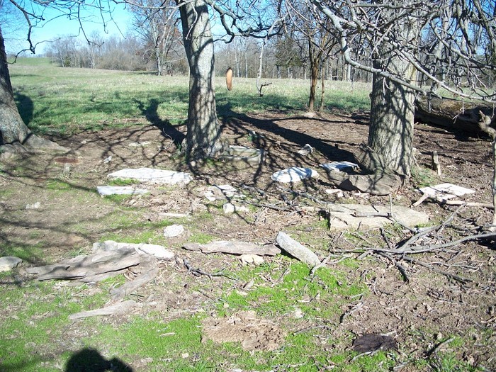
| Description | : | Directions: From the Mt. Sterling By-pass, take KY 713 East 8/10th mile to Osborne Road. Turn left and go 9/10th mile to Bramble Ridge Orchard, which will be on the left. From there, you walk thru the orchard, cross the creek, by the pond and then cross the fence. The cemetery is located in a small group of trees, on the ridge in the grass field. |
frequently asked questions (FAQ):
-
Where is Hopwood Cemetery?
Hopwood Cemetery is located at Montgomery County ,Kentucky ,USA.
-
Hopwood Cemetery cemetery's updated grave count on graveviews.com?
0 memorials
-
Where are the coordinates of the Hopwood Cemetery?
Latitude: 38.0597229
Longitude: -83.9083328
Nearby Cemetories:
1. Magowan Cemetery
Mount Sterling, Montgomery County, USA
Coordinate: 38.0483017, -83.9178009
2. Divine and Ramey Cemetery
Mount Sterling, Montgomery County, USA
Coordinate: 38.0680560, -83.9227780
3. Olive Hill Cemetery
Mount Sterling, Montgomery County, USA
Coordinate: 38.0593987, -83.9263992
4. Fairview Cemetery
Mount Sterling, Montgomery County, USA
Coordinate: 38.0588989, -83.9272003
5. Lincolnview Cemetery
Mount Sterling, Montgomery County, USA
Coordinate: 38.0583330, -83.9275000
6. Love Cemetery
Montgomery County, USA
Coordinate: 38.0460590, -83.9179920
7. Machpelah Cemetery
Mount Sterling, Montgomery County, USA
Coordinate: 38.0564003, -83.9310989
8. Walker Cemetery
Mount Sterling, Montgomery County, USA
Coordinate: 38.0544870, -83.9321890
9. Lockridge Cemetery
Montgomery County, USA
Coordinate: 38.0397220, -83.8933330
10. Estill's Defeat Cemetery
Mount Sterling, Montgomery County, USA
Coordinate: 38.0539120, -83.9376340
11. Chenault Cemetery
Mount Sterling, Montgomery County, USA
Coordinate: 38.0357450, -83.9220540
12. Episcopal Church Cemetery
Mount Sterling, Montgomery County, USA
Coordinate: 38.0566670, -83.9441670
13. Daniel Cemetery
Mount Sterling, Montgomery County, USA
Coordinate: 38.0666670, -83.9452780
14. Civil War Cemetery
Montgomery County, USA
Coordinate: 38.0561110, -83.9505560
15. Saint Thomas Cemetery
Mount Sterling, Montgomery County, USA
Coordinate: 38.0710983, -83.9483032
16. Spratt and Cockrell Family Cemetery
Mount Sterling, Montgomery County, USA
Coordinate: 38.0337100, -83.9377460
17. Jones Cemetery
Montgomery County, USA
Coordinate: 38.0891991, -83.8822021
18. Oldham Cemetery
Mount Sterling, Montgomery County, USA
Coordinate: 38.0838890, -83.8686110
19. Orear Cemetery
Montgomery County, USA
Coordinate: 38.0204210, -83.9019290
20. Plick Cemetery
Montgomery County, USA
Coordinate: 38.0550000, -83.8569440
21. Cheatham Cemetery
Montgomery County, USA
Coordinate: 38.0194440, -83.8800000
22. Calk Cemetery
Mount Sterling, Montgomery County, USA
Coordinate: 38.0290670, -83.9609640
23. Kirkpatrick Cemetery
Camargo, Montgomery County, USA
Coordinate: 38.0141670, -83.8741670
24. Ferguson Cemetery
Grassy Lick, Montgomery County, USA
Coordinate: 38.0680560, -83.9750000