
| Memorials | : | 0 |
| Location | : | Cherry Log, Gilmer County, USA |
| Coordinate | : | 34.8156440, -84.3640240 |
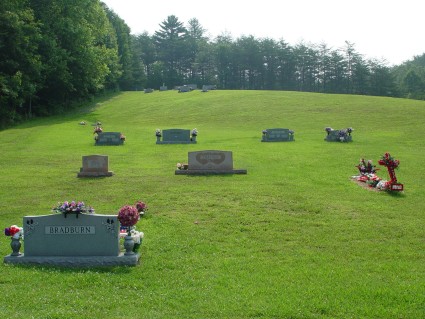
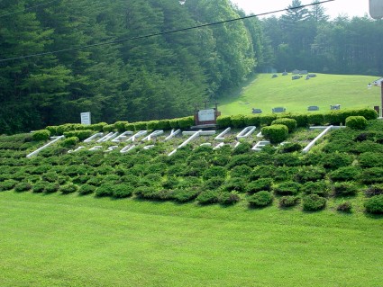
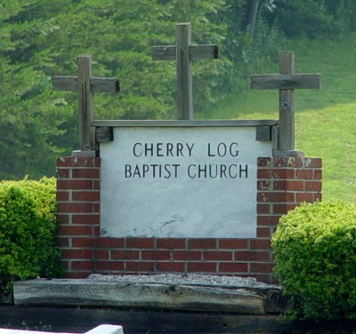
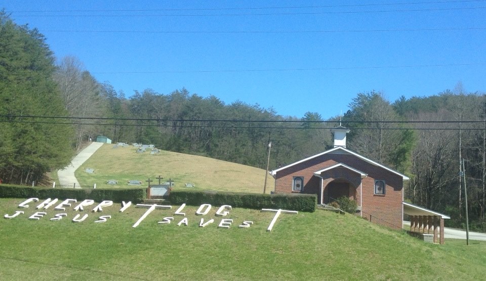
| Description | : | Cherry Log Baptist Church is located eleven miles north of Ellijay, on the right side of Highway 515, just south of the Gilmer-Fannin County line. This listing is only for the cemetery located adjacent to the church. The earliest burial in this cemetery was in 1977. The original cemetery for this church has burials dating back to the 1860s, and is listed separately as the Cherry Log Baptist Church Old Cemetery. It is located on a tree-covered hillside on the opposite side of Hwy 515 and is not visible from the church. To get to the old cemetery... Read More |
frequently asked questions (FAQ):
-
Where is Cherry Log Baptist Church Cemetery?
Cherry Log Baptist Church Cemetery is located at Cherry Log, Gilmer County ,Georgia ,USA.
-
Cherry Log Baptist Church Cemetery cemetery's updated grave count on graveviews.com?
0 memorials
-
Where are the coordinates of the Cherry Log Baptist Church Cemetery?
Latitude: 34.8156440
Longitude: -84.3640240
Nearby Cemetories:
1. Cherry Log Baptist Church Old Cemetery
Cherry Log, Gilmer County, USA
Coordinate: 34.8147415, -84.3675650
2. Sisson Cemetery
Cherry Log, Gilmer County, USA
Coordinate: 34.8271590, -84.3768400
3. Cherry Hill Cemetery
Cherry Log, Gilmer County, USA
Coordinate: 34.7901000, -84.3842000
4. Underwood Cemetery
Gilmer County, USA
Coordinate: 34.7891890, -84.3848250
5. Golden Cemetery
Fannin County, USA
Coordinate: 34.8442001, -84.3842010
6. Holloway Family Cemetery
Gilmer County, USA
Coordinate: 34.8208600, -84.4063100
7. Boardtown Church of Christ Cemetery
Gilmer County, USA
Coordinate: 34.8213997, -84.4064026
8. Blue Ridge Church of Christ Cemetery
Blue Ridge, Fannin County, USA
Coordinate: 34.8453180, -84.3354050
9. Chapman Cemetery
Gilmer County, USA
Coordinate: 34.8161011, -84.4152985
10. Sharp Cemetery
Gilmer County, USA
Coordinate: 34.7869300, -84.4019900
11. Rock Creek Baptist Church Cemetery
Cherry Log, Gilmer County, USA
Coordinate: 34.7777220, -84.3896390
12. Rogers Family Cemetery
Cherry Log, Gilmer County, USA
Coordinate: 34.7811800, -84.3976480
13. Sunrise Tabernacle Cemetery
Fannin County, USA
Coordinate: 34.8622600, -84.3461200
14. New Antioch Baptist Church Cemetery
Fannin County, USA
Coordinate: 34.8295590, -84.3069240
15. Mount Pleasant Baptist Church Cemetery #1
Gilmer County, USA
Coordinate: 34.8013230, -84.4245730
16. Macedonia Church of Christ Cemetery
Blue Ridge, Fannin County, USA
Coordinate: 34.8651500, -84.3861150
17. Padgett's Chapel Cemetery
Blue Ridge, Fannin County, USA
Coordinate: 34.8637380, -84.3305030
18. O Zion Baptist Church Cemetery
Blue Ridge, Fannin County, USA
Coordinate: 34.8314880, -84.2992400
19. Saint Anthony's Church Cemetery
Blue Ridge, Fannin County, USA
Coordinate: 34.8621530, -84.3266590
20. McKinney Cemetery
Fannin County, USA
Coordinate: 34.8616223, -84.3243939
21. Gartrell Family Cemetery
Blue Ridge, Fannin County, USA
Coordinate: 34.8615870, -84.3242930
22. Crawford Cemetery
Blue Ridge, Fannin County, USA
Coordinate: 34.8619890, -84.3246460
23. Saint Lukes Episcopal Church Cemetery
Blue Ridge, Fannin County, USA
Coordinate: 34.8628400, -84.3201200
24. Whitaker Cemetery
Cherry Log, Gilmer County, USA
Coordinate: 34.7672220, -84.4134720