
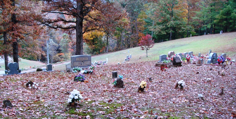
| Memorials | : | 1 |
| Location | : | Gilmer County, USA |
| Coordinate | : | 34.8213997, -84.4064026 |
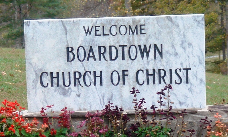
| Description | : | Directions: From the roundabout in center of Ellijay, turn right (north) onto N. Dalton Street (signs also say "Hwy 52" (west). Go approximately one-half mile, where Hwy 52 makes a sharp turn to the west (left). Don't make that sharp turn ... continue north almost straight ahead onto Boardtown Road. Travel 10.3 miles on Boardtown Road; turn right onto Lucius Road; church is .2 mile on right; cemetery on opposite side of road. Alternate route: From Ellijay, take Hwy 515 north approx 10 miles to Cherry Log. Turn left onto Lucius Road; travel approx. 2 miles; church will be on the left,... Read More |
frequently asked questions (FAQ):
-
Where is Boardtown Church of Christ Cemetery?
Boardtown Church of Christ Cemetery is located at 2583 Lucius Road Gilmer County ,Georgia ,USA.
-
Boardtown Church of Christ Cemetery cemetery's updated grave count on graveviews.com?
1 memorials
-
Where are the coordinates of the Boardtown Church of Christ Cemetery?
Latitude: 34.8213997
Longitude: -84.4064026
Nearby Cemetories:
1. Holloway Family Cemetery
Gilmer County, USA
Coordinate: 34.8208600, -84.4063100
2. Chapman Cemetery
Gilmer County, USA
Coordinate: 34.8161011, -84.4152985
3. Sisson Cemetery
Cherry Log, Gilmer County, USA
Coordinate: 34.8271590, -84.3768400
4. Mount Pleasant Baptist Church Cemetery #1
Gilmer County, USA
Coordinate: 34.8013230, -84.4245730
5. Golden Cemetery
Fannin County, USA
Coordinate: 34.8442001, -84.3842010
6. Cherry Log Baptist Church Old Cemetery
Cherry Log, Gilmer County, USA
Coordinate: 34.8147415, -84.3675650
7. Sharp Cemetery
Gilmer County, USA
Coordinate: 34.7869300, -84.4019900
8. Cherry Log Baptist Church Cemetery
Cherry Log, Gilmer County, USA
Coordinate: 34.8156440, -84.3640240
9. Cherry Hill Cemetery
Cherry Log, Gilmer County, USA
Coordinate: 34.7901000, -84.3842000
10. Underwood Cemetery
Gilmer County, USA
Coordinate: 34.7891890, -84.3848250
11. Rogers Family Cemetery
Cherry Log, Gilmer County, USA
Coordinate: 34.7811800, -84.3976480
12. Rock Creek Baptist Church Cemetery
Cherry Log, Gilmer County, USA
Coordinate: 34.7777220, -84.3896390
13. Macedonia Church of Christ Cemetery
Blue Ridge, Fannin County, USA
Coordinate: 34.8651500, -84.3861150
14. Johnson Family Cemetery
Gilmer County, USA
Coordinate: 34.8335880, -84.4629230
15. Cashes Valley Church of Christ Cemetery
Gilmer County, USA
Coordinate: 34.8361015, -84.4700012
16. Whitaker Cemetery
Cherry Log, Gilmer County, USA
Coordinate: 34.7672220, -84.4134720
17. Jones Cemetery
Ellijay, Gilmer County, USA
Coordinate: 34.7743988, -84.4443970
18. Blue Ridge Church of Christ Cemetery
Blue Ridge, Fannin County, USA
Coordinate: 34.8453180, -84.3354050
19. Sunrise Tabernacle Cemetery
Fannin County, USA
Coordinate: 34.8622600, -84.3461200
20. Salem Baptist Church Cemetery
Ellijay, Gilmer County, USA
Coordinate: 34.7642479, -84.4466705
21. Sugar Creek Baptist Church Cemetery
Blue Ridge, Fannin County, USA
Coordinate: 34.8790400, -84.3598080
22. Mount Moriah Church Cemetery
Fannin County, USA
Coordinate: 34.8920000, -84.4260000
23. New Vision Church
Blue Ridge, Fannin County, USA
Coordinate: 34.8932950, -84.4228980
24. Padgett's Chapel Cemetery
Blue Ridge, Fannin County, USA
Coordinate: 34.8637380, -84.3305030