
| Memorials | : | 0 |
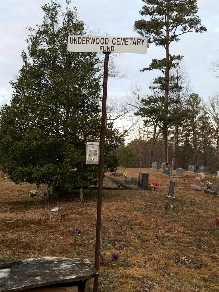
| Location | : | Gilmer County, USA |
| Coordinate | : | 34.7891890, -84.3848250 |
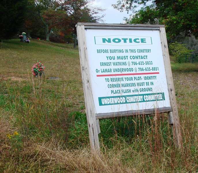
| Description | : | Directions: From Ellijay, travel north on Hwy 515 approximately nine miles to Cherry Log; exit to the right reads "Old S. R. 5". This "exit" road is very short and dead-ends into a portion of Old State Road 5 which has been re-named as "Cherry Log Street." Turn left; immediately turn left again, and up the hill to the cemetery. This cemetery is on private property, owned by the family of John H. & Hannah Watkins Underwood for approximately 120 years. However, there are even older still-legible tombstones, indicating the cemetery was originally established when the property... Read More |
frequently asked questions (FAQ):
-
Where is Underwood Cemetery?
Underwood Cemetery is located at Cherry Log Gilmer County ,Georgia ,USA.
-
Underwood Cemetery cemetery's updated grave count on graveviews.com?
0 memorials
-
Where are the coordinates of the Underwood Cemetery?
Latitude: 34.7891890
Longitude: -84.3848250
Nearby Cemetories:
1. Cherry Hill Cemetery
Cherry Log, Gilmer County, USA
Coordinate: 34.7901000, -84.3842000
2. Rock Creek Baptist Church Cemetery
Cherry Log, Gilmer County, USA
Coordinate: 34.7777220, -84.3896390
3. Rogers Family Cemetery
Cherry Log, Gilmer County, USA
Coordinate: 34.7811800, -84.3976480
4. Sharp Cemetery
Gilmer County, USA
Coordinate: 34.7869300, -84.4019900
5. Cherry Log Baptist Church Old Cemetery
Cherry Log, Gilmer County, USA
Coordinate: 34.8147415, -84.3675650
6. Cherry Log Baptist Church Cemetery
Cherry Log, Gilmer County, USA
Coordinate: 34.8156440, -84.3640240
7. Whitaker Cemetery
Cherry Log, Gilmer County, USA
Coordinate: 34.7672220, -84.4134720
8. Mount Pleasant Baptist Church Cemetery #1
Gilmer County, USA
Coordinate: 34.8013230, -84.4245730
9. Holloway Family Cemetery
Gilmer County, USA
Coordinate: 34.8208600, -84.4063100
10. Chapman Cemetery
Gilmer County, USA
Coordinate: 34.8161011, -84.4152985
11. Boardtown Church of Christ Cemetery
Gilmer County, USA
Coordinate: 34.8213997, -84.4064026
12. Sisson Cemetery
Cherry Log, Gilmer County, USA
Coordinate: 34.8271590, -84.3768400
13. Jones Cemetery
Ellijay, Gilmer County, USA
Coordinate: 34.7743988, -84.4443970
14. Golden Cemetery
Fannin County, USA
Coordinate: 34.8442001, -84.3842010
15. Salem Baptist Church Cemetery
Ellijay, Gilmer County, USA
Coordinate: 34.7642479, -84.4466705
16. Lanning Family Cemetery
East Ellijay, Gilmer County, USA
Coordinate: 34.7229940, -84.3782870
17. Blue Ridge Church of Christ Cemetery
Blue Ridge, Fannin County, USA
Coordinate: 34.8453180, -84.3354050
18. Northcutt Cemetery
Ellijay, Gilmer County, USA
Coordinate: 34.7298730, -84.4368060
19. New Antioch Baptist Church Cemetery
Fannin County, USA
Coordinate: 34.8295590, -84.3069240
20. Macedonia Church of Christ Cemetery
Blue Ridge, Fannin County, USA
Coordinate: 34.8651500, -84.3861150
21. Johnson Family Cemetery
Gilmer County, USA
Coordinate: 34.8335880, -84.4629230
22. Sunrise Tabernacle Cemetery
Fannin County, USA
Coordinate: 34.8622600, -84.3461200
23. O Zion Baptist Church Cemetery
Blue Ridge, Fannin County, USA
Coordinate: 34.8314880, -84.2992400
24. Cashes Valley Church of Christ Cemetery
Gilmer County, USA
Coordinate: 34.8361015, -84.4700012