
| Memorials | : | 0 |
| Location | : | Gilmer County, USA |
| Coordinate | : | 34.8013230, -84.4245730 |
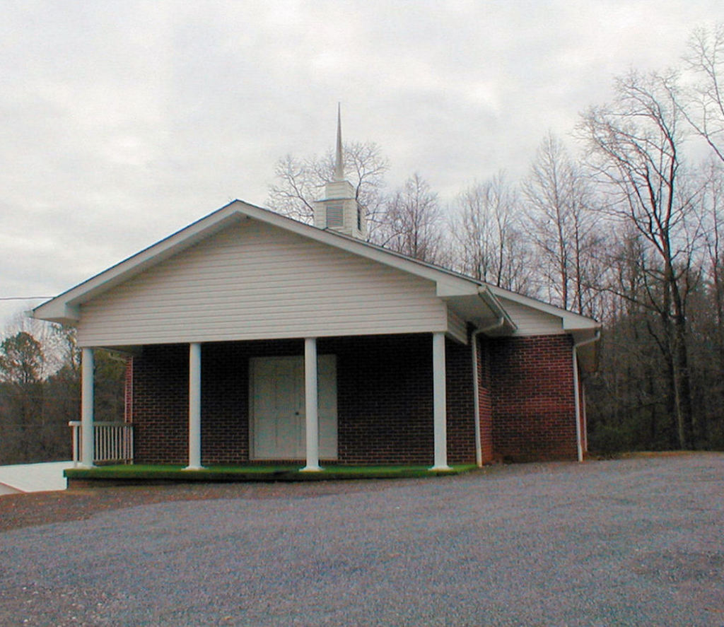
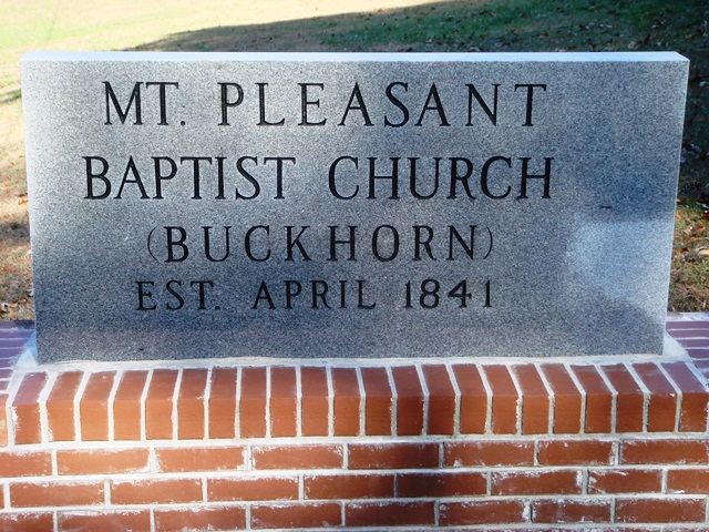
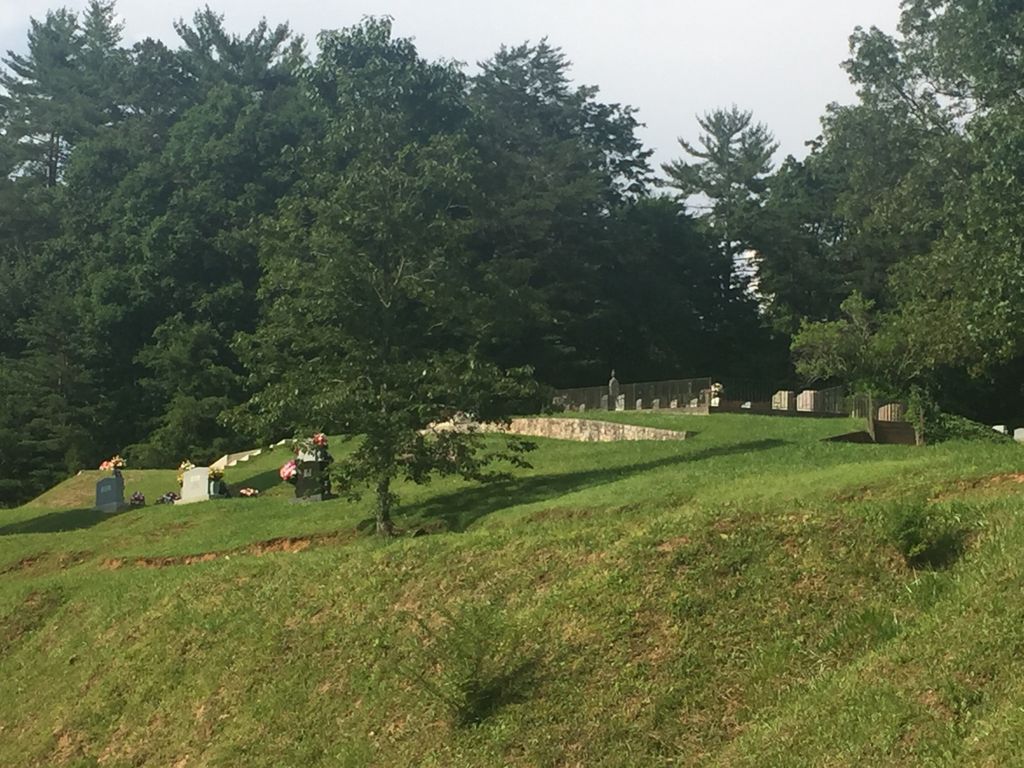
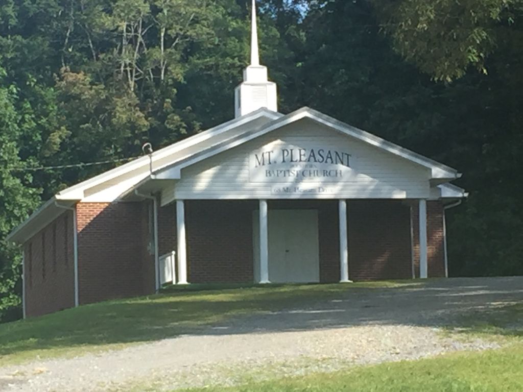
| Description | : | Directions: From the roundabout in center of Ellijay, turn right (north) onto N. Dalton Street (signs also say "Hwy 52" (west). Go approximately one-half mile, where Hwy 52 makes a sharp turn to the west (left). Don't make that sharp turn ... continue north almost straight ahead onto Boardtown Road. Travel 8.3 miles on Boardtown Road. Turn right onto Mt. Pleasant Baptist Church Road. Cemetery is on a hill to the left of the church. |
frequently asked questions (FAQ):
-
Where is Mount Pleasant Baptist Church Cemetery #1?
Mount Pleasant Baptist Church Cemetery #1 is located at Gilmer County ,Georgia ,USA.
-
Mount Pleasant Baptist Church Cemetery #1 cemetery's updated grave count on graveviews.com?
0 memorials
-
Where are the coordinates of the Mount Pleasant Baptist Church Cemetery #1?
Latitude: 34.8013230
Longitude: -84.4245730
Nearby Cemetories:
1. Chapman Cemetery
Gilmer County, USA
Coordinate: 34.8161011, -84.4152985
2. Sharp Cemetery
Gilmer County, USA
Coordinate: 34.7869300, -84.4019900
3. Holloway Family Cemetery
Gilmer County, USA
Coordinate: 34.8208600, -84.4063100
4. Boardtown Church of Christ Cemetery
Gilmer County, USA
Coordinate: 34.8213997, -84.4064026
5. Rogers Family Cemetery
Cherry Log, Gilmer County, USA
Coordinate: 34.7811800, -84.3976480
6. Jones Cemetery
Ellijay, Gilmer County, USA
Coordinate: 34.7743988, -84.4443970
7. Underwood Cemetery
Gilmer County, USA
Coordinate: 34.7891890, -84.3848250
8. Cherry Hill Cemetery
Cherry Log, Gilmer County, USA
Coordinate: 34.7901000, -84.3842000
9. Whitaker Cemetery
Cherry Log, Gilmer County, USA
Coordinate: 34.7672220, -84.4134720
10. Rock Creek Baptist Church Cemetery
Cherry Log, Gilmer County, USA
Coordinate: 34.7777220, -84.3896390
11. Salem Baptist Church Cemetery
Ellijay, Gilmer County, USA
Coordinate: 34.7642479, -84.4466705
12. Johnson Family Cemetery
Gilmer County, USA
Coordinate: 34.8335880, -84.4629230
13. Sisson Cemetery
Cherry Log, Gilmer County, USA
Coordinate: 34.8271590, -84.3768400
14. Cherry Log Baptist Church Old Cemetery
Cherry Log, Gilmer County, USA
Coordinate: 34.8147415, -84.3675650
15. Cashes Valley Church of Christ Cemetery
Gilmer County, USA
Coordinate: 34.8361015, -84.4700012
16. Cherry Log Baptist Church Cemetery
Cherry Log, Gilmer County, USA
Coordinate: 34.8156440, -84.3640240
17. Golden Cemetery
Fannin County, USA
Coordinate: 34.8442001, -84.3842010
18. Flat Branch Baptist Church Cemetery
Flat Branch, Gilmer County, USA
Coordinate: 34.7724460, -84.4893530
19. Macedonia Church of Christ Cemetery
Blue Ridge, Fannin County, USA
Coordinate: 34.8651500, -84.3861150
20. Northcutt Cemetery
Ellijay, Gilmer County, USA
Coordinate: 34.7298730, -84.4368060
21. Kell Family Cemetery
Ellijay, Gilmer County, USA
Coordinate: 34.7277050, -84.4720750
22. Zion Hill Baptist Church Cemetery
Ellijay, Gilmer County, USA
Coordinate: 34.7864700, -84.5256030
23. Blue Ridge Church of Christ Cemetery
Blue Ridge, Fannin County, USA
Coordinate: 34.8453180, -84.3354050
24. Lanning Family Cemetery
East Ellijay, Gilmer County, USA
Coordinate: 34.7229940, -84.3782870