
| Memorials | : | 0 |
| Location | : | Cherry Log, Gilmer County, USA |
| Coordinate | : | 34.8147415, -84.3675650 |
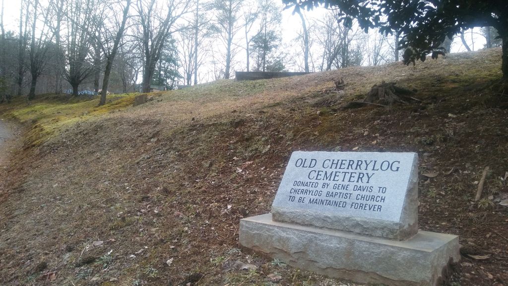
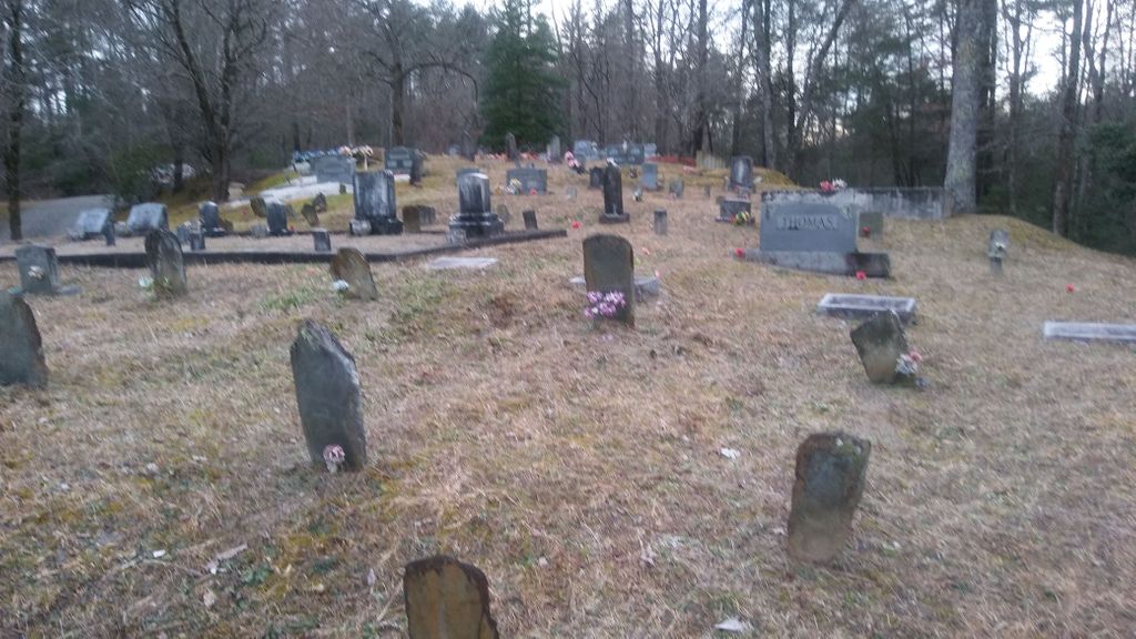
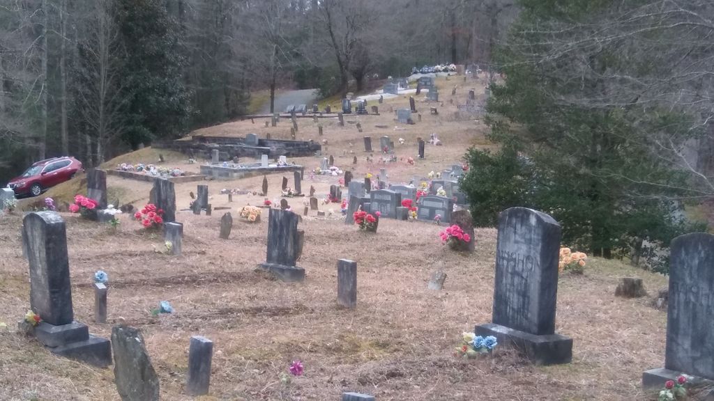
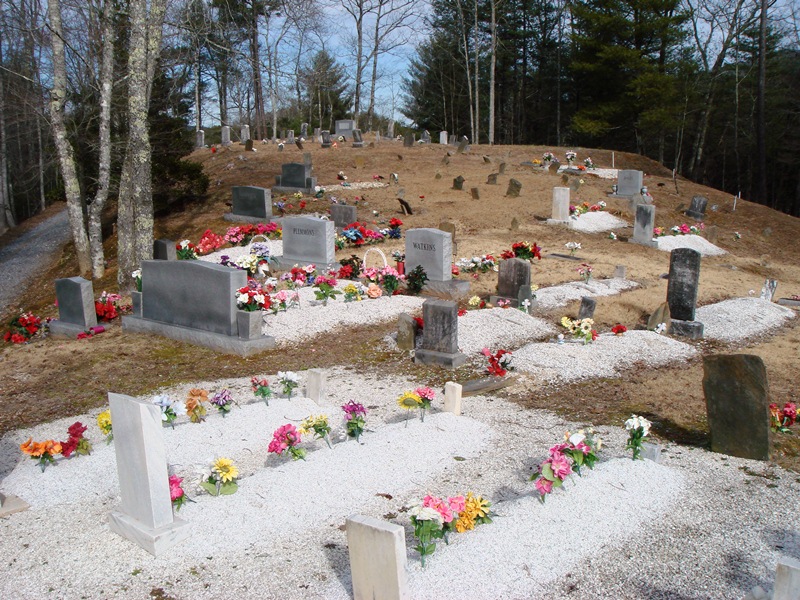
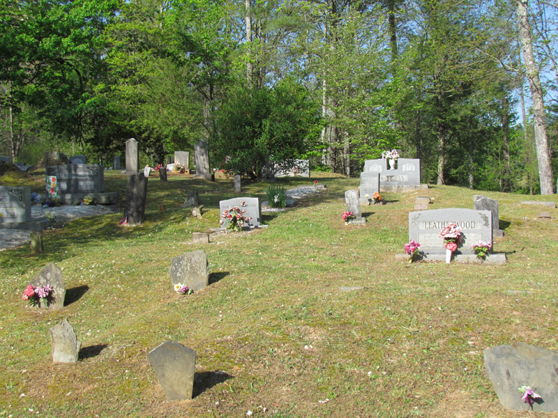
| Description | : | Cherry Log Baptist Church is located 11.3 miles north of the intersection of Georgia State Route 515 and U.S. 76 in East Ellijay. It is located on the right side of Highway 515, at Laurel Ridge Drive. Cherry Log Baptist Church has a newer cemetery behind the church. The old cemetery is across the highway and not visible from the church... The Old Cherry Log Cemetery, also known as The Upper Cherry Log Cemetery, and Cherry Log Baptist Church Old Cemetery, is located across SR 515 from the church. From the Laurel Ridge Drive intersection, cross over to... Read More |
frequently asked questions (FAQ):
-
Where is Cherry Log Baptist Church Old Cemetery?
Cherry Log Baptist Church Old Cemetery is located at Cherry Log, Gilmer County ,Georgia ,USA.
-
Cherry Log Baptist Church Old Cemetery cemetery's updated grave count on graveviews.com?
0 memorials
-
Where are the coordinates of the Cherry Log Baptist Church Old Cemetery?
Latitude: 34.8147415
Longitude: -84.3675650
Nearby Cemetories:
1. Cherry Log Baptist Church Cemetery
Cherry Log, Gilmer County, USA
Coordinate: 34.8156440, -84.3640240
2. Sisson Cemetery
Cherry Log, Gilmer County, USA
Coordinate: 34.8271590, -84.3768400
3. Cherry Hill Cemetery
Cherry Log, Gilmer County, USA
Coordinate: 34.7901000, -84.3842000
4. Underwood Cemetery
Gilmer County, USA
Coordinate: 34.7891890, -84.3848250
5. Holloway Family Cemetery
Gilmer County, USA
Coordinate: 34.8208600, -84.4063100
6. Golden Cemetery
Fannin County, USA
Coordinate: 34.8442001, -84.3842010
7. Boardtown Church of Christ Cemetery
Gilmer County, USA
Coordinate: 34.8213997, -84.4064026
8. Chapman Cemetery
Gilmer County, USA
Coordinate: 34.8161011, -84.4152985
9. Sharp Cemetery
Gilmer County, USA
Coordinate: 34.7869300, -84.4019900
10. Blue Ridge Church of Christ Cemetery
Blue Ridge, Fannin County, USA
Coordinate: 34.8453180, -84.3354050
11. Rock Creek Baptist Church Cemetery
Cherry Log, Gilmer County, USA
Coordinate: 34.7777220, -84.3896390
12. Rogers Family Cemetery
Cherry Log, Gilmer County, USA
Coordinate: 34.7811800, -84.3976480
13. Mount Pleasant Baptist Church Cemetery #1
Gilmer County, USA
Coordinate: 34.8013230, -84.4245730
14. Sunrise Tabernacle Cemetery
Fannin County, USA
Coordinate: 34.8622600, -84.3461200
15. New Antioch Baptist Church Cemetery
Fannin County, USA
Coordinate: 34.8295590, -84.3069240
16. Macedonia Church of Christ Cemetery
Blue Ridge, Fannin County, USA
Coordinate: 34.8651500, -84.3861150
17. Padgett's Chapel Cemetery
Blue Ridge, Fannin County, USA
Coordinate: 34.8637380, -84.3305030
18. Saint Anthony's Church Cemetery
Blue Ridge, Fannin County, USA
Coordinate: 34.8621530, -84.3266590
19. O Zion Baptist Church Cemetery
Blue Ridge, Fannin County, USA
Coordinate: 34.8314880, -84.2992400
20. McKinney Cemetery
Fannin County, USA
Coordinate: 34.8616223, -84.3243939
21. Gartrell Family Cemetery
Blue Ridge, Fannin County, USA
Coordinate: 34.8615870, -84.3242930
22. Crawford Cemetery
Blue Ridge, Fannin County, USA
Coordinate: 34.8619890, -84.3246460
23. Whitaker Cemetery
Cherry Log, Gilmer County, USA
Coordinate: 34.7672220, -84.4134720
24. Saint Lukes Episcopal Church Cemetery
Blue Ridge, Fannin County, USA
Coordinate: 34.8628400, -84.3201200