| Memorials | : | 0 |
| Location | : | Redhill, North Somerset Unitary Authority, England |
| Coordinate | : | 51.3657790, -2.7245240 |
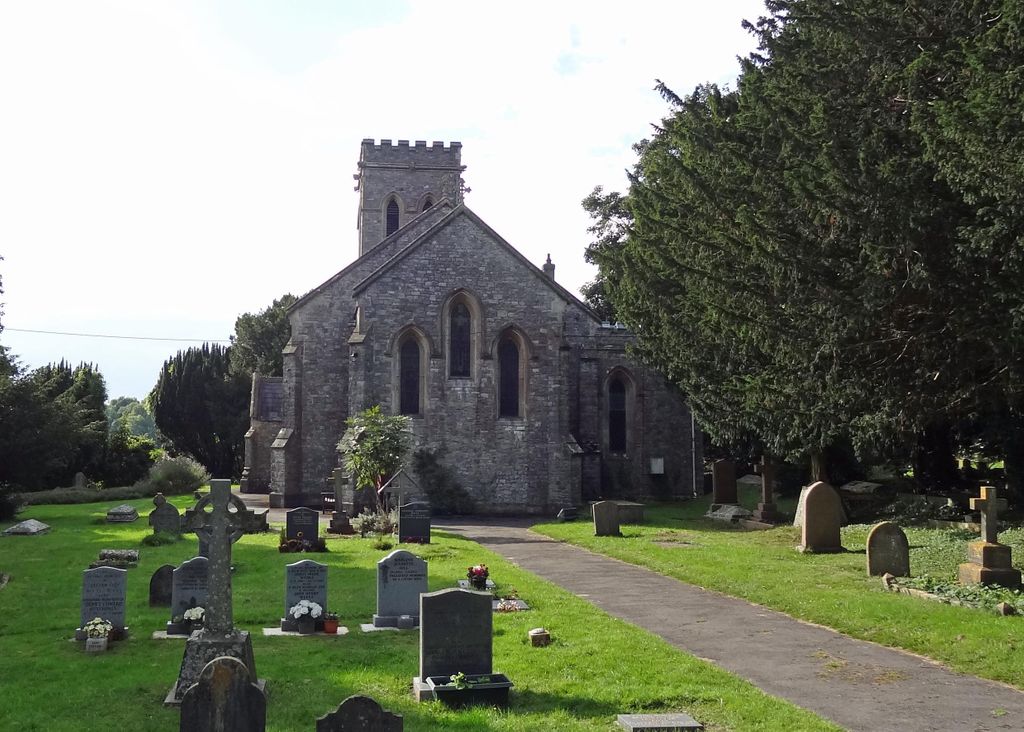
| Description | : | Before Christ Church was built in Redhill, worshippers had to go down to All Saints Church in Wrington, while from 1715 non-conformists used their own building. Christ Church, Redhill's chapel of ease was first erected in 1843 and consecrated in the following year by the Bishop of Salisbury. Built by James Wilson it is of Lancet style, with a west tower, a nave without aisles and a short chancel. The local inhabitants met its cost, with the Rector John Vane contributing the entire cost of the chancel, porch and tower. It has been designated by English Heritage as a Grade II... Read More |
frequently asked questions (FAQ):
-
Where is Christ Church Churchyard?
Christ Church Churchyard is located at Redhill, North Somerset Unitary Authority ,Somerset ,England.
-
Christ Church Churchyard cemetery's updated grave count on graveviews.com?
0 memorials
-
Where are the coordinates of the Christ Church Churchyard?
Latitude: 51.3657790
Longitude: -2.7245240
Nearby Cemetories:
1. St. Michael and All Angels Churchyard
Butcombe, North Somerset Unitary Authority, England
Coordinate: 51.3538470, -2.6973670
2. Wrington Chapel
Wrington, North Somerset Unitary Authority, England
Coordinate: 51.3651900, -2.7638270
3. All Saints Churchyard
Wrington, North Somerset Unitary Authority, England
Coordinate: 51.3610710, -2.7657110
4. St Katharine and The Noble Army Churchyard
Felton, North Somerset Unitary Authority, England
Coordinate: 51.3876440, -2.6979950
5. Langford Chapelyard
Lower Langford, North Somerset Unitary Authority, England
Coordinate: 51.3434850, -2.7715630
6. Holy Trinity Churchyard
Burrington, North Somerset Unitary Authority, England
Coordinate: 51.3307830, -2.7496010
7. St Andrew Churchyard
Blagdon, North Somerset Unitary Authority, England
Coordinate: 51.3275610, -2.7127710
8. Blessed Virgin Mary Churchyard
Nempnett Thrubwell, Bath and North East Somerset Unitary Authority, England
Coordinate: 51.3407790, -2.6721100
9. The Blessed Virgin Mary Churchyard
Nempnett Thrubwell, Bath and North East Somerset Unitary Authority, England
Coordinate: 51.3407560, -2.6720673
10. Holy Trinity Churchyard
Cleeve, North Somerset Unitary Authority, England
Coordinate: 51.3908200, -2.7773600
11. St. Nicholas' Churchyard
Brockley, North Somerset Unitary Authority, England
Coordinate: 51.3988950, -2.7686830
12. St Mary's Church
Lower Langford, North Somerset Unitary Authority, England
Coordinate: 51.3399805, -2.7813469
13. Church of St. Mary and St. Peter
Winford, North Somerset Unitary Authority, England
Coordinate: 51.3820870, -2.6580510
14. St. Andrew's Churchyard
Backwell, North Somerset Unitary Authority, England
Coordinate: 51.4118600, -2.7297400
15. Ss Mary and Edward Churchyard
Barrow Gurney, North Somerset Unitary Authority, England
Coordinate: 51.4130630, -2.6989510
16. St. Bartholomew Churchyard
Ubley, Bath and North East Somerset Unitary Authority, England
Coordinate: 51.3214600, -2.6766900
17. Saint Bridget's Churchyard
Chelvey, North Somerset Unitary Authority, England
Coordinate: 51.4117570, -2.7689680
18. St Andrew Churchyard
Congresbury, North Somerset Unitary Authority, England
Coordinate: 51.3701100, -2.8121320
19. St. Andrew's Churchyard
Chew Stoke, Bath and North East Somerset Unitary Authority, England
Coordinate: 51.3548580, -2.6379190
20. St Michael & All Angels
Flax Bourton, North Somerset Unitary Authority, England
Coordinate: 51.4212620, -2.7109840
21. Methodist Church Burial Ground
Churchill, North Somerset Unitary Authority, England
Coordinate: 51.3344140, -2.8000610
22. Chew Stoke Methodist Churchyard
Chew Stoke, Bath and North East Somerset Unitary Authority, England
Coordinate: 51.3518196, -2.6332706
23. St Michael and All Angels
Rowberrow, North Somerset Unitary Authority, England
Coordinate: 51.3240000, -2.7915000
24. Saint John the Baptist Churchyard
Churchill, North Somerset Unitary Authority, England
Coordinate: 51.3384750, -2.8092710


