
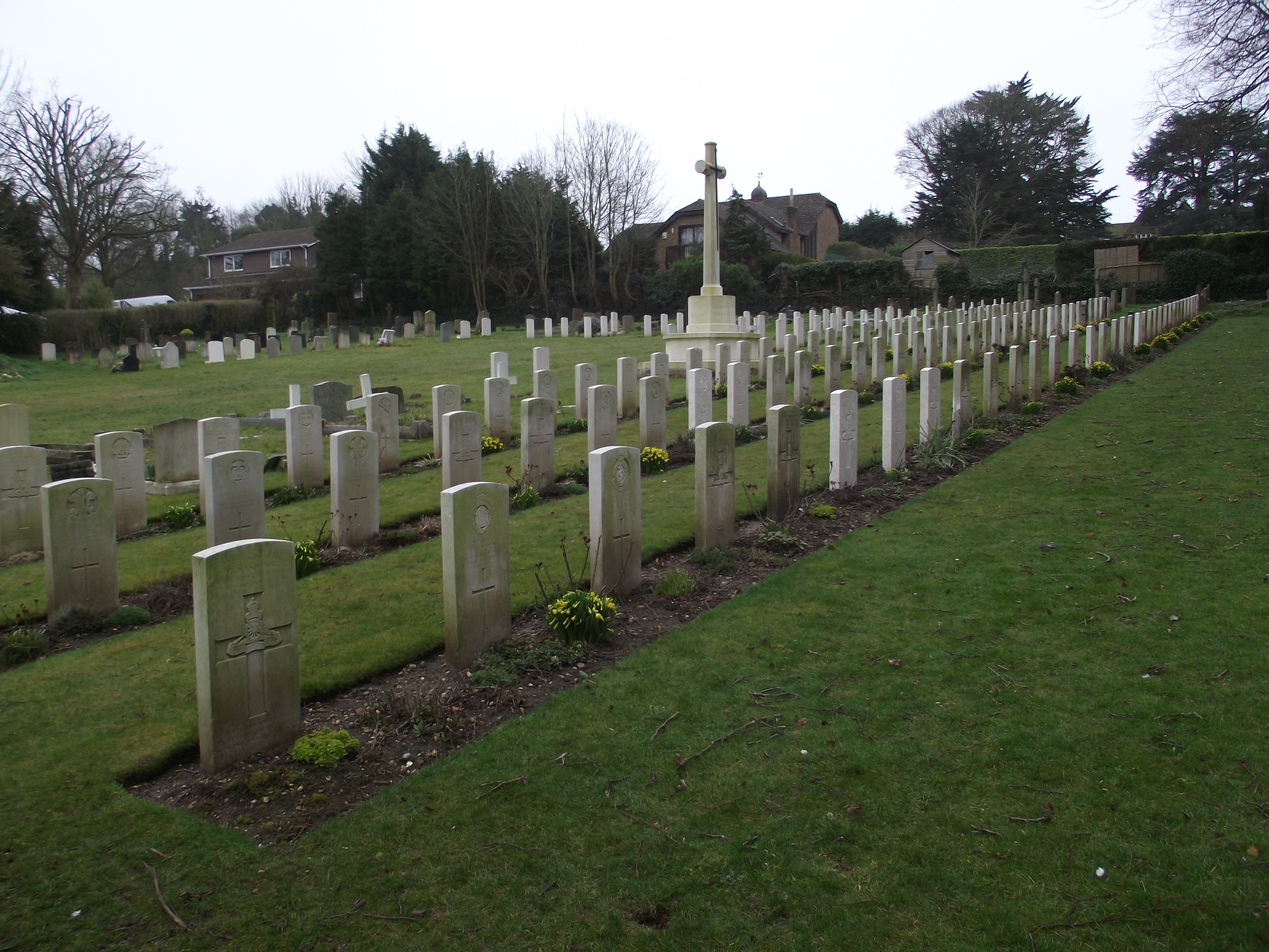
| Memorials | : | 102 |
| Location | : | Widley, City of Winchester, England |
| Coordinate | : | 50.8547300, -1.0507540 |
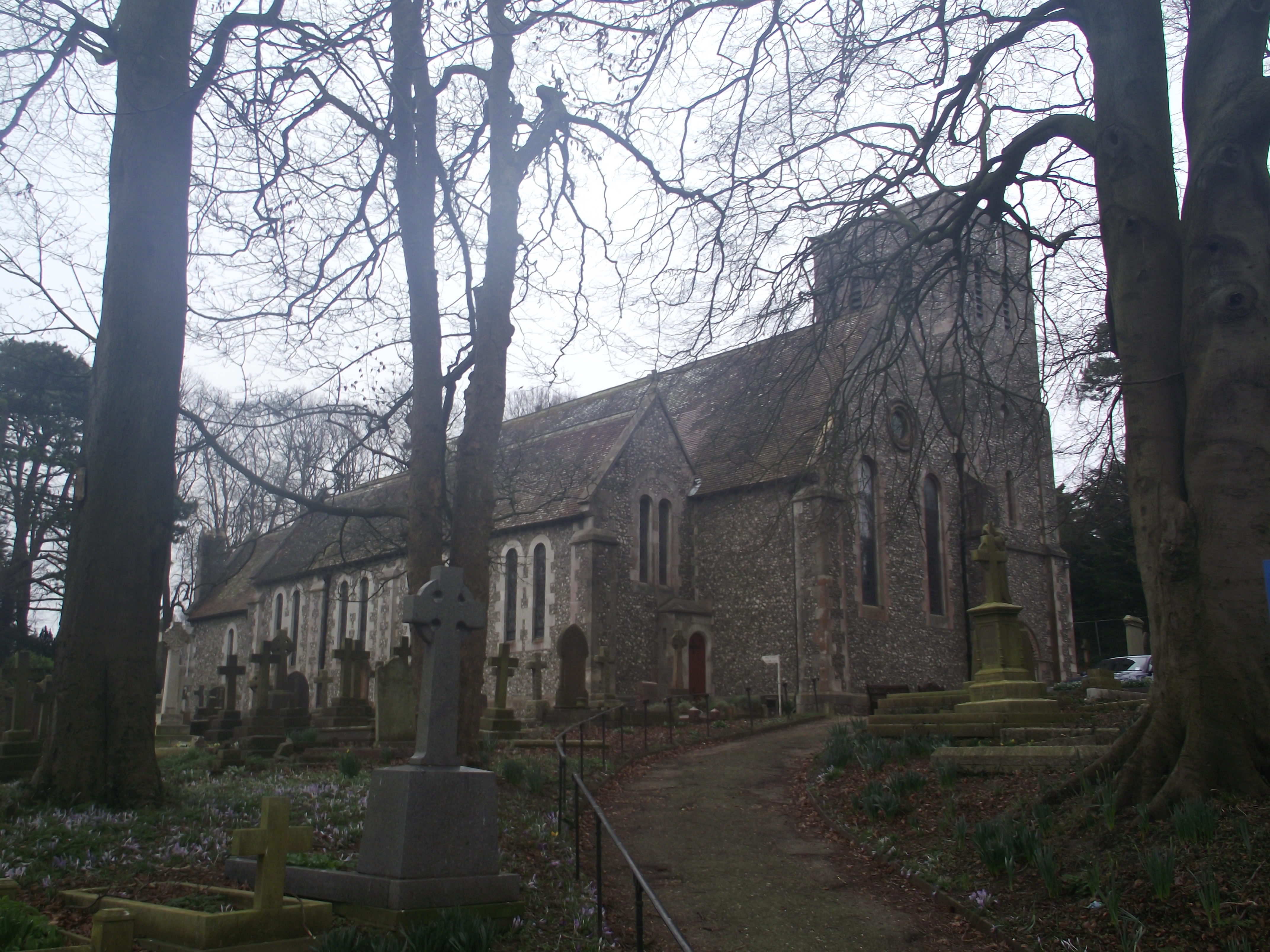
| Description | : | This Anglican church has been serving the Widley, Purbrook and Cosham area for over 130 years. The church has many historic military links, including a military cemetery within the churchyard. |
frequently asked questions (FAQ):
-
Where is Christ Church Portsdown Churchyard?
Christ Church Portsdown Churchyard is located at Widley, City of Winchester ,Hampshire ,England.
-
Christ Church Portsdown Churchyard cemetery's updated grave count on graveviews.com?
0 memorials
-
Where are the coordinates of the Christ Church Portsdown Churchyard?
Latitude: 50.8547300
Longitude: -1.0507540

Nearby Cemetories:
1. St Mary Magdalene Churchyard
Widley, City of Winchester, England
Coordinate: 50.8623650, -1.0642640
2. St John the Baptist Churchyard
Purbrook, Havant Borough, England
Coordinate: 50.8678210, -1.0447060
3. St. Andrew's Churchyard
Farlington, Portsmouth Unitary Authority, England
Coordinate: 50.8477200, -1.0274510
4. St Peter and St Paul Churchyard
Wymering, Portsmouth Unitary Authority, England
Coordinate: 50.8457490, -1.0777170
5. St. George the Martyr Churchyard
Waterlooville, Havant Borough, England
Coordinate: 50.8804060, -1.0328690
6. St. Thomas Churchyard
Bedhampton, Havant Borough, England
Coordinate: 50.8529400, -1.0032960
7. Waterlooville Cemetery
Waterlooville, Havant Borough, England
Coordinate: 50.8802800, -1.0246400
8. St. James' Churchyard
Southwick, City of Winchester, England
Coordinate: 50.8739800, -1.1113800
9. St. Mary's Churchyard
Portchester, Fareham Borough, England
Coordinate: 50.8366280, -1.1134270
10. St. Faith's Churchyard
Havant, Havant Borough, England
Coordinate: 50.8513550, -0.9819910
11. Roman Grove Cemetery
Portchester, Fareham Borough, England
Coordinate: 50.8384600, -1.1206200
12. New Lane Cemetery
Havant, Havant Borough, England
Coordinate: 50.8550670, -0.9753490
13. Mile End Cemetery
Portsea, Portsmouth Unitary Authority, England
Coordinate: 50.8108900, -1.0876400
14. Denmead Burial Ground
Denmead, City of Winchester, England
Coordinate: 50.9057570, -1.0662400
15. Kingston Cemetery
Portsmouth, Portsmouth Unitary Authority, England
Coordinate: 50.8031440, -1.0683260
16. St. Mary's Churchyard
Portsea, Portsmouth Unitary Authority, England
Coordinate: 50.8035350, -1.0763490
17. Warblington Cemetery
Warblington, Havant Borough, England
Coordinate: 50.8431290, -0.9669690
18. St Thomas A Becket Churchyard
Warblington, Havant Borough, England
Coordinate: 50.8436920, -0.9660980
19. Portchester Crematorium Gardens
Portchester, Fareham Borough, England
Coordinate: 50.8499680, -1.1382190
20. Milton Cemetery
Portsmouth, Portsmouth Unitary Authority, England
Coordinate: 50.7988700, -1.0608030
21. St John the Baptist Churchyard
Rowlands Castle, East Hampshire District, England
Coordinate: 50.8848500, -0.9695200
22. St James Churchyard
Eastney, Portsmouth Unitary Authority, England
Coordinate: 50.7940650, -1.0581150
23. St. Nicholas' Churchyard
Boarhunt, City of Winchester, England
Coordinate: 50.8709800, -1.1442000
24. HMS Victoria Monument
Portsmouth, Portsmouth Unitary Authority, England
Coordinate: 50.7997200, -1.0950800