| Memorials | : | 1 |
| Location | : | Widley, City of Winchester, England |
| Coordinate | : | 50.8623650, -1.0642640 |
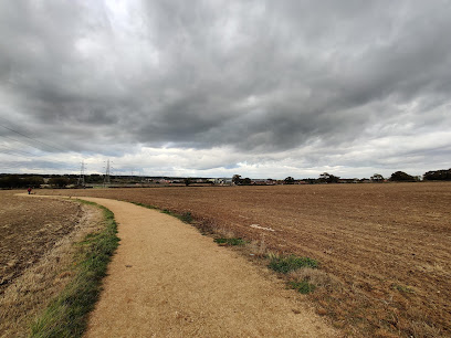
| Description | : | A church at this site was first mentioned in 1154 AD. The original mediaeval church was extended in 1709, 1813 and 1824 but the building suffered a partial collapse in 1847. A new church was built from the rubble and opened in 1850. However, the original village of Widley was relocated in the 1860s to make way for Fort Widley, and the congregation of the St Mary Magdalene church declined until the church was closed in about 1907. After extensive vandalism, the building was demolished in 1953 and the churchyard cleared. Only a few headstones remain. A burial register covering... Read More |
frequently asked questions (FAQ):
-
Where is St Mary Magdalene Churchyard?
St Mary Magdalene Churchyard is located at 1 Widley Walk Widley, City of Winchester ,Hampshire , PO7 5SBEngland.
-
St Mary Magdalene Churchyard cemetery's updated grave count on graveviews.com?
0 memorials
-
Where are the coordinates of the St Mary Magdalene Churchyard?
Latitude: 50.8623650
Longitude: -1.0642640
Nearby Cemetories:
1. Christ Church Portsdown Churchyard
Widley, City of Winchester, England
Coordinate: 50.8547300, -1.0507540
2. St John the Baptist Churchyard
Purbrook, Havant Borough, England
Coordinate: 50.8678210, -1.0447060
3. St Peter and St Paul Churchyard
Wymering, Portsmouth Unitary Authority, England
Coordinate: 50.8457490, -1.0777170
4. St. George the Martyr Churchyard
Waterlooville, Havant Borough, England
Coordinate: 50.8804060, -1.0328690
5. St. Andrew's Churchyard
Farlington, Portsmouth Unitary Authority, England
Coordinate: 50.8477200, -1.0274510
6. Waterlooville Cemetery
Waterlooville, Havant Borough, England
Coordinate: 50.8802800, -1.0246400
7. St. James' Churchyard
Southwick, City of Winchester, England
Coordinate: 50.8739800, -1.1113800
8. St. Thomas Churchyard
Bedhampton, Havant Borough, England
Coordinate: 50.8529400, -1.0032960
9. St. Mary's Churchyard
Portchester, Fareham Borough, England
Coordinate: 50.8366280, -1.1134270
10. Roman Grove Cemetery
Portchester, Fareham Borough, England
Coordinate: 50.8384600, -1.1206200
11. Denmead Burial Ground
Denmead, City of Winchester, England
Coordinate: 50.9057570, -1.0662400
12. Portchester Crematorium Gardens
Portchester, Fareham Borough, England
Coordinate: 50.8499680, -1.1382190
13. St. Nicholas' Churchyard
Boarhunt, City of Winchester, England
Coordinate: 50.8709800, -1.1442000
14. St. Faith's Churchyard
Havant, Havant Borough, England
Coordinate: 50.8513550, -0.9819910
15. Mile End Cemetery
Portsea, Portsmouth Unitary Authority, England
Coordinate: 50.8108900, -1.0876400
16. New Lane Cemetery
Havant, Havant Borough, England
Coordinate: 50.8550670, -0.9753490
17. Kingston Cemetery
Portsmouth, Portsmouth Unitary Authority, England
Coordinate: 50.8031440, -1.0683260
18. St. Mary's Churchyard
Portsea, Portsmouth Unitary Authority, England
Coordinate: 50.8035350, -1.0763490
19. Milton Cemetery
Portsmouth, Portsmouth Unitary Authority, England
Coordinate: 50.7988700, -1.0608030
20. St John the Baptist Churchyard
Rowlands Castle, East Hampshire District, England
Coordinate: 50.8848500, -0.9695200
21. Holy Trinity Churchyard
Newtown, City of Winchester, England
Coordinate: 50.9100400, -1.1322400
22. Warblington Cemetery
Warblington, Havant Borough, England
Coordinate: 50.8431290, -0.9669690
23. St Thomas A Becket Churchyard
Warblington, Havant Borough, England
Coordinate: 50.8436920, -0.9660980
24. HMS Victoria Monument
Portsmouth, Portsmouth Unitary Authority, England
Coordinate: 50.7997200, -1.0950800

