
| Memorials | : | 6 |
| Location | : | Aymestrey, Herefordshire Unitary Authority, England |
| Coordinate | : | 52.2813000, -2.8428000 |
frequently asked questions (FAQ):
-
Where is Church of St John the Baptist and St Alkmund?
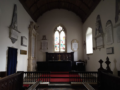
Church of St John the Baptist and St Alkmund is located at A4110, Aymestrey, County of Herefordshire Aymestrey, Herefordshire Unitary Authority ,Herefordshire , HR6 9STEngland.
-
Church of St John the Baptist and St Alkmund cemetery's updated grave count on graveviews.com?
6 memorials
-
Where are the coordinates of the Church of St John the Baptist and St Alkmund?
Latitude: 52.2813000
Longitude: -2.8428000
Nearby Cemetories:
1. St Michael and All Angels Churchyard
Croft, Herefordshire Unitary Authority, England
Coordinate: 52.2841090, -2.8079510
2. St Michael and All Angels Churchyard
Kingsland, Herefordshire Unitary Authority, England
Coordinate: 52.2469640, -2.8117000
3. All Saint's Churchyard
Leominster, Herefordshire Unitary Authority, England
Coordinate: 52.2496430, -2.7703330
4. St. Michael and All Angels Churchyard
Lingen, Herefordshire Unitary Authority, England
Coordinate: 52.2992480, -2.9317460
5. St. Mary the Virgin Churchyard
Elton, Shropshire Unitary Authority, England
Coordinate: 52.3345972, -2.7969324
6. St. Peter and St. Paul
Leominster, Herefordshire Unitary Authority, England
Coordinate: 52.2704100, -2.7398260
7. St. George's Churchyard
Burrington, Herefordshire Unitary Authority, England
Coordinate: 52.3440700, -2.8200100
8. St. Barnabas Churchyard
Brampton Bryan, Herefordshire Unitary Authority, England
Coordinate: 52.3470760, -2.9255360
9. Priory Churchyard
Leominster, Herefordshire Unitary Authority, England
Coordinate: 52.2293470, -2.7357830
10. Leominster Nunnery (Defunct)
Leominster, Herefordshire Unitary Authority, England
Coordinate: 52.2294090, -2.7343900
11. Leominster Moravian Burial Ground
Leominster, Herefordshire Unitary Authority, England
Coordinate: 52.2230890, -2.7394685
12. St. John's Churchyard
Ivington, Herefordshire Unitary Authority, England
Coordinate: 52.2054890, -2.7700320
13. Leominster Cemetery
Leominster, Herefordshire Unitary Authority, England
Coordinate: 52.2144280, -2.7380940
14. St. James the Less Churchyard
Kimbolton, Herefordshire Unitary Authority, England
Coordinate: 52.2507757, -2.6957349
15. St. Andrew, Ashford Bowdler.
Ashford Bowdler, Shropshire Unitary Authority, England
Coordinate: 52.3308770, -2.7065930
16. St Mary Churchyard
Bucknell, Shropshire Unitary Authority, England
Coordinate: 52.3592220, -2.9490030
17. St Mary Churchyard
Bedstone, Shropshire Unitary Authority, England
Coordinate: 52.3759660, -2.9284570
18. St. Mary the Virgin Churchyard
Bromfield, Shropshire Unitary Authority, England
Coordinate: 52.3873900, -2.7636700
19. St. Mary Magdalene Churchyard
Little Hereford, Herefordshire Unitary Authority, England
Coordinate: 52.3112129, -2.6572039
20. St Cuthbert Churchyard
Clungunford, Shropshire Unitary Authority, England
Coordinate: 52.4032350, -2.8909360
21. St Michael and All Angels Churchyard
Knill, Herefordshire Unitary Authority, England
Coordinate: 52.2377070, -3.0396000
22. St Mary's Churchyard
Hopton Castle, Shropshire Unitary Authority, England
Coordinate: 52.3985640, -2.9369870
23. St. Edward Churchyard
Hopton Castle, Shropshire Unitary Authority, England
Coordinate: 52.3985700, -2.9369700
24. St. Mary the Virgin
Kings Pyon, Herefordshire Unitary Authority, England
Coordinate: 52.1510000, -2.8218000